
MARSHAL VASILEVSKIY
Tanker
Current Trip
GOF FOR ORDER
| Time Travelled | --- |
|---|---|
| Remaining Time | --- |
| Distance Travelled | 0.10 nm |
| Remaining Distance | --- |
| AVG Speed | --- |
| MAX Speed | --- |
| AVG Wind | 6.1 knots |
| MAX Wind | 9.3 knots |
| MIN Temp | 1.2°C / 34.16°F |
| MAX Temp | 7.2°C / 44.96°F |
| Draught | 9.7 m |
| Position Received | 22 m ago |
Current Position
| Longitude | --- |
|---|---|
| Latitude | --- |
| Status | At anchor |
| Speed | 0.3 Knots |
| Course | 31° |
| Area | Gulf of Finland |
| Station | T-AIS |
| Position Received | 22 m ago |
Info
Information
The current position of MARSHAL VASILEVSKIY is in Gulf of Finland with coordinates 60.30882° / 27.98384° as reported on 2025-12-11 20:01 by AIS to our vessel tracker app. The vessel's current speed is 0.3 Knots
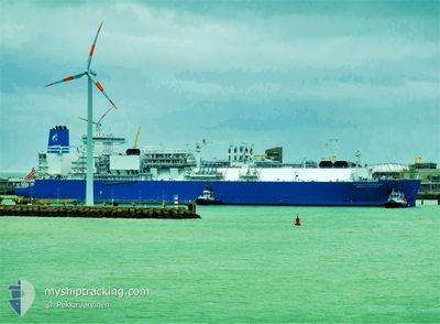
The vessel MARSHAL VASILEVSKIY (IMO: 9778313, MMSI: 273437230) is a Tanker It's sailing under the flag of [RU] Russia.
In this page you can find informations about the vessels current position, last detected port calls, and current voyage information. If the vessels is not in coverage by AIS you will find the latest position.
The current position of MARSHAL VASILEVSKIY is detected by our AIS receivers and we are not responsible for the reliability of the data. The last position was recorded while the vessel was in Coverage by the Ais receivers of our vessel tracking app.
The current draught of MARSHAL VASILEVSKIY as reported by AIS is 9.7 meters
Weather
| Temperature | 2.9°C / 37.22°F |
|---|---|
| Wind Speed | 11 knots |
| Direction | --- N |
| Pressure | 1004.6 hPa |
| Humidity | 78.2 % |
| Cloud Coverage | 100 % |
Featured Company
Last Port Calls
Most Visited Ports (Last year)
| Port | Arrivals |
|---|
Last Trips
| Origin | Departure | Destination | Arrival | Distance |
|---|
Events
| Time | Event | Details | Position / Dest | Info |
|---|---|---|---|---|
| 2025-12-11 12:41 | IN Coverage |
60.30936 / 27.99069
Gulf of Finland
|
Speed: 0.1 kn Course: 185.4° |
|
| 2025-12-11 11:23 | OUT of Coverage |
60.31003 / 27.99130
Gulf of Finland
|
Speed: 0.1 kn Course: 155.9° |
|
| 2025-12-11 09:52 | STOP Moving | 19.69 nm, West of PRIMORSK |
60.31164 / 27.99148
GOF FOR ORDER
|
Speed: 0.2 kn Course: 262° |
| 2025-12-11 09:31 | IN Coverage |
60.31196 / 27.99148
Gulf of Finland
|
Speed: 0.6 kn Course: 0.7° |
|
| 2025-12-11 08:23 | OUT of Coverage |
60.31171 / 27.99136
Gulf of Finland
|
Speed: 0.5 kn Course: 4.6° |
|
| 2025-12-09 20:43 | Status Changed | At anchor Under way using engine |
60.31027 / 27.98947
GOF FOR ORDER
|
Speed: 0.6 kn Course: 280° |
| 2025-12-09 20:26 | STOP Moving | 19.9 nm, West of PRIMORSK |
60.30991 / 27.98484
GOF FOR ORDER
|
Speed: 0.2 kn Course: 280° |
| 2025-12-09 04:03 | Change Sea Area | Russian part of the Gulf of Finland Estonian part of the Gulf of Finland |
59.95621 / 26.41159
Gulf of Finland
GOF FOR ORDER
|
Speed: 11.7 kn Course: 74.7° |
| 2025-12-09 03:05 | Detected in Sea | Estonian part of the Gulf of Finland |
59.90789 / 26.05115
Gulf of Finland
GOF FOR ORDER
|
Speed: 11.7 kn Course: 77.8° |
| 2025-12-09 02:16 | Change Sea Area | Finnish part of the Gulf of Finland Estonian part of the Gulf of Finland |
59.86869 / 25.74332
Gulf of Finland
GOF FOR ORDER
|
Speed: 12 kn Course: 79.2° |