
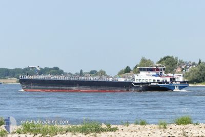
BRABO
Other Type
Current Trip
| Time Travelled | 1 day |
|---|---|
| Remaining Time | 20 h, 23 mins |
| Distance Travelled | 118.22 nm |
| Remaining Distance | 224.52 nm |
| AVG Speed | 10.3 Knots |
| MAX Speed | 12.3 Knots |
| AVG Wind | 9.6 knots |
| MAX Wind | 12 knots |
| MIN Temp | -1.4°C / 29.48°F |
| MAX Temp | 5.8°C / 42.44°F |
| Draught | 2.6 m |
| Position Received | 3 m ago |
Current Position
| Longitude | --- |
|---|---|
| Latitude | --- |
| Status | Under way using engine |
| Speed | 12 Knots |
| Course | 319° |
| Area | North Sea |
| Station | T-AIS |
| Position Received | 3 m ago |
Info
Information
The current position of BRABO is in North Sea with coordinates 50.58705° / 7.21545° as reported on 2025-12-24 05:33 by AIS to our vessel tracker app. The vessel's current speed is 12 Knots and is heading at the port of ANTWERP. The estimated time of arrival as calculated by MyShipTracking vessel tracking app is 2025-12-25 02:59 LT
The vessel BRABO (MMSI: 244740961) is a Other Type It's sailing under the flag of [NL] Netherlands.
In this page you can find informations about the vessels current position, last detected port calls, and current voyage information. If the vessels is not in coverage by AIS you will find the latest position.
The current position of BRABO is detected by our AIS receivers and we are not responsible for the reliability of the data. The last position was recorded while the vessel was in Coverage by the Ais receivers of our vessel tracking app.
The current draught of BRABO as reported by AIS is 2.6 meters
Weather
| Temperature | -0.9°C / 30.38°F |
|---|---|
| Wind Speed | 9 knots |
| Direction | 67° ENE |
| Pressure | 1027.1 hPa |
| Humidity | 70.8 % |
| Cloud Coverage | 12 % |
Featured Company
Last Port Calls
| Port | Arrival | Departure | Time In Port |
|---|---|---|---|
| 2025-12-21 11:05 | 2025-12-22 09:23 | 22 h | |
| 2025-12-18 15:39 | 2025-12-19 15:16 | 23 h | |
| 2025-12-15 17:58 | 2025-12-16 05:10 | 11 h | |
| 2025-12-15 07:21 | 2025-12-15 09:22 | 2 h | |
| 2025-12-11 09:46 | 2025-12-15 00:55 | 3 d | |
| 2025-12-10 22:32 | 2025-12-11 09:18 | 10 h | |
| 2025-12-10 14:02 | 2025-12-10 22:20 | 8 h | |
| 2025-12-10 11:01 | 2025-12-10 12:11 | 1 h | |
| 2025-12-10 01:33 | 2025-12-10 02:10 | 37 m | |
| 2025-12-09 01:47 | 2025-12-09 14:13 | 12 h |
Most Visited Ports (Last year)
| Port | Arrivals | |
|---|---|---|
| 35 | ||
| 26 | ||
| 23 | ||
| 18 | ||
| 17 | ||
| 16 |
Last Trips
| Origin | Departure | Destination | Arrival | Distance | |
|---|---|---|---|---|---|
| 2025-12-19 15:16 | 2025-12-21 11:05 | 101.93 nm | |||
| 2025-12-16 05:10 | 2025-12-18 15:39 | 269.60 nm | |||
| 2025-12-15 09:22 | 2025-12-15 17:58 | 40.77 nm | |||
| 2025-12-15 00:55 | 2025-12-15 07:21 | 4.53 nm | |||
| 2025-12-11 09:18 | 2025-12-11 09:46 | 1.69 nm | |||
| 2025-12-10 22:20 | 2025-12-10 22:32 | 0.76 nm | |||
| 2025-12-10 12:11 | 2025-12-10 14:02 | 6.97 nm | |||
| 2025-12-10 02:10 | 2025-12-10 11:01 | 46.04 nm | |||
| 2025-12-09 14:13 | 2025-12-10 01:33 | 78.07 nm | |||
| 2025-12-09 01:29 | 2025-12-09 01:47 | 1.29 nm |
Events
| Time | Event | Details | Position / Dest | Info |
|---|---|---|---|---|
| 2025-12-24 05:02 | Status Changed | Under way using engine Default |
50.51190 / 7.30241
ANTWERPEN BEVRIJDIN
|
Speed: 12 kn Course: 309° |
| 2025-12-24 05:02 | IN Coverage |
50.51190 / 7.30241
North Sea
ANTWERPEN BEVRIJDIN
|
Speed: 11.6 kn Course: 326° |
|
| 2025-12-24 00:41 | Status Changed | Default Under way using engine |
50.00500 / 7.85833
ANTWERPEN BEVRIJDIN
|
Speed: 11.5 kn Course: 349° |
| 2025-12-24 00:35 | OUT of Coverage |
49.98802 / 7.86294
North Sea
ANTWERPEN BEVRIJDIN
|
Speed: 11.5 kn Course: 349° |
|
| 2025-12-23 20:12 | Destination Changed | ANTWERPEN BEVRIJDIN KARLSRUHE MIRO |
49.69251 / 8.35654
ANTWERPEN BEVRIJDIN
|
Speed: 10.3 kn Course: 15° |
| 2025-12-23 20:12 | ETA Changed | 2025/12/24 21:24 2025/12/20 00:22 |
49.69251 / 8.35654
ANTWERPEN BEVRIJDIN
|
Speed: 10.3 kn Course: 15° |
| 2025-12-23 17:28 | Status Changed | Under way using engine Default |
49.30993 / 8.45685
KARLSRUHE MIRO
|
Speed: Course: -1° |
| 2025-12-23 17:28 | START Moving | 5.9 nm, North East of GERMERSHEIM |
49.30993 / 8.45685
KARLSRUHE MIRO
|
Speed: 4.4 kn Course: 330° |
| 2025-12-23 17:28 | IN Coverage |
49.30993 / 8.45685
North Sea
|
Speed: 4.4 kn Course: 330° |
|
| 2025-12-22 12:12 | OUT of Coverage |
49.31264 / 8.45546
North Sea
|
Speed: 2.8 kn Course: 147° |