
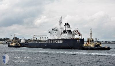
MARIE C
Reserved for future use
Current Trip
| Time Travelled | 12 days |
|---|---|
| Remaining Time | --- |
| Distance Travelled | 3295.10 nm |
| Remaining Distance | --- |
| AVG Speed | 11.2 Knots |
| MAX Speed | 14.9 Knots |
| AVG Wind | 14 knots |
| MAX Wind | 30.1 knots |
| MIN Temp | 3.3°C / 37.94°F |
| MAX Temp | 19.9°C / 67.82°F |
| Draught | 8.6 m |
| Position Received | 1 d ago |
Current Position
| Longitude | -30.58981° |
|---|---|
| Latitude | 42.44102° |
| Status | Under way using engine |
| Speed | 12.2 Knots |
| Course | 84.3° |
| Area | North Atlantic Ocean |
| Station | T-AIS |
| Position Received | 1 d ago |
Info
Information
The current position of MARIE C is in North Atlantic Ocean with coordinates 42.44102° / -30.58981° as reported on 2024-05-13 18:07 by AIS to our vessel tracker app. The vessel's current speed is 12.2 Knots and is heading at the port of ROTTERDAM. The estimated time of arrival as calculated by MyShipTracking vessel tracking app is 2024-05-18 20:00 LT
The vessel MARIE C (IMO: 9749348, MMSI: 538006807) is a Reserved for future use It's sailing under the flag of [MH] Marshall Is.
In this page you can find informations about the vessels current position, last detected port calls, and current voyage information. If the vessels is not in coverage by AIS you will find the latest position.
The current position of MARIE C is detected by our AIS receivers and we are not responsible for the reliability of the data. The last position was recorded while the vessel was in Coverage by the Ais receivers of our vessel tracking app.
The current draught of MARIE C as reported by AIS is 8.6 meters
Weather
| Temperature | 14°C / 57.2°F |
|---|---|
| Wind Speed | 17 knots |
| Direction | 314° NW |
| Pressure | 1016.3 hPa |
| Humidity | 92.9 % |
| Cloud Coverage | 100 % |
Featured Company
Last Port Calls
| Port | Arrival | Departure | Time In Port |
|---|---|---|---|
| 2024-04-30 17:46 | 2024-05-03 05:02 | 2 d | |
| 2024-04-19 17:42 | 2024-04-19 21:14 | 3 h | |
| 2024-04-17 07:09 | 2024-04-17 14:31 | 7 h | |
| 2024-04-15 09:32 | 2024-04-17 04:17 | 1 d | |
| 2024-04-11 08:04 | 2024-04-13 02:40 | 1 d | |
| 2024-04-05 22:00 | 2024-04-08 20:14 | 2 d | |
| 2024-04-02 22:56 | 2024-04-04 19:00 | 1 d | |
| 2024-03-11 14:04 | 2024-03-13 19:07 | 2 d | |
| 2024-03-06 11:54 | 2024-03-10 15:26 | 4 d | |
| 2024-03-02 09:23 | 2024-03-04 20:02 | 2 d |
Most Visited Ports (Last year)
| Port | Arrivals | |
|---|---|---|
| 4 | ||
| 3 | ||
| 3 | ||
| 3 | ||
| 3 | ||
| 2 |
Last Trips
| Origin | Departure | Destination | Arrival | Distance | |
|---|---|---|---|---|---|
| 2024-04-19 16:14 | 2024-04-30 15:16 | 2834.53 nm | |||
| 2024-04-17 09:31 | 2024-04-19 12:42 | 77.08 nm | |||
| 2024-04-16 23:17 | 2024-04-17 02:09 | 20.71 nm | |||
| 2024-04-12 21:40 | 2024-04-15 04:32 | 486.99 nm | |||
| 2024-04-08 15:14 | 2024-04-11 03:04 | 271.22 nm | |||
| 2024-04-04 14:00 | 2024-04-05 17:00 | 49.82 nm | |||
| 2024-03-13 20:07 | 2024-04-02 17:56 | 5641.59 nm | |||
| 2024-03-10 16:26 | 2024-03-11 15:04 | 215.07 nm | |||
| 2024-03-04 21:02 | 2024-03-06 12:54 | 339.54 nm | |||
| 2024-02-29 10:36 | 2024-03-02 10:23 | 450.96 nm |
Events
| Time | Event | Details | Position / Dest | Info |
|---|---|---|---|---|
| 2024-05-13 18:22 | Status Changed | Default Under way using engine |
42.44667 / -30.51667
NL RTM
|
Speed: 12.2 kn Course: 84.3° |
| 2024-05-13 18:07 | Status Changed | Under way using engine Default |
42.44102 / -30.58981
NL RTM
|
Speed: 12 kn Course: 84° |
| 2024-05-13 18:07 | OUT of Coverage |
42.44102 / -30.58981
North Atlantic Ocean
NL RTM
|
Speed: 12.2 kn Course: 84.3° |
|
| 2024-05-13 17:55 | Status Changed | Default Under way using engine |
42.43500 / -30.64333
NL RTM
|
Speed: 12.3 kn Course: 82.4° |
| 2024-05-13 17:52 | Status Changed | Under way using engine Default |
42.43501 / -30.65838
NL RTM
|
Speed: 12.1 kn Course: 82° |
| 2024-05-13 17:46 | Status Changed | Default Under way using engine |
42.43241 / -30.68688
NL RTM
|
Speed: 12.3 kn Course: 84.4° |
| 2024-05-13 17:31 | Change Sea Area | Portuguese (Azores) part of the North Atlantic Ocean United States part of the North Atlantic Ocean |
42.42722 / -30.75319
North Atlantic Ocean
NL RTM
|
Speed: 12.3 kn Course: 82.8° |
| 2024-05-13 17:31 | Status Changed | Under way using engine Default |
42.42722 / -30.75319
NL RTM
|
Speed: 12 kn Course: 86° |
| 2024-05-13 17:22 | IN Coverage |
42.42722 / -30.75319
North Atlantic Ocean
NL RTM
|
Speed: 12.3 kn Course: 82.8° |
|
| 2024-05-07 13:02 | OUT of Coverage |
43.02152 / -70.50080
North Atlantic Ocean
NL RTM
|
Speed: 12.1 kn Course: 100.7° |