
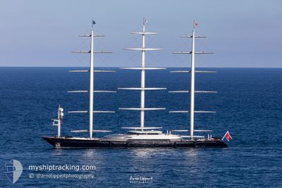
MALTESE FALCON
Yacht
Current Trip
| Time Travelled | 8 days |
|---|---|
| Remaining Time | --- |
| Distance Travelled | 163.27 nm |
| Remaining Distance | --- |
| AVG Speed | 9.2 Knots |
| MAX Speed | 14.5 Knots |
| AVG Wind | 9 knots |
| MAX Wind | 13 knots |
| MIN Temp | 25°C / 77°F |
| MAX Temp | 26.4°C / 79.52°F |
| Draught | 0 m |
| Position Received | 2 m ago |
Current Position
| Longitude | --- |
|---|---|
| Latitude | --- |
| Status | At anchor |
| Speed | |
| Course | 122° |
| Area | Caribbean Sea |
| Station | T-AIS |
| Position Received | 2 m ago |
Info
Information
The current position of MALTESE FALCON is in Caribbean Sea with coordinates 18.16333° / -63.11848° as reported on 2026-01-03 19:20 by AIS to our vessel tracker app. The vessel's current speed is 0 Knots
The vessel MALTESE FALCON (IMO: 9384552, MMSI: 249555000) is a Yacht that was built in 2006 ( 20 years old ). It's sailing under the flag of [MT] Malta.
In this page you can find informations about the vessels current position, last detected port calls, and current voyage information. If the vessels is not in coverage by AIS you will find the latest position.
The current position of MALTESE FALCON is detected by our AIS receivers and we are not responsible for the reliability of the data. The last position was recorded while the vessel was in Coverage by the Ais receivers of our vessel tracking app.
Weather
| Temperature | 25.9°C / 78.62°F |
|---|---|
| Wind Speed | 11 knots |
| Direction | 104° ESE |
| Pressure | 1013.6 hPa |
| Humidity | 75.1 % |
| Cloud Coverage | 6 % |
Featured Company
Last Port Calls
| Port | Arrival | Departure | Time In Port |
|---|---|---|---|
| 2025-12-18 15:31 | 2025-12-26 12:59 | 7 d | |
| 2025-12-06 17:54 | 2025-12-09 19:52 | 3 d | |
| 2025-12-02 20:33 | 2025-12-04 11:29 | 1 d | |
| 2025-12-01 11:14 |
Most Visited Ports (Last year)
| Port | Arrivals | |
|---|---|---|
| 1 | ||
| 1 | ||
| 1 | ||
| 1 | ||
| 1 | ||
| 1 |
Last Trips
| Origin | Departure | Destination | Arrival | Distance | |
|---|---|---|---|---|---|
| 2025-12-09 19:52 | 2025-12-18 15:31 | 2651.71 nm | |||
| 2025-12-04 11:29 | 2025-12-06 17:54 | 702.09 nm | |||
| 2025-12-01 11:14 | 2025-12-02 20:33 | 437.10 nm |
Events
| Time | Event | Details | Position / Dest | Info |
|---|---|---|---|---|
| 2026-01-03 18:58 | ETA Changed | 2026/01/03 00:00 |
18.16327 / -63.11853
AI AXA
|
Speed: 0.1 kn Course: 114° |
| 2026-01-03 17:46 | ETA Changed | 2026/01/04 00:00 |
18.16326 / -63.11856
AI AXA
|
Speed: 0.1 kn Course: 110° |
| 2026-01-03 16:32 | IN Coverage |
18.16312 / -63.11854
Caribbean Sea
|
Speed: 0.2 kn Course: 149° |
|
| 2026-01-03 14:11 | OUT of Coverage |
18.16318 / -63.11853
Caribbean Sea
|
Speed: 0.1 kn Course: 9° |
|
| 2026-01-03 11:26 | IN Coverage |
18.16312 / -63.11852
Caribbean Sea
|
Speed: Course: 171° |
|
| 2026-01-03 08:05 | OUT of Coverage |
18.16326 / -63.11853
Caribbean Sea
|
Speed: Course: 25° |
|
| 2026-01-03 08:02 | IN Coverage |
18.16322 / -63.11852
Caribbean Sea
|
Speed: Course: 3° |
|
| 2026-01-03 06:59 | OUT of Coverage |
18.16313 / -63.11850
Caribbean Sea
|
Speed: Course: 265° |
|
| 2026-01-03 06:59 | IN Coverage |
18.16313 / -63.11850
Caribbean Sea
|
Speed: Course: 265° |
|
| 2026-01-03 05:35 | OUT of Coverage |
18.16333 / -63.11841
Caribbean Sea
|
Speed: Course: 268° |