
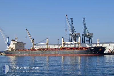
MAKRA
Bulk Carrier
Current Trip
| Time Travelled | 42 days |
|---|---|
| Remaining Time | 12 days |
| Distance Travelled | 10025.52 nm |
| Remaining Distance | 3198.64 nm |
| AVG Speed | 9.6 Knots |
| MAX Speed | 12.2 Knots |
| AVG Wind | 14.9 knots |
| MAX Wind | 30.2 knots |
| MIN Temp | 14°C / 57.2°F |
| MAX Temp | 29.6°C / 85.28°F |
| Draught | 11.2 m |
| Position Received | 9 d ago |
Current Position
| Longitude | 19.31283° |
|---|---|
| Latitude | -34.85522° |
| Status | Under way using engine |
| Speed | 10.5 Knots |
| Course | 113.2° |
| Area | South Atlantic Ocean |
| Station | T-AIS |
| Position Received | 9 d ago |
Info
Information
The current position of MAKRA is in South Atlantic Ocean with coordinates -34.85522° / 19.31283° as reported on 2024-04-14 15:50 by AIS to our vessel tracker app. The vessel's current speed is 10.5 Knots and is heading at the port of SINGAPORE. The estimated time of arrival as calculated by MyShipTracking vessel tracking app is 2024-05-07 00:11 LT
The vessel MAKRA (IMO: 9541813, MMSI: 311001036) is a Bulk Carrier that was built in 2012 ( 12 years old ). It's sailing under the flag of [BS] Bahamas.
In this page you can find informations about the vessels current position, last detected port calls, and current voyage information. If the vessels is not in coverage by AIS you will find the latest position.
The current position of MAKRA is detected by our AIS receivers and we are not responsible for the reliability of the data. The last position was recorded while the vessel was in Coverage by the Ais receivers of our vessel tracking app.
The current draught of MAKRA as reported by AIS is 11.2 meters
Weather
| Temperature | 26.6°C / 79.88°F |
|---|---|
| Wind Speed | 11 knots |
| Direction | 82° E |
| Pressure | 1013.8 hPa |
| Humidity | 82.3 % |
| Cloud Coverage | 7 % |
Featured Company
Last Port Calls
| Port | Arrival | Departure | Time In Port |
|---|---|---|---|
| 2024-03-05 20:55 | 2024-03-12 22:59 | 7 d | |
| 2024-02-20 16:45 | 2024-02-21 17:16 | 1 d | |
| 2024-02-04 03:03 |
Most Visited Ports (Last year)
| Port | Arrivals | |
|---|---|---|
| 2 | ||
| 2 | ||
| 2 | ||
| 1 | ||
| 1 | ||
| 1 |
Last Trips
| Origin | Departure | Destination | Arrival | Distance | |
|---|---|---|---|---|---|
| 2024-02-21 11:16 | 2024-03-05 14:55 | 92.79 nm | |||
| 2024-02-03 21:03 | 2024-02-20 10:45 | 3525.19 nm |
Events
| Time | Event | Details | Position / Dest | Info |
|---|---|---|---|---|
| 2024-04-14 15:56 | Status Changed | Default Under way using engine |
-34.86204 / 19.33169
SINGAPORE
|
Speed: 10.5 kn Course: 113.2° |
| 2024-04-14 15:50 | OUT of Coverage |
-34.85522 / 19.31283
South Atlantic Ocean
SINGAPORE
|
Speed: 10.5 kn Course: 113.2° |
|
| 2024-04-14 15:50 | Status Changed | Under way using engine Default |
-34.85483 / 19.31175
SINGAPORE
|
Speed: 10.5 kn Course: 114° |
| 2024-04-14 15:40 | Status Changed | Default Under way using engine |
-34.84374 / 19.28147
SINGAPORE
|
Speed: 10.5 kn Course: 113.6° |
| 2024-04-14 15:13 | Status Changed | Under way using engine Default |
-34.81094 / 19.19308
SINGAPORE
|
Speed: 10.2 kn Course: 115° |
| 2024-04-14 14:52 | Status Changed | Default Under way using engine |
-34.78772 / 19.13032
SINGAPORE
|
Speed: 9.9 kn Course: 114.1° |
| 2024-04-14 13:46 | Status Changed | Under way using engine Default |
-34.70840 / 18.93607
SINGAPORE
|
Speed: 10 kn Course: 118° |
| 2024-04-14 13:42 | Status Changed | Default Under way using engine |
-34.70212 / 18.92186
SINGAPORE
|
Speed: 9.9 kn Course: 117.5° |
| 2024-04-14 13:37 | Status Changed | Under way using engine Default |
-34.69678 / 18.90951
SINGAPORE
|
Speed: 9.9 kn Course: 118° |
| 2024-04-14 12:33 | OUT of Coverage |
-34.61207 / 18.72342
South Atlantic Ocean
SINGAPORE
|
Speed: 9.6 kn Course: 117.8° |