
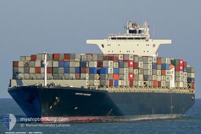
MAERSK SANTANA
Container Ship
Current Trip
| Time Travelled | 2 days |
|---|---|
| Remaining Time | 6 days |
| Distance Travelled | 1126.16 nm |
| Remaining Distance | 2878.40 nm |
| AVG Speed | 18.4 Knots |
| MAX Speed | 21.5 Knots |
| AVG Wind | 15.2 knots |
| MAX Wind | 20.9 knots |
| MIN Temp | 7.7°C / 45.86°F |
| MAX Temp | 20.2°C / 68.36°F |
| Draught | 13.7 m |
| Position Received | 2 d ago |
Current Position
| Longitude | 141.25667° |
|---|---|
| Latitude | 35.31356° |
| Status | Under way using engine |
| Speed | 21.2 Knots |
| Course | 49.5° |
| Area | North Pacific Ocean |
| Station | T-AIS |
| Position Received | 2 d ago |
Info
Information
The current position of MAERSK SANTANA is in North Pacific Ocean with coordinates 35.31356° / 141.25667° as reported on 2024-05-10 16:28 by AIS to our vessel tracker app. The vessel's current speed is 21.2 Knots and is heading at the port of PRINCE RUPERT. The estimated time of arrival as calculated by MyShipTracking vessel tracking app is 2024-05-18 21:25 LT
The vessel MAERSK SANTANA (IMO: 9289934, MMSI: 563000900) is a Container Ship that was built in 2005 ( 19 years old ). It's sailing under the flag of [SG] Singapore.
In this page you can find informations about the vessels current position, last detected port calls, and current voyage information. If the vessels is not in coverage by AIS you will find the latest position.
The current position of MAERSK SANTANA is detected by our AIS receivers and we are not responsible for the reliability of the data. The last position was recorded while the vessel was in Coverage by the Ais receivers of our vessel tracking app.
The current draught of MAERSK SANTANA as reported by AIS is 13.7 meters
Weather
| Temperature | 7.7°C / 45.86°F |
|---|---|
| Wind Speed | 17 knots |
| Direction | 186° S |
| Pressure | 1032.4 hPa |
| Humidity | 86.7 % |
| Cloud Coverage | 79 % |
Featured Company
Last Port Calls
| Port | Arrival | Departure | Time In Port |
|---|---|---|---|
| 2024-05-10 12:15 | 2024-05-10 19:07 | 6 h | |
| 2024-05-07 00:24 | 2024-05-08 13:40 | 1 d | |
| 2024-05-03 16:08 | 2024-05-04 19:04 | 1 d | |
| 2024-04-25 03:44 | 2024-04-26 03:53 | 1 d | |
| 2024-04-17 05:19 | 2024-04-18 00:36 | 19 h | |
| 2024-04-14 18:30 | 2024-04-15 00:14 | 5 h | |
| 2024-03-28 14:31 | 2024-03-30 17:00 | 2 d | |
| 2024-03-16 22:25 | 2024-03-19 16:54 | 2 d | |
| 2024-03-16 21:22 | 2024-03-16 21:45 | 22 m | |
| 2024-03-06 18:07 | 2024-03-07 00:50 | 6 h |
Most Visited Ports (Last year)
| Port | Arrivals | |
|---|---|---|
| 13 | ||
| 12 | ||
| 12 | ||
| 7 | ||
| 6 | ||
| 5 |
Last Trips
| Origin | Departure | Destination | Arrival | Distance | |
|---|---|---|---|---|---|
| 2024-05-08 13:40 | 2024-05-10 12:15 | 856.16 nm | |||
| 2024-05-04 19:04 | 2024-05-07 00:24 | 497.89 nm | |||
| 2024-04-26 03:53 | 2024-05-03 16:08 | 1022.10 nm | |||
| 2024-04-18 00:36 | 2024-04-25 03:44 | 1327.20 nm | |||
| 2024-04-15 00:14 | 2024-04-17 05:19 | 856.23 nm | |||
| 2024-03-30 17:00 | 2024-04-14 18:30 | 4452.52 nm | |||
| 2024-03-19 16:54 | 2024-03-28 14:31 | 871.99 nm | |||
| 2024-03-16 21:45 | 2024-03-16 22:25 | 0.89 nm | |||
| 2024-03-07 00:50 | 2024-03-16 21:22 | 3845.17 nm | |||
| 2024-03-04 09:39 | 2024-03-06 18:07 | 687.41 nm |
Events
| Time | Event | Details | Position / Dest | Info |
|---|---|---|---|---|
| 2024-05-10 16:35 | Status Changed | Default Under way using engine |
35.33800 / 141.29131
CAPRR
|
Speed: 21.2 kn Course: 49.5° |
| 2024-05-10 16:28 | OUT of Coverage |
35.31356 / 141.25667
North Pacific Ocean
CAPRR
|
Speed: 21.2 kn Course: 49.5° |
|
| 2024-05-10 12:25 | Status Changed | Under way using engine Default |
34.85138 / 139.75958
CAPRR
|
Speed: 19.9 kn Course: 140° |
| 2024-05-10 12:25 | IN Coverage |
34.84856 / 139.76323
North Pacific Ocean
CAPRR
|
Speed: 20.1 kn Course: 130.7° |
|
| 2024-05-10 11:16 | Status Changed | Default Under way using engine |
35.17084 / 139.75044
CAPRR
|
Speed: 10.4 kn Course: 210.4° |
| 2024-05-10 11:09 | OUT of Coverage |
35.19566 / 139.75608
North Pacific Ocean
CAPRR
|
Speed: 10.4 kn Course: 210.4° |
|
| 2024-05-10 10:07 | PORT DEPARTURE |
|
35.38116 / 139.68546
CAPRR
|
Speed: 8 kn Course: 158° |
| 2024-05-10 09:58 | START Moving |
35.39390 / 139.67389
[JP] YOKOHAMA
|
Speed: 3.1 kn Course: 134° |
|
| 2024-05-10 09:40 | Status Changed | Under way using engine Moored |
35.39728 / 139.67865
[JP] YOKOHAMA
|
Speed: Course: 45° |
| 2024-05-10 06:37 | Status Changed | Moored Under way using engine |
35.39692 / 139.67872
[JP] YOKOHAMA
|
Speed: Course: 46° |