
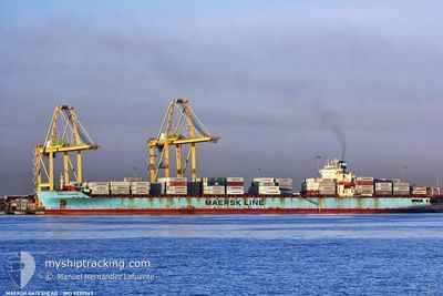
MAERSK GATESHEAD
Container Ship
Current Trip
| Time Travelled | 13 h, 49 mins |
|---|---|
| Remaining Time | --- |
| Distance Travelled | 165.22 nm |
| Remaining Distance | --- |
| AVG Speed | 13.3 Knots |
| MAX Speed | 19.6 Knots |
| AVG Wind | 13.4 knots |
| MAX Wind | 17 knots |
| MIN Temp | 4.9°C / 40.82°F |
| MAX Temp | 7.2°C / 44.96°F |
| Draught | 9.5 m |
| Position Received | 9 m ago |
Current Position
| Longitude | --- |
|---|---|
| Latitude | --- |
| Status | Under way using engine |
| Speed | 12.4 Knots |
| Course | 196.6° |
| Area | North Sea |
| Station | T-AIS |
| Position Received | 9 m ago |
Info
Information
The current position of MAERSK GATESHEAD is in North Sea with coordinates 53.70623° / 4.70692° as reported on 2025-03-03 04:09 by AIS to our vessel tracker app. The vessel's current speed is 12.4 Knots and is heading at the port of TANGIER. The estimated time of arrival as calculated by MyShipTracking vessel tracking app is 2025-03-09 12:30 LT
The vessel MAERSK GATESHEAD (IMO: 9235543, MMSI: 563076200) is a Container Ship that was built in 2002 ( 23 years old ). It's sailing under the flag of [SG] Singapore.
In this page you can find informations about the vessels current position, last detected port calls, and current voyage information. If the vessels is not in coverage by AIS you will find the latest position.
The current position of MAERSK GATESHEAD is detected by our AIS receivers and we are not responsible for the reliability of the data. The last position was recorded while the vessel was in Coverage by the Ais receivers of our vessel tracking app.
The current draught of MAERSK GATESHEAD as reported by AIS is 9.5 meters
Weather
| Temperature | 5.8°C / 42.44°F |
|---|---|
| Wind Speed | 16 knots |
| Direction | 253° WSW |
| Pressure | 1028.3 hPa |
| Humidity | 83.7 % |
| Cloud Coverage | 4 % |
Featured Company
Last Port Calls
| Port | Arrival | Departure | Time In Port |
|---|---|---|---|
| 2025-02-28 11:52 | 2025-03-02 14:29 | 2 d | |
| 2025-02-13 10:48 | 2025-02-14 17:41 | 1 d | |
| 2025-02-10 14:21 | 2025-02-11 12:33 | 22 h | |
| 2025-02-03 08:06 | 2025-02-03 22:27 | 14 h | |
| 2025-01-30 21:29 | 2025-01-31 08:00 | 10 h | |
| 2025-01-28 11:04 | 2025-01-29 07:02 | 19 h | |
| 2025-01-18 12:38 | 2025-01-19 09:19 | 20 h | |
| 2025-01-12 02:52 | 2025-01-13 14:11 | 1 d | |
| 2025-01-09 19:42 | 2025-01-10 21:49 | 1 d |
Last Trips
| Origin | Departure | Destination | Arrival | Distance | |
|---|---|---|---|---|---|
| 2025-02-14 12:41 | 2025-02-28 12:52 | 4752.30 nm | |||
| 2025-02-11 07:33 | 2025-02-13 05:48 | 724.99 nm | |||
| 2025-02-03 17:27 | 2025-02-10 09:21 | 665.19 nm | |||
| 2025-01-31 03:00 | 2025-02-03 03:06 | 210.25 nm | |||
| 2025-01-29 02:02 | 2025-01-30 16:29 | 344.51 nm | |||
| 2025-01-19 10:19 | 2025-01-28 06:04 | 3691.89 nm | |||
| 2025-01-13 15:11 | 2025-01-18 13:38 | 329.75 nm | |||
| 2025-01-10 22:49 | 2025-01-12 03:52 | 380.35 nm | |||
| 2024-12-29 15:23 | 2025-01-09 20:42 | 3781.63 nm |
Events
| Time | Event | Details | Position / Dest | Info |
|---|---|---|---|---|
| 2025-03-03 04:14 | Status Changed | Default Under way using engine |
53.68979 / 4.69834
TANGIER MED 2
|
Speed: 12.4 kn Course: 196.6° |
| 2025-03-03 04:04 | Status Changed | Under way using engine Default |
53.72205 / 4.71534
TANGIER MED 2
|
Speed: 12.1 kn Course: 198° |
| 2025-03-03 03:54 | Status Changed | Default Under way using engine |
53.75445 / 4.73400
TANGIER MED 2
|
Speed: 12 kn Course: 199.6° |
| 2025-03-03 03:47 | Status Changed | Under way using engine Default |
53.77371 / 4.74608
TANGIER MED 2
|
Speed: 12 kn Course: 202° |
| 2025-03-03 03:38 | Status Changed | Default Under way using engine |
53.80294 / 4.77277
TANGIER MED 2
|
Speed: 12 kn Course: 203° |
| 2025-03-03 02:06 | Status Changed | Under way using engine Default |
54.07805 / 4.98660
TANGIER MED 2
|
Speed: 12.1 kn Course: 261° |
| 2025-03-03 01:21 | Status Changed | Default Under way using engine |
54.10012 / 5.23520
TANGIER MED 2
|
Speed: 11.4 kn Course: 261.9° |
| 2025-03-03 00:39 | Status Changed | Under way using engine Default |
54.12075 / 5.46035
TANGIER MED 2
|
Speed: 11.1 kn Course: 264° |
| 2025-03-03 00:32 | Status Changed | Default Under way using engine |
54.12397 / 5.49895
TANGIER MED 2
|
Speed: 11.4 kn Course: 259.8° |
| 2025-03-03 00:27 | Status Changed | Under way using engine Default |
54.12655 / 5.52356
TANGIER MED 2
|
Speed: 11.3 kn Course: 259° |