
LUCY BORCHARD
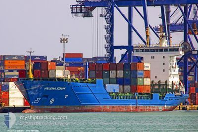
Container Ship
Current Trip
| Time Travelled | 3 days |
|---|---|
| Remaining Time | 9 h, 44 mins |
| Distance Travelled | 1095.90 nm |
| Remaining Distance | 189.86 nm |
| AVG Speed | 14.2 Knots |
| MAX Speed | 16 Knots |
| AVG Wind | 12.2 knots |
| MAX Wind | 25.2 knots |
| MIN Temp | 13.6°C / 56.48°F |
| MAX Temp | 19.1°C / 66.38°F |
| Draught | 6.7 m |
| Position Received | 4 h, 21 m ago |
Current Position
| Longitude | --- |
|---|---|
| Latitude | --- |
| Status | Under way using engine |
| Speed | 13 Knots |
| Course | 313° |
| Area | Adriatic Sea |
| Station | T-AIS |
| Position Received | 4 h, 21 m ago |
Info
Information
The current position of LUCY BORCHARD is in Adriatic Sea with coordinates 42.70463° / 15.64958° as reported on 2025-12-13 12:42 by AIS to our vessel tracker app. The vessel's current speed is 13 Knots and is heading at the port of RAVENNA. The estimated time of arrival as calculated by MyShipTracking vessel tracking app is 2025-12-14 03:48 LT
The vessel LUCY BORCHARD (IMO: 9390824, MMSI: 305032000) is a Container Ship that was built in 2006 ( 19 years old ). It's sailing under the flag of [AG] Antigua Barbuda.
In this page you can find informations about the vessels current position, last detected port calls, and current voyage information. If the vessels is not in coverage by AIS you will find the latest position.
The current position of LUCY BORCHARD is detected by our AIS receivers and we are not responsible for the reliability of the data. The last position was recorded while the vessel was in Coverage by the Ais receivers of our vessel tracking app.
The current draught of LUCY BORCHARD as reported by AIS is 6.7 meters
Weather
| Temperature | 13.9°C / 57.02°F |
|---|---|
| Wind Speed | 9 knots |
| Direction | 319° NW |
| Pressure | 1025.1 hPa |
| Humidity | 71.1 % |
| Cloud Coverage | 10 % |
Featured Company
Last Port Calls
| Port | Arrival | Departure | Time In Port |
|---|---|---|---|
| 2025-12-09 14:52 | 2025-12-10 13:39 | 22 h | |
| 2025-12-08 05:08 | 2025-12-08 22:37 | 17 h | |
| 2025-12-06 21:32 | 2025-12-07 10:18 | 12 h | |
| 2025-12-05 17:57 | 2025-12-06 00:31 | 6 h | |
| 2025-12-01 07:29 | 2025-12-01 21:11 | 13 h | |
| 2025-11-30 07:06 | 2025-11-30 19:01 | 11 h | |
| 2025-11-26 07:24 | 2025-11-26 17:24 | 9 h | |
| 2025-11-24 17:05 | 2025-11-25 06:32 | 13 h | |
| 2025-11-22 22:12 | 2025-11-23 08:09 | 9 h | |
| 2025-11-21 20:06 | 2025-11-22 03:32 | 7 h |
Most Visited Ports (Last year)
| Port | Arrivals | |
|---|---|---|
| 48 | ||
| 25 | ||
| 25 | ||
| 24 | ||
| 23 |
Last Trips
| Origin | Departure | Destination | Arrival | Distance | |
|---|---|---|---|---|---|
| 2025-12-08 22:37 | 2025-12-09 14:52 | 192.60 nm | |||
| 2025-12-07 10:18 | 2025-12-08 05:08 | 274.14 nm | |||
| 2025-12-06 00:31 | 2025-12-06 21:32 | 275.88 nm | |||
| 2025-12-01 21:11 | 2025-12-05 17:57 | 1268.87 nm | |||
| 2025-11-30 19:01 | 2025-12-01 07:29 | 104.46 nm | |||
| 2025-11-26 17:24 | 2025-11-30 07:06 | 1229.46 nm | |||
| 2025-11-25 06:32 | 2025-11-26 07:24 | 193.53 nm | |||
| 2025-11-23 08:09 | 2025-11-24 17:05 | 269.98 nm | |||
| 2025-11-22 03:32 | 2025-11-22 22:12 | 270.77 nm | |||
| 2025-11-18 00:23 | 2025-11-21 20:06 | 1268.48 nm |
Events
| Time | Event | Details | Position / Dest | Info |
|---|---|---|---|---|
| 2025-12-13 12:42 | OUT of Coverage |
42.70463 / 15.64958
Adriatic Sea
IT RAN
|
Speed: 13 kn Course: 313° |
|
| 2025-12-13 09:40 | Change Sea Area | Croatian part of the Adriatic Sea Italian part of the Adriatic Sea |
42.22944 / 16.28606
Adriatic Sea
IT RAN
|
Speed: 12.7 kn Course: 318.5° |
| 2025-12-13 07:46 | Status Changed | Under way using engine Default |
41.92655 / 16.66007
IT RAN
|
Speed: 13 kn Course: 319° |
| 2025-12-13 07:33 | IN Coverage |
41.92889 / 16.65734
Adriatic Sea
IT RAN
|
Speed: 13 kn Course: 318.8° |
|
| 2025-12-13 03:16 | Status Changed | Default Under way using engine |
41.17501 / 17.57992
IT RAN
|
Speed: 13.8 kn Course: 316.2° |
| 2025-12-13 03:11 | OUT of Coverage |
41.16181 / 17.59645
Adriatic Sea
IT RAN
|
Speed: 13.8 kn Course: 316.2° |
|
| 2025-12-13 03:10 | Status Changed | Under way using engine Default |
41.16131 / 17.59709
IT RAN
|
Speed: 13.8 kn Course: 316° |
| 2025-12-13 03:09 | Status Changed | Default Under way using engine |
41.15764 / 17.60174
IT RAN
|
Speed: 13.8 kn Course: 316.1° |
| 2025-12-13 03:04 | Status Changed | Under way using engine Default |
41.14230 / 17.62113
IT RAN
|
Speed: 13.7 kn Course: 316° |
| 2025-12-13 02:45 | IN Coverage |
41.14230 / 17.62113
Adriatic Sea
IT RAN
|
Speed: 13.7 kn Course: 316.6° |