
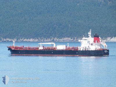
LOUISIANA
Tanker
Current Trip
| Time Travelled | 1 day |
|---|---|
| Remaining Time | 2 days |
| Distance Travelled | 353.33 nm |
| Remaining Distance | 725.23 nm |
| AVG Speed | 11.4 Knots |
| MAX Speed | 14.2 Knots |
| AVG Wind | 4.9 knots |
| MAX Wind | 10 knots |
| MIN Temp | 13.3°C / 55.94°F |
| MAX Temp | 18.3°C / 64.94°F |
| Draught | 8.4 m |
| Position Received | 1 m ago |
Current Position
| Longitude | -123.73377° |
|---|---|
| Latitude | 36.20680° |
| Status | Under way using engine |
| Speed | 13.7 Knots |
| Course | 336.2° |
| Area | North Pacific Ocean |
| Station | T-AIS |
| Position Received | 1 m ago |
Info
Information
The current position of LOUISIANA is in North Pacific Ocean with coordinates 36.20680° / -123.73377° as reported on 2024-05-11 02:52 by AIS to our vessel tracker app. The vessel's current speed is 13.7 Knots and is heading at the port of PORTLAND. The estimated time of arrival as calculated by MyShipTracking vessel tracking app is 2024-05-13 09:12 LT
The vessel LOUISIANA (IMO: 9704790, MMSI: 338110000) is a Tanker It's sailing under the flag of [US] USA.
In this page you can find informations about the vessels current position, last detected port calls, and current voyage information. If the vessels is not in coverage by AIS you will find the latest position.
The current position of LOUISIANA is detected by our AIS receivers and we are not responsible for the reliability of the data. The last position was recorded while the vessel was in Coverage by the Ais receivers of our vessel tracking app.
The current draught of LOUISIANA as reported by AIS is 8.4 meters
Weather
| Temperature | 15.5°C / 59.9°F |
|---|---|
| Wind Speed | 9 knots |
| Direction | 308° NW |
| Pressure | 1014.3 hPa |
| Humidity | 79 % |
| Cloud Coverage | --- |
Featured Company
Last Port Calls
| Port | Arrival | Departure | Time In Port |
|---|---|---|---|
| 2024-05-06 22:19 | 2024-05-09 20:17 | 2 d | |
| 2024-04-30 00:42 | 2024-05-02 03:17 | 2 d | |
| 2024-04-28 01:54 | 2024-04-28 17:06 | 15 h | |
| 2024-04-26 06:46 | 2024-04-26 23:11 | 16 h | |
| 2024-04-18 08:15 | 2024-04-21 20:46 | 3 d | |
| 2024-04-15 16:08 | 2024-04-16 16:10 | 1 d | |
| 2024-04-13 12:33 | 2024-04-14 06:43 | 18 h | |
| 2024-04-02 21:09 | 2024-04-04 15:54 | 1 d | |
| 2024-03-31 14:19 | 2024-04-01 14:33 | 1 d | |
| 2024-03-21 13:26 | 2024-03-27 01:17 | 5 d |
Most Visited Ports (Last year)
| Port | Arrivals | |
|---|---|---|
| 18 | ||
| 17 | ||
| 13 | ||
| 11 | ||
| 9 | ||
| 3 |
Last Trips
| Origin | Departure | Destination | Arrival | Distance | |
|---|---|---|---|---|---|
| 2024-05-01 20:17 | 2024-05-06 15:19 | 1384.29 nm | |||
| 2024-04-28 10:06 | 2024-04-29 17:42 | 374.03 nm | |||
| 2024-04-26 16:11 | 2024-04-27 18:54 | 332.93 nm | |||
| 2024-04-21 12:46 | 2024-04-25 23:46 | 1365.71 nm | |||
| 2024-04-16 08:10 | 2024-04-18 00:15 | 400.72 nm | |||
| 2024-04-13 22:43 | 2024-04-15 08:08 | 401.53 nm | |||
| 2024-04-04 08:54 | 2024-04-13 04:33 | 1537.38 nm | |||
| 2024-04-01 07:33 | 2024-04-02 14:09 | 392.40 nm | |||
| 2024-03-26 18:17 | 2024-03-31 07:19 | 1305.21 nm | |||
| 2024-03-17 10:21 | 2024-03-21 06:26 | 1234.54 nm |
Events
| Time | Event | Details | Position / Dest | Info |
|---|---|---|---|---|
| 2024-05-10 19:24 | Status Changed | Under way using engine Default |
34.82499 / -122.64233
COLUMBIA RIVER,OR
|
Speed: 13.7 kn Course: 317° |
| 2024-05-10 19:23 | Status Changed | Default Under way using engine |
34.82226 / -122.63921
COLUMBIA RIVER,OR
|
Speed: 13.7 kn Course: 316.7° |
| 2024-05-10 19:22 | Status Changed | Under way using engine Default |
34.82128 / -122.63811
COLUMBIA RIVER,OR
|
Speed: 13.4 kn Course: 317° |
| 2024-05-10 18:34 | Status Changed | Default Under way using engine |
34.69167 / -122.48666
COLUMBIA RIVER,OR
|
Speed: 13 kn Course: 314° |
| 2024-05-10 18:07 | Status Changed | Under way using engine Default |
34.62247 / -122.40135
COLUMBIA RIVER,OR
|
Speed: 13.6 kn Course: 316° |
| 2024-05-10 17:58 | IN Coverage |
34.62247 / -122.40135
North Pacific Ocean
COLUMBIA RIVER,OR
|
Speed: 13.5 kn Course: 316.5° |
|
| 2024-05-10 14:58 | Status Changed | Default Under way using engine |
34.08933 / -121.82487
COLUMBIA RIVER,OR
|
Speed: 13.7 kn Course: 316.6° |
| 2024-05-10 14:51 | OUT of Coverage |
34.06990 / -121.80287
North Pacific Ocean
COLUMBIA RIVER,OR
|
Speed: 13.7 kn Course: 316.6° |
|
| 2024-05-10 14:50 | Status Changed | Under way using engine Default |
34.06714 / -121.79971
COLUMBIA RIVER,OR
|
Speed: 13 kn Course: 316° |
| 2024-05-10 14:34 | Status Changed | Default Under way using engine |
34.02167 / -121.74834
COLUMBIA RIVER,OR
|
Speed: 13.6 kn Course: 315.4° |