
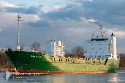
LINK STAR
Ro-Ro Cargo
Current Trip
| Time Travelled | 1 day |
|---|---|
| Remaining Time | --- |
| Distance Travelled | 496.51 nm |
| Remaining Distance | 429.02 nm |
| AVG Speed | 11.5 Knots |
| MAX Speed | 13.2 Knots |
| AVG Wind | 8.5 knots |
| MAX Wind | 18.8 knots |
| MIN Temp | 3.6°C / 38.48°F |
| MAX Temp | 10°C / 50°F |
| Draught | 6.1 m |
| Position Received | 10 d ago |
Current Position
| Longitude | 1.89103° |
|---|---|
| Latitude | 59.05823° |
| Status | Under way using engine |
| Speed | 12.5 Knots |
| Course | 290.8° |
| Area | North Sea |
| Station | T-AIS |
| Position Received | 10 d ago |
Info
Information
The current position of LINK STAR is in North Sea with coordinates 59.05823° / 1.89103° as reported on 2024-05-02 19:23 by AIS to our vessel tracker app. The vessel's current speed is 12.5 Knots and is heading at the port of HERJOLFUR. The estimated time of arrival as calculated by MyShipTracking vessel tracking app is 2024-05-05 10:00 LT
The vessel LINK STAR (IMO: 8805602, MMSI: 259101000) is a Ro-Ro Cargo that was built in 1989 ( 35 years old ). It's sailing under the flag of [NO] Norway.
In this page you can find informations about the vessels current position, last detected port calls, and current voyage information. If the vessels is not in coverage by AIS you will find the latest position.
The current position of LINK STAR is detected by our AIS receivers and we are not responsible for the reliability of the data. The last position was recorded while the vessel was in Coverage by the Ais receivers of our vessel tracking app.
The current draught of LINK STAR as reported by AIS is 6.1 meters
Weather
| Temperature | 8.8°C / 47.84°F |
|---|---|
| Wind Speed | 6 knots |
| Direction | 170° S |
| Pressure | 1007.9 hPa |
| Humidity | 98.3 % |
| Cloud Coverage | 100 % |
Featured Company
Last Port Calls
| Port | Arrival | Departure | Time In Port |
|---|---|---|---|
| 2024-05-10 18:46 | 2024-05-11 00:41 | 5 h | |
| 2024-05-10 05:39 | 2024-05-10 12:36 | 6 h | |
| 2024-05-07 09:42 | 2024-05-08 18:33 | 1 d | |
| 2024-05-05 09:42 | 2024-05-06 18:39 | 1 d | |
| 2024-04-24 04:45 | 2024-04-28 16:17 | 4 d | |
| 2024-04-19 00:02 | 2024-04-20 12:54 | 1 d | |
| 2024-04-15 19:56 | 2024-04-17 08:45 | 1 d | |
| 2024-04-15 08:28 | 2024-04-15 15:24 | 6 h | |
| 2024-04-14 14:33 | 2024-04-14 22:22 | 7 h | |
| 2024-04-09 14:58 | 2024-04-12 01:02 | 2 d |
Most Visited Ports (Last year)
| Port | Arrivals | |
|---|---|---|
| 38 | ||
| 20 | ||
| 20 | ||
| 18 | ||
| 16 | ||
| 16 |
Last Trips
| Origin | Departure | Destination | Arrival | Distance | |
|---|---|---|---|---|---|
| 2024-05-10 12:36 | 2024-05-10 18:46 | 76.25 nm | |||
| 2024-05-08 18:33 | 2024-05-10 05:39 | 295.53 nm | |||
| 2024-05-06 18:39 | 2024-05-07 09:42 | 112.04 nm | |||
| 2024-04-28 16:17 | 2024-05-05 09:42 | 1773.81 nm | |||
| 2024-04-20 12:54 | 2024-04-24 04:45 | 969.14 nm | |||
| 2024-04-17 08:45 | 2024-04-19 00:02 | 354.08 nm | |||
| 2024-04-15 15:24 | 2024-04-15 19:56 | 1.57 nm | |||
| 2024-04-14 22:22 | 2024-04-15 08:28 | 1.60 nm | |||
| 2024-04-12 01:02 | 2024-04-14 14:33 | 311.01 nm | |||
| 2024-04-07 08:52 | 2024-04-09 14:58 | 311.21 nm |
Events
| Time | Event | Details | Position / Dest | Info |
|---|---|---|---|---|
| 2024-05-11 00:42 | START Moving | 1.97 nm, North West of AKUREYRI |
65.72184 / -18.10690
THORLAKSHOFN
|
Speed: 11 kn Course: 353° |
| 2024-05-11 00:41 | PORT DEPARTURE |
|
65.72184 / -18.10690
THORLAKSHOFN
|
Speed: 3 kn Course: -1° |
| 2024-05-10 18:47 | STOP Moving |
65.70443 / -18.11215
[IS] AKUREYRI
|
Speed: 0.1 kn Course: 186° |
|
| 2024-05-10 18:46 | PORT ARRIVAL |
|
65.70443 / -18.11215
[IS] AKUREYRI
|
Speed: 0.8 kn Course: 191° |
| 2024-05-10 12:51 | START Moving | 3.32 nm, North East of SAUDARKROKUR |
65.80334 / -19.58333
THORLAKSHOFN
|
Speed: 13 kn Course: -1° |
| 2024-05-10 12:36 | PORT DEPARTURE |
|
65.80334 / -19.58333
THORLAKSHOFN
|
Speed: Course: -1° |
| 2024-05-10 05:40 | STOP Moving |
65.75548 / -19.64273
[IS] SAUDARKROKUR
|
Speed: 0.1 kn Course: 328° |
|
| 2024-05-10 05:39 | PORT ARRIVAL |
|
65.75548 / -19.64273
[IS] SAUDARKROKUR
|
Speed: 2.2 kn Course: 308° |
| 2024-05-08 18:33 | PORT DEPARTURE |
|
64.29833 / -22.09500
THORLAKSHOFN
|
Speed: 4.2 kn Course: 205° |
| 2024-05-08 18:24 | START Moving |
64.31329 / -22.07146
[IS] AKRANES
|
Speed: 4.3 kn Course: 170° |