
LIDYA
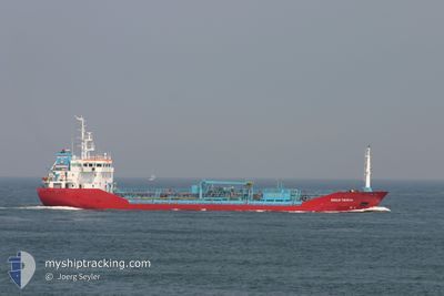
Oil/Chemical Tanker
Current Trip
| Trip Time | 3 days |
|---|---|
| Trip Distance | 493.07 nm |
| AVG Speed | 8.7 Knots |
| MAX Speed | 10 Knots |
| Draught | 4.2 m |
| AVG Wind | 5.4 knots |
| MAX Wind | 19.3 knots |
| MIN Temp | 7.3°C / 45.14°F |
| MAX Temp | 16.9°C / 62.42°F |
| Position Received | 2 m ago |
Current Position
| Longitude | --- |
|---|---|
| Latitude | --- |
| Status | At anchor |
| Speed | 0.8 Knots |
| Course | 55° |
| Area | Aegean Sea |
| Station | T-AIS |
| Position Received | 2 m ago |
Info
Information
The current position of LIDYA is in Aegean Sea with coordinates 38.81873° / 26.97088° as reported on 2025-03-05 08:46 by AIS to our vessel tracker app. The vessel's current speed is 0.8 Knots and is currently inside the port of ALIAGA.
The vessel LIDYA (IMO: 9260550, MMSI: 271045665) is a Oil/Chemical Tanker that was built in 2003 ( 22 years old ). It's sailing under the flag of [TR] Turkey.
In this page you can find informations about the vessels current position, last detected port calls, and current voyage information. If the vessels is not in coverage by AIS you will find the latest position.
The current position of LIDYA is detected by our AIS receivers and we are not responsible for the reliability of the data. The last position was recorded while the vessel was in Coverage by the Ais receivers of our vessel tracking app.
The current draught of LIDYA as reported by AIS is 4.2 meters
Weather
| Temperature | 9.5°C / 49.1°F |
|---|---|
| Wind Speed | 7 knots |
| Direction | 67° ENE |
| Pressure | 1024.1 hPa |
| Humidity | 52.7 % |
| Cloud Coverage | --- |
Featured Company
Most Visited Ports (Last year)
| Port | Arrivals | |
|---|---|---|
| 35 | ||
| 4 | ||
| 2 | ||
| 2 |
Events
| Time | Event | Details | Position / Dest | Info |
|---|---|---|---|---|
| 2025-03-05 08:48 | STOP Moving |
38.81865 / 26.97078
[TR] ALIAGA
|
Speed: 0.2 kn Course: 49° |
|
| 2025-03-05 08:39 | Status Changed | At anchor Under way using engine |
38.81960 / 26.97270
[TR] ALIAGA
|
Speed: 0.9 kn Course: 85° |
| 2025-03-05 08:20 | PORT ARRIVAL |
|
38.83745 / 26.95367
[TR] ALIAGA
|
Speed: 8.8 kn Course: 141° |
| 2025-03-05 07:18 | Status Changed | Under way using engine Default |
38.84605 / 26.79882
TR ALI
|
Speed: 7.7 kn Course: 64° |
| 2025-03-05 07:13 | Status Changed | Default Under way using engine |
38.84185 / 26.78698
TR ALI
|
Speed: 7.7 kn Course: 65° |
| 2025-03-05 06:50 | Status Changed | Under way using engine Default |
38.82328 / 26.72845
TR ALI
|
Speed: 7.6 kn Course: 69° |
| 2025-03-05 06:45 | Status Changed | Default Under way using engine |
38.81975 / 26.71664
TR ALI
|
Speed: 7.6 kn Course: 70.6° |
| 2025-03-05 06:40 | Change Sea Area | Turkish part of the Aegean Sea Greek part of the Aegean Sea |
38.81603 / 26.70407
Aegean Sea
TR ALI
|
Speed: 7.4 kn Course: 69.8° |
| 2025-03-05 06:38 | Status Changed | Under way using engine Default |
38.81427 / 26.69837
TR ALI
|
Speed: 7.2 kn Course: 68° |
| 2025-03-05 06:38 | IN Coverage |
38.81603 / 26.70407
Aegean Sea
TR ALI
|
Speed: 7.4 kn Course: 69.8° |