
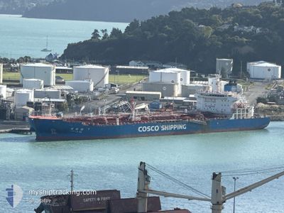
LIAN LE HU
Tanker
Current Trip
| Time Travelled | 3 days |
|---|---|
| Remaining Time | --- |
| Distance Travelled | 954.13 nm |
| Remaining Distance | --- |
| AVG Speed | 14.4 Knots |
| MAX Speed | 16.8 Knots |
| AVG Wind | 11.8 knots |
| MAX Wind | 23 knots |
| MIN Temp | 26°C / 78.8°F |
| MAX Temp | 27.9°C / 82.22°F |
| Draught | 8.2 m |
| Position Received | 2 d ago |
Current Position
| Longitude | --- |
|---|---|
| Latitude | --- |
| Status | Under way using engine |
| Speed | 14.8 Knots |
| Course | 285.9° |
| Area | Laccadive Sea |
| Station | T-AIS |
| Position Received | 2 d ago |
Info
Information
The current position of LIAN LE HU is in Laccadive Sea with coordinates 7.79124° / 76.95114° as reported on 2025-12-13 20:36 by AIS to our vessel tracker app. The vessel's current speed is 14.8 Knots and is heading at the port of FUJAIRAH. The estimated time of arrival as calculated by MyShipTracking vessel tracking app is 2025-12-18 22:30 LT
The vessel LIAN LE HU (IMO: 9747118, MMSI: 477100200) is a Tanker It's sailing under the flag of [HK] Hong Kong.
In this page you can find informations about the vessels current position, last detected port calls, and current voyage information. If the vessels is not in coverage by AIS you will find the latest position.
The current position of LIAN LE HU is detected by our AIS receivers and we are not responsible for the reliability of the data. The last position was recorded while the vessel was in Coverage by the Ais receivers of our vessel tracking app.
The current draught of LIAN LE HU as reported by AIS is 8.2 meters
Weather
| Temperature | 25.7°C / 78.26°F |
|---|---|
| Wind Speed | 11 knots |
| Direction | 69° ENE |
| Pressure | 1015 hPa |
| Humidity | 68.5 % |
| Cloud Coverage | 8 % |
Featured Company
Last Port Calls
| Port | Arrival | Departure | Time In Port |
|---|---|---|---|
| 2025-12-11 09:22 | 2025-12-13 09:42 | 2 d | |
| 2025-12-04 01:19 | 2025-12-05 07:44 | 1 d | |
| 2025-11-14 12:20 | 2025-11-18 06:27 | 3 d | |
| 2025-10-15 15:52 | 2025-10-17 17:02 | 2 d |
Most Visited Ports (Last year)
| Port | Arrivals | |
|---|---|---|
| 2 | ||
| 2 | ||
| 2 | ||
| 2 | ||
| 2 | ||
| 1 |
Last Trips
| Origin | Departure | Destination | Arrival | Distance | |
|---|---|---|---|---|---|
| 2025-12-05 07:44 | 2025-12-11 09:22 | 1281.01 nm | |||
| 2025-11-18 06:27 | 2025-12-04 01:19 | 3335.21 nm | |||
| 2025-10-17 17:02 | 2025-11-14 12:20 | 2855.29 nm | |||
| 2025-09-28 15:47 | 2025-10-15 15:52 | 3164.26 nm |
Events
| Time | Event | Details | Position / Dest | Info |
|---|---|---|---|---|
| 2025-12-13 20:38 | Status Changed | Default Under way using engine |
7.79387 / 76.94239
AE FJR
|
Speed: 14.8 kn Course: 285.9° |
| 2025-12-13 20:36 | OUT of Coverage |
7.79124 / 76.95114
Laccadive Sea
AE FJR
|
Speed: 14.8 kn Course: 285.9° |
|
| 2025-12-13 19:05 | ETA Changed | 2025/12/18 18:30 2025/12/20 00:01 |
7.66378 / 77.29425
AE FJR
|
Speed: 14.5 kn Course: 293.1° |
| 2025-12-13 18:37 | Status Changed | Under way using engine Default |
7.61871 / 77.39594
AE FJR
|
Speed: 14.3 kn Course: 300° |
| 2025-12-13 18:22 | IN Coverage |
7.61871 / 77.39594
Laccadive Sea
AE FJR
|
Speed: 14.5 kn Course: 298.3° |
|
| 2025-12-13 14:14 | Status Changed | Default Under way using engine |
7.38163 / 78.41708
AE FJR
|
Speed: 13.8 kn Course: 286.4° |
| 2025-12-13 14:05 | OUT of Coverage |
7.37105 / 78.45331
Laccadive Sea
AE FJR
|
Speed: 13.8 kn Course: 286.4° |
|
| 2025-12-13 13:46 | Status Changed | Under way using engine Default |
7.35131 / 78.52130
AE FJR
|
Speed: 13.6 kn Course: 286° |
| 2025-12-13 13:41 | Status Changed | Default Under way using engine |
7.34581 / 78.54024
AE FJR
|
Speed: 13.5 kn Course: 285.7° |
| 2025-12-13 13:36 | Detected in Sea | Indian part of the Laccadive Sea |
7.34042 / 78.55974
Laccadive Sea
AE FJR
|
Speed: 13.5 kn Course: 283.6° |