
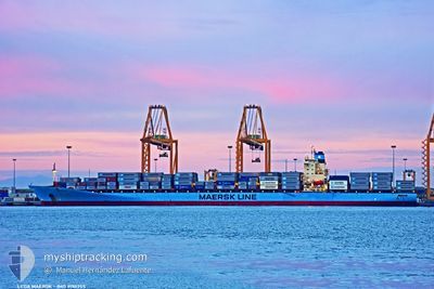
LEDA MAERSK
Container Ship
Current Trip
| Time Travelled | 1 day |
|---|---|
| Remaining Time | --- |
| Distance Travelled | 127.67 nm |
| Remaining Distance | 808.42 nm |
| AVG Speed | 10 Knots |
| MAX Speed | 14.9 Knots |
| AVG Wind | 10.1 knots |
| MAX Wind | 13 knots |
| MIN Temp | 20.6°C / 69.08°F |
| MAX Temp | 23.8°C / 74.84°F |
| Draught | 13 m |
| Position Received | 4 d ago |
Current Position
| Longitude | --- |
|---|---|
| Latitude | --- |
| Status | Under way using engine |
| Speed | 16.3 Knots |
| Course | 175.1° |
| Area | North Pacific Ocean |
| Station | T-AIS |
| Position Received | 4 d ago |
Info
Information
The current position of LEDA MAERSK is in North Pacific Ocean with coordinates 8.71645° / -79.45448° as reported on 2025-12-11 00:38 by AIS to our vessel tracker app. The vessel's current speed is 16.3 Knots and is heading at the port of MANZANILLO. The estimated time of arrival as calculated by MyShipTracking vessel tracking app is 2025-12-04 17:00 LT
The vessel LEDA MAERSK (IMO: 9190755, MMSI: 477648800) is a Container Ship that was built in 2001 ( 24 years old ). It's sailing under the flag of [HK] Hong Kong.
In this page you can find informations about the vessels current position, last detected port calls, and current voyage information. If the vessels is not in coverage by AIS you will find the latest position.
The current position of LEDA MAERSK is detected by our AIS receivers and we are not responsible for the reliability of the data. The last position was recorded while the vessel was in Coverage by the Ais receivers of our vessel tracking app.
The current draught of LEDA MAERSK as reported by AIS is 13 meters
Weather
| Temperature | 21.7°C / 71.06°F |
|---|---|
| Wind Speed | 14 knots |
| Direction | 259° W |
| Pressure | 1010.1 hPa |
| Humidity | 84.2 % |
| Cloud Coverage | 45 % |
Featured Company
Last Port Calls
| Port | Arrival | Departure | Time In Port |
|---|---|---|---|
| 2025-12-12 22:46 | 2025-12-13 17:21 | 18 h | |
| 2025-12-09 12:19 | 2025-12-10 18:11 | 1 d | |
| 2025-12-07 16:05 | 2025-12-08 09:59 | 17 h | |
| 2025-12-04 15:43 | 2025-12-05 19:03 | 1 d | |
| 2025-11-28 04:25 | 2025-11-29 02:40 | 22 h | |
| 2025-11-19 10:21 | 2025-11-20 10:30 | 1 d | |
| 2025-11-18 18:50 | 2025-11-19 10:15 | 15 h | |
| 2025-11-10 05:29 | 2025-11-11 04:25 | 22 h | |
| 2025-11-08 22:43 | 2025-11-09 22:41 | 23 h | |
| 2025-11-06 15:30 | 2025-11-07 01:59 | 10 h |
Most Visited Ports (Last year)
| Port | Arrivals | |
|---|---|---|
| 13 | ||
| 11 | ||
| 11 | ||
| 10 | ||
| 6 | ||
| 6 |
Last Trips
| Origin | Departure | Destination | Arrival | Distance | |
|---|---|---|---|---|---|
| 2025-12-10 18:11 | 2025-12-12 22:46 | 789.32 nm | |||
| 2025-12-08 09:59 | 2025-12-09 12:19 | 360.85 nm | |||
| 2025-12-05 19:03 | 2025-12-07 16:05 | 438.23 nm | |||
| 2025-11-29 02:40 | 2025-12-04 15:43 | 1999.68 nm | |||
| 2025-11-20 10:30 | 2025-11-28 04:25 | 3361.30 nm | |||
| 2025-11-19 10:15 | 2025-11-19 10:21 | 0.62 nm | |||
| 2025-11-11 04:25 | 2025-11-18 18:50 | 1957.33 nm | |||
| 2025-11-09 22:41 | 2025-11-10 05:29 | 64.28 nm | |||
| 2025-11-07 01:59 | 2025-11-08 22:43 | 100.70 nm | |||
| 2025-11-05 08:41 | 2025-11-06 15:30 | 378.44 nm |
Events
| Time | Event | Details | Position / Dest | Info |
|---|---|---|---|---|
| 2025-12-15 01:11 | STOP Moving | 1.06 nm, North of POSORJA |
-2.69188 / -80.24590
USNWK>PAMIT
|
Speed: 0.2 kn Course: 185° |
| 2025-12-15 00:47 | START Moving | 0.8 nm, North of POSORJA |
-2.69618 / -80.23489
USNWK>PAMIT
|
Speed: 3.7 kn Course: 288° |
| 2025-12-14 20:23 | STOP Moving | 0.95 nm, North East of POSORJA |
-2.69648 / -80.22937
USNWK>PAMIT
|
Speed: 0.2 kn Course: 18° |
| 2025-12-14 13:59 | START Moving |
-2.97972 / -80.98545
USNWK>PAMIT
|
Speed: 3.2 kn Course: 348° |
|
| 2025-12-14 08:57 | STOP Moving |
-3.01686 / -80.99576
USNWK>PAMIT
|
Speed: 0.3 kn Course: 314° |
|
| 2025-12-13 22:21 | PORT DEPARTURE |
|
-3.24257 / -80.00697
USNWK>PAMIT
|
Speed: 5.6 kn Course: 340° |
| 2025-12-13 22:16 | START Moving |
-3.25170 / -80.00471
[EC] PUERTO BOLIVAR
|
Speed: 5.6 kn Course: 340° |
|
| 2025-12-13 03:46 | STOP Moving |
-3.25735 / -80.00185
[EC] PUERTO BOLIVAR
|
Speed: 0.2 kn Course: 119° |
|
| 2025-12-13 03:46 | PORT ARRIVAL |
|
-3.25735 / -80.00185
[EC] PUERTO BOLIVAR
|
Speed: 0.6 kn Course: 359° |
| 2025-12-11 00:38 | OUT of Coverage |
8.71645 / -79.45448
North Pacific Ocean
|
Speed: 16.3 kn Course: 175.1° |