
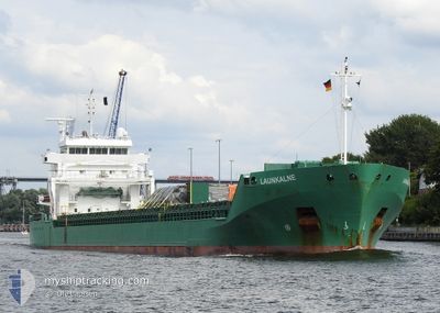
LAUNKALNE
General Cargo
Current Trip
| Time Travelled | 1 day |
|---|---|
| Remaining Time | 1 day |
| Distance Travelled | 290.24 nm |
| Remaining Distance | 295.54 nm |
| AVG Speed | 11.2 Knots |
| MAX Speed | 12.9 Knots |
| AVG Wind | 15.6 knots |
| MAX Wind | 20 knots |
| MIN Temp | -5.8°C / 21.56°F |
| MAX Temp | 3.1°C / 37.58°F |
| Draught | 6.5 m |
| Position Received | 2 m ago |
Current Position
| Longitude | --- |
|---|---|
| Latitude | --- |
| Status | Under way using engine |
| Speed | 10.6 Knots |
| Course | 219° |
| Area | Baltic Sea |
| Station | T-AIS |
| Position Received | 2 m ago |
Info
Information
The current position of LAUNKALNE is in Baltic Sea with coordinates 57.49264° / 19.32353° as reported on 2026-01-04 02:47 by AIS to our vessel tracker app. The vessel's current speed is 10.6 Knots and is heading at the port of AVEDORE. The estimated time of arrival as calculated by MyShipTracking vessel tracking app is 2026-01-05 07:22 LT
The vessel LAUNKALNE (IMO: 9504114, MMSI: 210388000) is a General Cargo that was built in 2010 ( 16 years old ). It's sailing under the flag of [CY] Cyprus.
In this page you can find informations about the vessels current position, last detected port calls, and current voyage information. If the vessels is not in coverage by AIS you will find the latest position.
The current position of LAUNKALNE is detected by our AIS receivers and we are not responsible for the reliability of the data. The last position was recorded while the vessel was in Coverage by the Ais receivers of our vessel tracking app.
The current draught of LAUNKALNE as reported by AIS is 6.5 meters
Weather
| Temperature | 1.7°C / 35.06°F |
|---|---|
| Wind Speed | 9 knots |
| Direction | 133° SE |
| Pressure | 988.4 hPa |
| Humidity | 67.5 % |
| Cloud Coverage | 98 % |
Featured Company
Last Port Calls
| Port | Arrival | Departure | Time In Port |
|---|---|---|---|
| 2026-01-01 09:17 | 2026-01-03 02:26 | 1 d | |
| 2025-12-26 19:36 | 2025-12-27 23:10 | 1 d | |
| 2025-12-21 07:57 | 2025-12-21 21:42 | 13 h | |
| 2025-12-17 10:47 | 2025-12-18 15:37 | 1 d | |
| 2025-12-13 20:50 | 2025-12-15 12:27 | 1 d | |
| 2025-12-06 08:31 | 2025-12-07 19:18 | 1 d | |
| 2025-11-26 14:51 | 2025-12-01 10:33 | 4 d | |
| 2025-11-23 15:17 | 2025-11-24 20:29 | 1 d | |
| 2025-11-19 10:33 | 2025-11-21 15:30 | 2 d | |
| 2025-11-12 21:22 | 2025-11-13 18:53 | 21 h |
Last Trips
| Origin | Departure | Destination | Arrival | Distance | |
|---|---|---|---|---|---|
| 2025-12-27 23:10 | 2026-01-01 09:17 | 597.08 nm | |||
| 2025-12-21 21:42 | 2025-12-26 19:36 | 1036.81 nm | |||
| 2025-12-18 15:37 | 2025-12-21 07:57 | 705.13 nm | |||
| 2025-12-15 12:27 | 2025-12-17 10:47 | 586.66 nm | |||
| 2025-12-07 19:18 | 2025-12-13 20:50 | 917.29 nm | |||
| 2025-12-01 10:33 | 2025-12-06 08:31 | 784.60 nm | |||
| 2025-11-24 20:29 | 2025-11-26 14:51 | 476.27 nm | |||
| 2025-11-21 15:30 | 2025-11-23 15:17 | 588.28 nm | |||
| 2025-11-13 18:53 | 2025-11-19 10:33 | 1059.27 nm | |||
| 2025-11-09 16:54 | 2025-11-12 21:22 | 723.24 nm |
Events
| Time | Event | Details | Position / Dest | Info |
|---|---|---|---|---|
| 2026-01-04 02:25 | Status Changed | Under way using engine Default |
57.53997 / 19.39984
DKAVE
|
Speed: 10.4 kn Course: 221° |
| 2026-01-04 02:21 | Status Changed | Default Under way using engine |
57.55010 / 19.41663
DKAVE
|
Speed: 10.4 kn Course: 212.6° |
| 2026-01-04 02:05 | Change Sea Area | Swedish part of the Baltic Sea Finnish part of the Baltic Sea |
57.58847 / 19.46371
Baltic Sea
DKAVE
|
Speed: 10.5 kn Course: 212° |
| 2026-01-04 02:05 | Status Changed | Under way using engine Default |
57.58847 / 19.46371
DKAVE
|
Speed: 10.6 kn Course: 212° |
| 2026-01-04 02:05 | IN Coverage |
57.58847 / 19.46371
Baltic Sea
DKAVE
|
Speed: 10.5 kn Course: 212° |
|
| 2026-01-03 12:09 | Status Changed | Default Under way using engine |
59.46063 / 22.44593
DKAVE
|
Speed: 10.2 kn Course: 231.7° |
| 2026-01-03 12:03 | OUT of Coverage |
59.46949 / 22.46835
Baltic Sea
DKAVE
|
Speed: 10.2 kn Course: 231.7° |
|
| 2026-01-03 11:21 | Status Changed | Under way using engine Default |
59.51803 / 22.67771
DKAVE
|
Speed: 10.1 kn Course: 252° |
| 2026-01-03 11:20 | Status Changed | Default Under way using engine |
59.51917 / 22.68377
DKAVE
|
Speed: 10.1 kn Course: 251.4° |
| 2026-01-03 11:16 | Status Changed | Under way using engine Default |
59.52303 / 22.70721
DKAVE
|
Speed: 10.2 kn Course: 252° |