
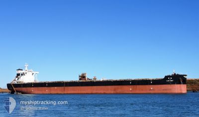
LAN MAY
Bulk Carrier
Current Trip
| Time Travelled | 21 days |
|---|---|
| Remaining Time | --- |
| Distance Travelled | 5248.40 nm |
| Remaining Distance | 1634.72 nm |
| AVG Speed | 11.8 Knots |
| MAX Speed | 18.4 Knots |
| AVG Wind | 13.2 knots |
| MAX Wind | 36.8 knots |
| MIN Temp | 9.9°C / 49.82°F |
| MAX Temp | 36.5°C / 97.7°F |
| Draught | 8.9 m |
| Position Received | 4 d ago |
Current Position
| Longitude | --- |
|---|---|
| Latitude | --- |
| Status | Under way using engine |
| Speed | 11.2 Knots |
| Course | 357.6° |
| Area | Indian Ocean |
| Station | T-AIS |
| Position Received | 4 d ago |
Info
Information
The current position of LAN MAY is in Indian Ocean with coordinates -14.87195° / 116.36889° as reported on 2025-12-08 22:53 by AIS to our vessel tracker app. The vessel's current speed is 11.2 Knots and is heading at the port of DAMPIER. The estimated time of arrival as calculated by MyShipTracking vessel tracking app is 2025-12-05 14:30 LT
The vessel LAN MAY (IMO: 9410167, MMSI: 636014631) is a Bulk Carrier that was built in 2011 ( 14 years old ). It's sailing under the flag of [LR] Liberia.
In this page you can find informations about the vessels current position, last detected port calls, and current voyage information. If the vessels is not in coverage by AIS you will find the latest position.
The current position of LAN MAY is detected by our AIS receivers and we are not responsible for the reliability of the data. The last position was recorded while the vessel was in Coverage by the Ais receivers of our vessel tracking app.
The current draught of LAN MAY as reported by AIS is 8.9 meters
Weather
| Temperature | 27.7°C / 81.86°F |
|---|---|
| Wind Speed | 5 knots |
| Direction | 42° NE |
| Pressure | 1007.2 hPa |
| Humidity | 78.7 % |
| Cloud Coverage | 92 % |
Featured Company
Last Port Calls
| Port | Arrival | Departure | Time In Port |
|---|---|---|---|
| 2025-11-19 18:44 | 2025-11-22 09:16 | 2 d | |
| 2025-10-16 15:44 | 2025-10-18 10:56 | 1 d |
Most Visited Ports (Last year)
| Port | Arrivals | |
|---|---|---|
| 2 | ||
| 2 | ||
| 2 | ||
| 2 | ||
| 1 | ||
| 1 |
Last Trips
| Origin | Departure | Destination | Arrival | Distance | |
|---|---|---|---|---|---|
| 2025-10-18 10:56 | 2025-11-19 18:44 | 7686.58 nm | |||
| 2025-09-27 23:03 | 2025-10-16 15:44 | 3848.20 nm |
Events
| Time | Event | Details | Position / Dest | Info |
|---|---|---|---|---|
| 2025-12-08 23:00 | Status Changed | Default Under way using engine |
-14.85028 / 116.36758
DAMPIER
|
Speed: 11.2 kn Course: 357.6° |
| 2025-12-08 22:53 | OUT of Coverage |
-14.87195 / 116.36889
Indian Ocean
|
Speed: 11.2 kn Course: 357.6° |
|
| 2025-12-08 22:51 | Change Sea Area | High seas of the Indian Ocean Australian part of the Indian Ocean |
-14.87929 / 116.36917
Indian Ocean
|
Speed: 11.2 kn Course: 358.6° |
| 2025-12-08 22:51 | Status Changed | Under way using engine Default |
-14.87929 / 116.36917
DAMPIER
|
Speed: 11.2 kn Course: 358° |
| 2025-12-08 22:48 | IN Coverage |
-14.87929 / 116.36917
Indian Ocean
|
Speed: 11.2 kn Course: 358.6° |
|
| 2025-12-07 15:12 | START Moving | 3.07 nm, West of DAMPIER |
-20.63160 / 116.68827
DAMPIER
|
Speed: 6.4 kn Course: 9° |
| 2025-12-06 20:02 | Status Changed | Default Moored |
-20.64905 / 116.67400
DAMPIER
|
Speed: Course: 62° |
| 2025-12-06 19:56 | Status Changed | Moored Default |
-20.64900 / 116.67392
DAMPIER
|
Speed: Course: 62° |
| 2025-12-06 19:56 | OUT of Coverage |
-20.64900 / 116.67392
Indian Ocean
|
Speed: Course: 145.6° |
|
| 2025-12-06 19:17 | Status Changed | Default Moored |
-20.64897 / 116.67390
DAMPIER
|
Speed: Course: 62° |