
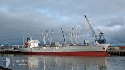
LAGOON PHOENIX
Reefer
Current Trip
| Time Travelled | 32 days |
|---|---|
| Remaining Time | --- |
| Distance Travelled | 5821.29 nm |
| Remaining Distance | --- |
| AVG Speed | 16 Knots |
| MAX Speed | 18.2 Knots |
| AVG Wind | 14 knots |
| MAX Wind | 28 knots |
| MIN Temp | 4°C / 39.2°F |
| MAX Temp | 27.9°C / 82.22°F |
| Draught | 5.4 m |
| Position Received | 9 d ago |
Current Position
| Longitude | --- |
|---|---|
| Latitude | --- |
| Status | At anchor |
| Speed | 0.1 Knots |
| Course | 318° |
| Area | South Atlantic Ocean |
| Station | T-AIS |
| Position Received | 9 d ago |
Info
Information
The current position of LAGOON PHOENIX is in South Atlantic Ocean with coordinates -51.57552° / -57.92266° as reported on 2025-02-23 23:15 by AIS to our vessel tracker app. The vessel's current speed is 0.1 Knots and is heading at the port of PORT STANLEY.
The vessel LAGOON PHOENIX (IMO: 9047245, MMSI: 311001255) is a Reefer that was built in 1993 ( 32 years old ). It's sailing under the flag of [BS] Bahamas.
In this page you can find informations about the vessels current position, last detected port calls, and current voyage information. If the vessels is not in coverage by AIS you will find the latest position.
The current position of LAGOON PHOENIX is detected by our AIS receivers and we are not responsible for the reliability of the data. The last position was recorded while the vessel was in Coverage by the Ais receivers of our vessel tracking app.
The current draught of LAGOON PHOENIX as reported by AIS is 5.4 meters
Weather
| Temperature | 12.1°C / 53.78°F |
|---|---|
| Wind Speed | 25 knots |
| Direction | 325° NW |
| Pressure | 984.2 hPa |
| Humidity | 76.9 % |
| Cloud Coverage | 50 % |
Featured Company
Last Port Calls
| Port | Arrival | Departure | Time In Port |
|---|---|---|---|
| 2025-01-31 06:30 | 2025-01-31 19:58 | 13 h | |
| 2025-01-23 13:27 | 2025-01-26 20:35 | 3 d | |
| 2025-01-15 04:26 | 2025-01-16 19:32 | 1 d | |
| 2025-01-05 19:51 | 2025-01-09 02:35 | 3 d |
Most Visited Ports (Last year)
| Port | Arrivals | |
|---|---|---|
| 2 | ||
| 2 | ||
| 2 | ||
| 2 | ||
| 1 | ||
| 1 |
Last Trips
| Origin | Departure | Destination | Arrival | Distance | |
|---|---|---|---|---|---|
| 2025-01-26 20:35 | 2025-01-31 06:30 | 910.53 nm | |||
| 2025-01-16 20:32 | 2025-01-23 13:27 | 2618.97 nm | |||
| 2025-01-09 02:35 | 2025-01-15 05:26 | 2591.84 nm | |||
| 2024-12-28 14:46 | 2025-01-05 19:51 | 2636.97 nm |
Events
| Time | Event | Details | Position / Dest | Info |
|---|---|---|---|---|
| 2025-03-01 23:38 | STOP Moving |
-51.67024 / -57.79464
PORT STANLEY
|
Speed: Course: 17° |
|
| 2025-03-01 21:18 | START Moving |
-51.57536 / -57.90334
PORT STANLEY
|
Speed: 6 kn Course: 90° |
|
| 2025-02-25 13:44 | STOP Moving |
-51.57159 / -57.92458
PORT STANLEY
|
Speed: 0.2 kn Course: 265° |
|
| 2025-02-25 11:37 | START Moving |
-51.57229 / -57.91972
PORT STANLEY
|
Speed: 3.6 kn Course: 256° |
|
| 2025-02-25 10:12 | STOP Moving |
-51.57061 / -57.91381
PORT STANLEY
|
Speed: 0.3 kn Course: 258° |
|
| 2025-02-23 23:18 | Status Changed | Default At anchor |
-51.57546 / -57.92264
PORT STANLEY
|
Speed: 0.1 kn Course: 318° |
| 2025-02-23 23:15 | OUT of Coverage |
-51.57552 / -57.92266
South Atlantic Ocean
|
Speed: 0.1 kn Course: 277° |
|
| 2025-02-23 22:57 | Status Changed | At anchor Default |
-51.57528 / -57.92251
PORT STANLEY
|
Speed: 0.2 kn Course: 293° |
| 2025-02-23 22:51 | Status Changed | Default At anchor |
-51.57544 / -57.92255
PORT STANLEY
|
Speed: 0.3 kn Course: 320° |
| 2025-02-23 22:36 | Status Changed | At anchor Default |
-51.57559 / -57.92251
PORT STANLEY
|
Speed: 0.3 kn Course: 286° |