
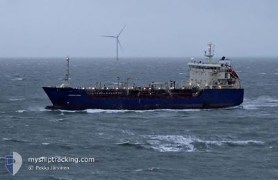
LAGAVULIN
Oil/Chemical Tanker
Current Trip
ARMED GUARDS ON BORD
| Time Travelled | 72 days |
|---|---|
| Remaining Time | --- |
| Distance Travelled | 1453.60 nm |
| Remaining Distance | --- |
| AVG Speed | 6.2 Knots |
| MAX Speed | 8.5 Knots |
| AVG Wind | 8.9 knots |
| MAX Wind | 18.7 knots |
| MIN Temp | 26°C / 78.8°F |
| MAX Temp | 28.6°C / 83.48°F |
| Draught | 6 m |
| Position Received | 2024-01-15 18:22 |
Current Position
| Longitude | --- |
|---|---|
| Latitude | --- |
| Status | Under way using engine |
| Speed | |
| Course | 190° |
| Area | South Atlantic Ocean |
| Station | T-AIS |
| Position Received | 2024-01-15 18:22 |
Info
Information
The current position of LAGAVULIN is in South Atlantic Ocean with coordinates -22.81270° / 14.51273° as reported on 2024-01-15 18:22 by AIS to our vessel tracker app. The vessel's current speed is 0 Knots
The vessel LAGAVULIN (IMO: 9130810, MMSI: 352001474) is a Oil/Chemical Tanker that was built in 1997 ( 28 years old ). It's sailing under the flag of [PA] Panama.
In this page you can find informations about the vessels current position, last detected port calls, and current voyage information. If the vessels is not in coverage by AIS you will find the latest position.
The current position of LAGAVULIN is detected by our AIS receivers and we are not responsible for the reliability of the data. The last position was recorded while the vessel was in Coverage by the Ais receivers of our vessel tracking app.
The current draught of LAGAVULIN as reported by AIS is 6 meters
Weather
| Temperature | 27.6°C / 81.68°F |
|---|---|
| Wind Speed | 11 knots |
| Direction | 232° SW |
| Pressure | 1009.3 hPa |
| Humidity | 86.8 % |
| Cloud Coverage | 62 % |
Featured Company
Last Port Calls
Most Visited Ports (Last year)
| Port | Arrivals | |
|---|---|---|
| 1 |
Last Trips
| Origin | Departure | Destination | Arrival | Distance |
|---|
Events
| Time | Event | Details | Position / Dest | Info |
|---|---|---|---|---|
| 2025-03-02 14:01 | STOP Moving | 6.32 nm, South West of LOME |
6.05278 / 1.22353
ARMED GUARDS ON BORD
|
Speed: 0.1 kn Course: 182° |
| 2025-03-02 13:25 | START Moving | 7.34 nm, South West of LOME |
6.03135 / 1.22493
ARMED GUARDS ON BORD
|
Speed: 4.6 kn Course: 354° |
| 2025-03-02 06:53 | STOP Moving | 7.32 nm, South West of LOME |
6.02905 / 1.22993
ARMED GUARDS ON BORD
|
Speed: 0.1 kn Course: 238° |
| 2025-03-02 06:30 | START Moving | 6.8 nm, South West of LOME |
6.03728 / 1.23283
ARMED GUARDS ON BORD
|
Speed: 3.6 kn Course: 206° |
| 2025-03-01 18:47 | STOP Moving | 6.46 nm, South West of LOME |
6.04212 / 1.23617
ARMED GUARDS ON BORD
|
Speed: 0.2 kn Course: 224° |
| 2025-03-01 18:29 | START Moving | 6.61 nm, South West of LOME |
6.03713 / 1.24037
ARMED GUARDS ON BORD
|
Speed: 4.5 kn Course: 322° |
| 2025-03-01 11:57 | STOP Moving | 6.65 nm, South West of LOME |
6.03478 / 1.24410
ARMED GUARDS ON BORD
|
Speed: Course: 191° |
| 2025-03-01 11:34 | START Moving | 6.56 nm, South West of LOME |
6.03900 / 1.23822
ARMED GUARDS ON BORD
|
Speed: 4.4 kn Course: 71° |
| 2025-02-28 03:18 | STOP Moving | 6.63 nm, South West of LOME |
6.03933 / 1.23510
ARMED GUARDS ON BORD
|
Speed: 0.2 kn Course: 235° |
| 2025-02-27 19:14 | STOP Moving | 5.89 nm, South West of LOME |
6.04775 / 1.24615
ARMED GUARDS ON BORD
|
Speed: Course: 205° |