
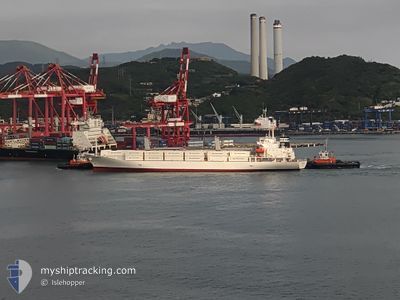
LADY ROSEBUD
Reefer
Current Trip
| Time Travelled | 7 days |
|---|---|
| Remaining Time | --- |
| Distance Travelled | 2106.98 nm |
| Remaining Distance | 189.00 nm |
| AVG Speed | 18.3 Knots |
| MAX Speed | 22.3 Knots |
| AVG Wind | 10.7 knots |
| MAX Wind | 22.9 knots |
| MIN Temp | 15.7°C / 60.26°F |
| MAX Temp | 29.5°C / 85.1°F |
| Draught | 6.8 m |
| Position Received | 7 d ago |
Current Position
| Longitude | 137.03355° |
|---|---|
| Latitude | 34.23755° |
| Status | Under way using engine |
| Speed | 18.7 Knots |
| Course | 193° |
| Area | Philippine Sea |
| Station | T-AIS |
| Position Received | 7 d ago |
Info
Information
The current position of LADY ROSEBUD is in Philippine Sea with coordinates 34.23755° / 137.03355° as reported on 2024-04-19 12:31 by AIS to our vessel tracker app. The vessel's current speed is 18.7 Knots and is heading at the port of DAVAO. The estimated time of arrival as calculated by MyShipTracking vessel tracking app is 2024-04-23 14:00 LT
The vessel LADY ROSEBUD (IMO: 9412749, MMSI: 351698000) is a Reefer that was built in 2009 ( 15 years old ). It's sailing under the flag of [PA] Panama.
In this page you can find informations about the vessels current position, last detected port calls, and current voyage information. If the vessels is not in coverage by AIS you will find the latest position.
The current position of LADY ROSEBUD is detected by our AIS receivers and we are not responsible for the reliability of the data. The last position was recorded while the vessel was in Coverage by the Ais receivers of our vessel tracking app.
The current draught of LADY ROSEBUD as reported by AIS is 6.8 meters
Weather
| Temperature | 28.3°C / 82.94°F |
|---|---|
| Wind Speed | 3 knots |
| Direction | 86° E |
| Pressure | 1009.3 hPa |
| Humidity | 78.8 % |
| Cloud Coverage | 100 % |
Featured Company
Events
| Time | Event | Details | Position / Dest | Info |
|---|---|---|---|---|
| 2024-04-19 12:31 | OUT of Coverage |
34.23755 / 137.03355
Philippine Sea
PH DVO
|
Speed: 18.7 kn Course: 193° |
|
| 2024-04-19 09:25 | PORT DEPARTURE |
|
34.98877 / 136.81757
PH DVO
|
Speed: 14.3 kn Course: 216° |
| 2024-04-19 09:13 | Draught Changed | 6.8 6.1 |
35.05167 / 136.85983
[JP] NAGOYA
|
Speed: 8.9 kn Course: 194° |
| 2024-04-19 09:13 | Destination Changed | PH DVO JP NGO |
35.05167 / 136.85983
[JP] NAGOYA
|
Speed: 8.9 kn Course: 194° |
| 2024-04-19 09:13 | ETA Changed | 2024/04/23 14:00 2024/04/18 22:30 |
35.05167 / 136.85983
[JP] NAGOYA
|
Speed: 8.9 kn Course: 194° |
| 2024-04-19 08:52 | IN Coverage |
35.05582 / 136.85843
Philippine Sea
[JP] NAGOYA
|
Speed: 0.6 kn Course: 24° |
|
| 2024-04-18 22:09 | OUT of Coverage |
35.03182 / 136.85313
Philippine Sea
[JP] NAGOYA
|
Speed: 8.1 kn Course: 30° |
|
| 2024-04-18 21:54 | PORT ARRIVAL |
|
34.99377 / 136.82298
[JP] NAGOYA
|
Speed: 12.8 kn Course: 34° |
| 2024-04-18 16:25 | Draught Changed | 6.1 8.3 |
34.51267 / 138.13893
JP NGO
|
Speed: 18 kn Course: 269° |
| 2024-04-18 16:25 | Destination Changed | JP NGO JP KWS OT |
34.51267 / 138.13893
JP NGO
|
Speed: 18 kn Course: 269° |