
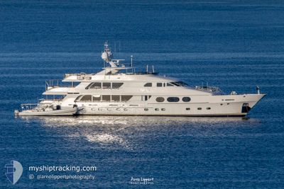
LADY JOY
Yacht
Current Trip
| Time Travelled | 2 days |
|---|---|
| Remaining Time | --- |
| Distance Travelled | 0.99 nm |
| Remaining Distance | --- |
| AVG Speed | --- |
| MAX Speed | --- |
| AVG Wind | 14.9 knots |
| MAX Wind | 15 knots |
| MIN Temp | 23.4°C / 74.12°F |
| MAX Temp | 23.7°C / 74.66°F |
| Draught | 2.5 m |
| Position Received | 2 d ago |
Current Position
| Longitude | --- |
|---|---|
| Latitude | --- |
| Status | Under way using engine |
| Speed | |
| Course | 98° |
| Area | North Atlantic Ocean |
| Station | T-AIS |
| Position Received | 2 d ago |
Info
Information
The current position of LADY JOY is in North Atlantic Ocean with coordinates 25.07408° / -77.27592° as reported on 2026-01-06 20:39 by AIS to our vessel tracker app. The vessel's current speed is 0 Knots
The vessel LADY JOY (IMO: 9439010, MMSI: 538080044) is a Yacht that was built in 2007 ( 19 years old ). It's sailing under the flag of [MH] Marshall Is.
In this page you can find informations about the vessels current position, last detected port calls, and current voyage information. If the vessels is not in coverage by AIS you will find the latest position.
The current position of LADY JOY is detected by our AIS receivers and we are not responsible for the reliability of the data. The last position was recorded while the vessel was in Coverage by the Ais receivers of our vessel tracking app.
The current draught of LADY JOY as reported by AIS is 2.5 meters
Weather
| Temperature | 23.8°C / 74.84°F |
|---|---|
| Wind Speed | 11 knots |
| Direction | 100° E |
| Pressure | 1016.5 hPa |
| Humidity | 66.9 % |
| Cloud Coverage | --- |
Featured Company
Last Port Calls
| Port | Arrival | Departure | Time In Port |
|---|---|---|---|
| 2026-01-04 09:25 | 2026-01-06 10:14 | 2 d | |
| 2025-12-27 09:55 | 2025-12-28 17:35 | 1 d | |
| 2025-12-20 09:56 | 2025-12-21 11:34 | 1 d | |
| 2025-11-25 17:55 | 2025-12-01 15:36 | 5 d | |
| 2025-11-24 18:22 | |||
| 2025-11-06 09:44 |
Most Visited Ports (Last year)
| Port | Arrivals | |
|---|---|---|
| 4 | ||
| 3 | ||
| 2 | ||
| 1 | ||
| 1 | ||
| 1 |
Last Trips
| Origin | Departure | Destination | Arrival | Distance | |
|---|---|---|---|---|---|
| 2025-12-28 17:35 | 2026-01-04 09:25 | 157.14 nm | |||
| 2025-12-21 11:34 | 2025-12-27 09:55 | 160.32 nm | |||
| 2025-12-01 15:36 | 2025-12-20 09:56 | 409.78 nm | |||
| 2025-11-06 09:44 | 2025-11-25 17:55 | 605.60 nm | |||
| 2025-11-06 09:44 | 2025-11-24 18:22 | 605.59 nm |
Events
| Time | Event | Details | Position / Dest | Info |
|---|---|---|---|---|
| 2026-01-06 20:39 | OUT of Coverage |
25.07408 / -77.27592
North Atlantic Ocean
|
Speed: Course: 330° |
|
| 2026-01-06 20:06 | IN Coverage |
25.07409 / -77.27592
North Atlantic Ocean
|
Speed: 0.1 kn Course: 161.4° |
|
| 2026-01-06 17:43 | OUT of Coverage |
25.07420 / -77.27593
North Atlantic Ocean
|
Speed: 0.4 kn Course: 15.4° |
|
| 2026-01-06 15:25 | STOP Moving | 3.11 nm, East of NASSAU |
25.07421 / -77.27543
NASSAU
|
Speed: 0.2 kn Course: 116° |
| 2026-01-06 15:14 | PORT DEPARTURE |
|
25.07462 / -77.29164
NASSAU
|
Speed: 6.9 kn Course: 106° |
| 2026-01-06 15:03 | START Moving |
25.07608 / -77.31465
[BS] NASSAU
|
Speed: 5.2 kn Course: 99° |
|
| 2026-01-06 14:51 | Status Changed | Under way using engine Moored |
25.07569 / -77.31679
[BS] NASSAU
|
Speed: Course: 6° |
| 2026-01-05 22:34 | ETA Changed | 2026/01/03 21:45 |
25.07569 / -77.31676
[BS] NASSAU
|
Speed: Course: 6° |
| 2026-01-05 22:16 | ETA Changed | 2026/01/03 21:45 |
25.07569 / -77.31678
[BS] NASSAU
|
Speed: Course: 6° |
| 2026-01-05 17:52 | ETA Changed | 2026/01/03 21:45 |
25.07569 / -77.31679
[BS] NASSAU
|
Speed: Course: 6° |