
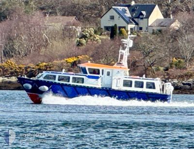
LADY HEATHER
Passenger
Current Trip
| Time Travelled | 2 h, 59 mins |
|---|---|
| Remaining Time | --- |
| Distance Travelled | 6.26 nm |
| Remaining Distance | --- |
| AVG Speed | 17.5 Knots |
| MAX Speed | 20.5 Knots |
| AVG Wind | 2 knots |
| MAX Wind | 2 knots |
| MIN Temp | 0.4°C / 32.72°F |
| MAX Temp | 1.9°C / 35.42°F |
| Draught | 1.2 m |
| Position Received | 2 h, 26 m ago |
Current Position
| Longitude | --- |
|---|---|
| Latitude | --- |
| Status | Under way using engine |
| Speed | |
| Course | --- |
| Area | Inner Seas off the West Coast of Scotland |
| Station | T-AIS |
| Position Received | 2 h, 26 m ago |
Info
Information
The current position of LADY HEATHER is in Inner Seas off the West Coast of Scotland with coordinates 56.51626° / -5.36749° as reported on 2026-01-09 20:00 by AIS to our vessel tracker app. The vessel's current speed is 0 Knots
The vessel LADY HEATHER (MMSI: 232004148) is a Passenger It's sailing under the flag of [GB] United Kingdom.
In this page you can find informations about the vessels current position, last detected port calls, and current voyage information. If the vessels is not in coverage by AIS you will find the latest position.
The current position of LADY HEATHER is detected by our AIS receivers and we are not responsible for the reliability of the data. The last position was recorded while the vessel was in Coverage by the Ais receivers of our vessel tracking app.
The current draught of LADY HEATHER as reported by AIS is 1.2 meters
Weather
| Temperature | 0.4°C / 32.72°F |
|---|---|
| Wind Speed | 2 knots |
| Direction | 97° E |
| Pressure | 1007 hPa |
| Humidity | 98.7 % |
| Cloud Coverage | 100 % |
Featured Company
Last Port Calls
| Port | Arrival | Departure | Time In Port |
|---|---|---|---|
| 2026-01-09 18:54 | 2026-01-09 19:28 | 33 m | |
| 2026-01-09 16:45 | 2026-01-09 16:48 | 2 m | |
| 2026-01-09 15:17 | 2026-01-09 15:34 | 16 m | |
| 2026-01-09 12:30 | 2026-01-09 13:01 | 31 m | |
| 2026-01-09 08:42 | 2026-01-09 08:45 | 3 m | |
| 2026-01-09 07:02 | 2026-01-09 07:26 | 24 m | |
| 2026-01-08 22:07 | 2026-01-08 22:09 | 2 m | |
| 2026-01-08 18:54 | 2026-01-08 19:15 | 21 m | |
| 2026-01-08 16:33 | 2026-01-08 16:42 | 8 m | |
| 2026-01-08 15:10 | 2026-01-08 15:31 | 20 m |
Most Visited Ports (Last year)
| Port | Arrivals | |
|---|---|---|
| 1339 | ||
| 2 |
Last Trips
| Origin | Departure | Destination | Arrival | Distance | |
|---|---|---|---|---|---|
| 2026-01-09 16:48 | 2026-01-09 18:54 | 14.03 nm | |||
| 2026-01-09 15:34 | 2026-01-09 16:45 | 15.71 nm | |||
| 2026-01-09 13:01 | 2026-01-09 15:17 | 15.75 nm | |||
| 2026-01-09 08:45 | 2026-01-09 12:30 | 14.11 nm | |||
| 2026-01-09 07:26 | 2026-01-09 08:42 | 15.71 nm | |||
| 2026-01-08 22:09 | 2026-01-09 07:02 | 15.62 nm | |||
| 2026-01-08 19:15 | 2026-01-08 22:07 | 15.85 nm | |||
| 2026-01-08 16:42 | 2026-01-08 18:54 | 15.36 nm | |||
| 2026-01-08 15:31 | 2026-01-08 16:33 | 14.80 nm | |||
| 2026-01-08 13:02 | 2026-01-08 15:10 | 15.74 nm |
Events
| Time | Event | Details | Position / Dest | Info |
|---|---|---|---|---|
| 2026-01-09 20:00 | OUT of Coverage |
56.51626 / -5.36749
Inner Seas off the West Coast of Scotland
|
Speed: Course: 142.3° |
|
| 2026-01-09 19:56 | STOP Moving | 2.77 nm, South East of PORT APPIN PIER |
56.51625 / -5.36754
GBGSA
|
Speed: 0.3 kn Course: 511° |
| 2026-01-09 19:28 | PORT DEPARTURE |
|
56.56510 / -5.52989
GBGSA
|
Speed: 9.7 kn Course: 87.2° |
| 2026-01-09 18:54 | PORT ARRIVAL |
|
56.56531 / -5.53778
[GB] GLENSANDA
|
Speed: 17.5 kn Course: 267.7° |
| 2026-01-09 18:28 | START Moving | 2.65 nm, South East of PORT APPIN PIER |
56.51746 / -5.37059
GBGSA
|
Speed: 11.4 kn Course: 293.7° |
| 2026-01-09 17:14 | STOP Moving | 2.77 nm, South East of PORT APPIN PIER |
56.51623 / -5.36752
GBGSA
|
Speed: 0.2 kn Course: 511° |
| 2026-01-09 16:48 | PORT DEPARTURE |
|
56.56396 / -5.51185
GBGSA
|
Speed: 12.7 kn Course: 96.9° |
| 2026-01-09 16:45 | PORT ARRIVAL |
|
56.56520 / -5.53600
[GB] GLENSANDA
|
Speed: 17.6 kn Course: 277.3° |
| 2026-01-09 16:08 | START Moving | 2.66 nm, South East of PORT APPIN PIER |
56.51730 / -5.37071
GBGSA
|
Speed: 12.3 kn Course: 295.8° |
| 2026-01-09 16:03 | STOP Moving | 2.77 nm, South East of PORT APPIN PIER |
56.51622 / -5.36754
GBGSA
|
Speed: Course: 511° |