
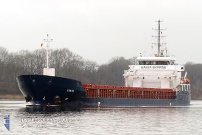
KIRSI
Cargo
Current Trip
SESTV
| Time Travelled | 4 h, 47 mins |
|---|---|
| Remaining Time | --- |
| Distance Travelled | 44.12 nm |
| Remaining Distance | --- |
| AVG Speed | 9.6 Knots |
| MAX Speed | 10.4 Knots |
| AVG Wind | 21 knots |
| MAX Wind | 23.7 knots |
| MIN Temp | 8.8°C / 47.84°F |
| MAX Temp | 9.6°C / 49.28°F |
| Draught | 5.1 m |
| Position Received | 1 m ago |
Current Position
| Longitude | --- |
|---|---|
| Latitude | --- |
| Status | Under way using engine |
| Speed | 9.5 Knots |
| Course | 115.8° |
| Area | Baltic Sea |
| Station | T-AIS |
| Position Received | 1 m ago |
Info
Information
The current position of KIRSI is in Baltic Sea with coordinates 54.52893° / 11.34082° as reported on 2025-12-08 15:05 by AIS to our vessel tracker app. The vessel's current speed is 9.5 Knots
The vessel KIRSI (IMO: 9490179, MMSI: 304964000) is a Cargo It's sailing under the flag of [AG] Antigua Barbuda.
In this page you can find informations about the vessels current position, last detected port calls, and current voyage information. If the vessels is not in coverage by AIS you will find the latest position.
The current position of KIRSI is detected by our AIS receivers and we are not responsible for the reliability of the data. The last position was recorded while the vessel was in Coverage by the Ais receivers of our vessel tracking app.
The current draught of KIRSI as reported by AIS is 5.1 meters
Weather
| Temperature | 8.9°C / 48.02°F |
|---|---|
| Wind Speed | 19 knots |
| Direction | 225° SW |
| Pressure | 1008.6 hPa |
| Humidity | 86.9 % |
| Cloud Coverage | 100 % |
Featured Company
Last Port Calls
| Port | Arrival | Departure | Time In Port |
|---|---|---|---|
| 2025-12-08 11:14 | 2025-12-08 11:19 | 4 m | |
| 2025-12-02 00:03 | 2025-12-04 02:04 | 2 d | |
| 2025-11-16 11:18 | 2025-11-17 03:11 | 15 h | |
| 2025-11-12 12:03 | 2025-11-14 15:07 | 2 d | |
| 2025-11-09 17:45 | 2025-11-11 12:40 | 1 d | |
| 2025-11-06 18:25 | 2025-11-08 12:21 | 1 d | |
| 2025-10-30 10:47 | 2025-10-31 19:31 | 1 d | |
| 2025-10-26 18:34 | 2025-10-29 22:35 | 3 d | |
| 2025-10-21 04:41 | 2025-10-21 06:24 | 1 h | |
| 2025-10-15 20:20 | 2025-10-17 12:44 | 1 d |
Most Visited Ports (Last year)
| Port | Arrivals | |
|---|---|---|
| 16 | ||
| 14 | ||
| 4 | ||
| 4 | ||
| 2 | ||
| 2 |
Last Trips
| Origin | Departure | Destination | Arrival | Distance | |
|---|---|---|---|---|---|
| 2025-12-04 02:04 | 2025-12-08 11:14 | 940.96 nm | |||
| 2025-11-17 03:11 | 2025-12-02 00:03 | 1876.25 nm | |||
| 2025-11-14 15:07 | 2025-11-16 11:18 | 456.77 nm | |||
| 2025-11-11 12:40 | 2025-11-12 12:03 | 174.86 nm | |||
| 2025-11-08 12:21 | 2025-11-09 17:45 | 175.69 nm | |||
| 2025-10-31 19:31 | 2025-11-06 18:25 | 833.55 nm | |||
| 2025-10-29 22:35 | 2025-10-30 10:47 | 26.37 nm | |||
| 2025-10-21 06:24 | 2025-10-26 18:34 | 933.10 nm | |||
| 2025-10-17 12:44 | 2025-10-21 04:41 | 839.54 nm | |||
| 2025-10-12 09:15 | 2025-10-15 20:20 | 605.85 nm |
Events
| Time | Event | Details | Position / Dest | Info |
|---|---|---|---|---|
| 2025-12-08 13:04 | Status Changed | Under way using engine Default |
54.56330 / 10.79858
SESTV
|
Speed: 10.1 kn Course: 86° |
| 2025-12-08 12:45 | IN Coverage |
54.56330 / 10.79858
Baltic Sea
SESTV
|
Speed: 10.1 kn Course: 85.9° |
|
| 2025-12-08 11:37 | Status Changed | Default Under way using engine |
54.50505 / 10.39312
SESTV
|
Speed: 10 kn Course: 65.4° |
| 2025-12-08 11:36 | OUT of Coverage |
54.50432 / 10.39037
Baltic Sea
SESTV
|
Speed: 10 kn Course: 65.4° |
|
| 2025-12-08 11:36 | Status Changed | Under way using engine Default |
54.50411 / 10.38957
SESTV
|
Speed: 10 kn Course: 65° |
| 2025-12-08 11:29 | Status Changed | Default Under way using engine |
54.49629 / 10.35809
SESTV
|
Speed: 9 kn Course: 103.3° |
| 2025-12-08 11:01 | Change Sea Area | German part of the Baltic Sea German part of the North Sea |
54.46114 / 10.27081
Baltic Sea
SESTV
|
Speed: 8.6 kn Course: 37.4° |
| 2025-12-08 10:19 | PORT DEPARTURE |
|
54.36407 / 10.17075
SESTV
|
Speed: 9.1 kn Course: 58° |
| 2025-12-08 10:14 | PORT ARRIVAL |
|
54.36401 / 10.15193
[DE] KIEL
|
Speed: 6 kn Course: 106° |
| 2025-12-08 10:11 | START Moving | 1.33 nm, South West of STICKENHΟRN SPORT |
54.36508 / 10.14516
SESTV
|
Speed: 3.5 kn Course: 105° |