
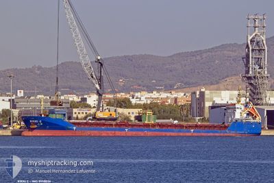
KIKKI C
General Cargo
Current Trip
| Time Travelled | 4 days |
|---|---|
| Remaining Time | --- |
| Distance Travelled | 703.35 nm |
| Remaining Distance | --- |
| AVG Speed | 7.2 Knots |
| MAX Speed | 9.6 Knots |
| AVG Wind | 8.2 knots |
| MAX Wind | 25.3 knots |
| MIN Temp | 10.4°C / 50.72°F |
| MAX Temp | 16°C / 60.8°F |
| Draught | 6.7 m |
| Position Received | 2 d ago |
Current Position
| Longitude | --- |
|---|---|
| Latitude | --- |
| Status | Under way using engine |
| Speed | 7.3 Knots |
| Course | 358° |
| Area | North Atlantic Ocean |
| Station | T-AIS |
| Position Received | 2 d ago |
Info
Information
The current position of KIKKI C is in North Atlantic Ocean with coordinates 39.50617° / -9.83450° as reported on 2025-03-01 23:09 by AIS to our vessel tracker app. The vessel's current speed is 7.3 Knots and is heading at the port of HAUGESUND. The estimated time of arrival as calculated by MyShipTracking vessel tracking app is 2025-03-08 21:00 LT
The vessel KIKKI C (IMO: 9558036, MMSI: 255806480) is a General Cargo that was built in 2011 ( 14 years old ). It's sailing under the flag of [PT] Portugal.
In this page you can find informations about the vessels current position, last detected port calls, and current voyage information. If the vessels is not in coverage by AIS you will find the latest position.
The current position of KIKKI C is detected by our AIS receivers and we are not responsible for the reliability of the data. The last position was recorded while the vessel was in Coverage by the Ais receivers of our vessel tracking app.
The current draught of KIKKI C as reported by AIS is 6.7 meters
Weather
| Temperature | 12.2°C / 53.96°F |
|---|---|
| Wind Speed | 23 knots |
| Direction | 65° ENE |
| Pressure | 1021.6 hPa |
| Humidity | 74.6 % |
| Cloud Coverage | 5 % |
Featured Company
Last Port Calls
| Port | Arrival | Departure | Time In Port |
|---|---|---|---|
| 2025-02-27 21:43 | 2025-02-28 01:54 | 4 h | |
| 2025-02-23 17:46 | 2025-02-26 15:23 | 2 d | |
| 2025-02-19 10:59 | 2025-02-22 12:28 | 3 d | |
| 2025-02-08 20:10 | 2025-02-11 11:37 | 2 d | |
| 2025-02-06 08:49 | 2025-02-08 15:38 | 2 d | |
| 2025-02-06 05:30 | 2025-02-06 07:20 | 1 h | |
| 2025-01-26 09:04 | 2025-01-27 16:48 | 1 d | |
| 2025-01-24 00:40 | 2025-01-24 05:27 | 4 h | |
| 2025-01-21 04:00 | 2025-01-23 17:40 | 2 d | |
| 2025-01-15 06:31 | 2025-01-16 20:31 | 1 d |
Last Trips
| Origin | Departure | Destination | Arrival | Distance | |
|---|---|---|---|---|---|
| 2025-02-26 15:23 | 2025-02-27 21:43 | 170.08 nm | |||
| 2025-02-22 12:28 | 2025-02-23 17:46 | 299.09 nm | |||
| 2025-02-11 11:37 | 2025-02-19 10:59 | 1419.91 nm | |||
| 2025-02-08 15:38 | 2025-02-08 20:10 | 33.90 nm | |||
| 2025-02-06 07:20 | 2025-02-06 08:49 | 8.26 nm | |||
| 2025-01-27 16:48 | 2025-02-06 05:30 | 1702.01 nm | |||
| 2025-01-24 05:27 | 2025-01-26 09:04 | 326.21 nm | |||
| 2025-01-23 17:40 | 2025-01-24 00:40 | 27.44 nm | |||
| 2025-01-16 20:31 | 2025-01-21 04:00 | 936.11 nm | |||
| 2025-01-15 00:49 | 2025-01-15 06:31 | 36.97 nm |
Events
| Time | Event | Details | Position / Dest | Info |
|---|---|---|---|---|
| 2025-03-01 23:15 | Status Changed | Default Under way using engine |
39.51933 / -9.83517
NOHAU
|
Speed: 7.3 kn Course: 358° |
| 2025-03-01 23:09 | OUT of Coverage |
39.50617 / -9.83450
North Atlantic Ocean
NOHAU
|
Speed: 7.3 kn Course: 358° |
|
| 2025-03-01 23:01 | Status Changed | Under way using engine Default |
39.49017 / -9.83400
NOHAU
|
Speed: 7.4 kn Course: 5° |
| 2025-03-01 22:55 | Status Changed | Default Under way using engine |
39.47817 / -9.83533
NOHAU
|
Speed: 7.3 kn Course: 2° |
| 2025-03-01 22:47 | Status Changed | Under way using engine Default |
39.46017 / -9.83700
NOHAU
|
Speed: 6.8 kn Course: 3° |
| 2025-03-01 22:44 | Status Changed | Default Under way using engine |
39.45433 / -9.83767
NOHAU
|
Speed: 7 kn Course: 4° |
| 2025-03-01 22:37 | Status Changed | Under way using engine Default |
39.44117 / -9.83900
NOHAU
|
Speed: 6.7 kn Course: 5° |
| 2025-03-01 22:31 | Status Changed | Default Under way using engine |
39.43033 / -9.84017
NOHAU
|
Speed: 6.9 kn Course: 5° |
| 2025-03-01 22:26 | Status Changed | Under way using engine Default |
39.42050 / -9.84133
NOHAU
|
Speed: 6.8 kn Course: 5° |
| 2025-03-01 22:20 | Status Changed | Default Under way using engine |
39.40883 / -9.84233
NOHAU
|
Speed: 6.9 kn Course: 4° |