
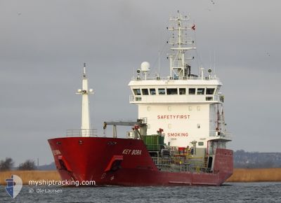
KEY BORA
Oil/Chemical Tanker
Current Trip
| Trip Time | 3 days |
|---|---|
| Trip Distance | 612.03 nm |
| AVG Speed | 8.1 Knots |
| MAX Speed | 11.1 Knots |
| Draught | 6.2 m |
| AVG Wind | 17.9 knots |
| MAX Wind | 36 knots |
| MIN Temp | 2.4°C / 36.32°F |
| MAX Temp | 9°C / 48.2°F |
| Position Received | 2 m ago |
Current Position
| Longitude | --- |
|---|---|
| Latitude | --- |
| Status | Moored |
| Speed | |
| Course | 127° |
| Area | Norwegian Sea |
| Station | T-AIS |
| Position Received | 2 m ago |
Info
Information
The current position of KEY BORA is in Norwegian Sea with coordinates 63.05553° / 7.66002° as reported on 2025-12-05 11:31 by AIS to our vessel tracker app. The vessel's current speed is 0 Knots and is currently inside the port of AVEROY.
The vessel KEY BORA (IMO: 9316024, MMSI: 236385000) is a Oil/Chemical Tanker that was built in 2006 ( 19 years old ). It's sailing under the flag of [GI] Gibraltar.
In this page you can find informations about the vessels current position, last detected port calls, and current voyage information. If the vessels is not in coverage by AIS you will find the latest position.
The current position of KEY BORA is detected by our AIS receivers and we are not responsible for the reliability of the data. The last position was recorded while the vessel was in Coverage by the Ais receivers of our vessel tracking app.
The current draught of KEY BORA as reported by AIS is 6.2 meters
Weather
| Temperature | 2.8°C / 37.04°F |
|---|---|
| Wind Speed | 9 knots |
| Direction | 160° SSE |
| Pressure | 1011.4 hPa |
| Humidity | 69.3 % |
| Cloud Coverage | 99 % |
Featured Company
Last Port Calls
| Port | Arrival | Departure | Time In Port |
|---|---|---|---|
| 2025-12-05 03:05 | |||
| 2025-12-01 07:31 | 2025-12-01 21:06 | 13 h | |
| 2025-11-27 19:48 | 2025-11-29 06:44 | 1 d | |
| 2025-11-25 05:39 | 2025-11-26 13:57 | 1 d | |
| 2025-11-24 08:44 | 2025-11-24 20:51 | 12 h | |
| 2025-11-22 11:58 | 2025-11-23 09:23 | 21 h | |
| 2025-11-18 07:31 | 2025-11-19 19:00 | 1 d | |
| 2025-11-16 16:04 | 2025-11-17 18:59 | 1 d | |
| 2025-11-11 06:30 | 2025-11-11 13:08 | 6 h | |
| 2025-11-08 01:59 | 2025-11-08 19:24 | 17 h |
Most Visited Ports (Last year)
| Port | Arrivals | |
|---|---|---|
| 7 | ||
| 6 | ||
| 6 | ||
| 6 | ||
| 6 | ||
| 4 |
Last Trips
| Origin | Departure | Destination | Arrival | Distance | |
|---|---|---|---|---|---|
| 2025-12-01 21:06 | 2025-12-05 03:05 | 612.03 nm | |||
| 2025-11-29 06:44 | 2025-12-01 07:31 | 311.55 nm | |||
| 2025-11-26 13:57 | 2025-11-27 19:48 | 258.06 nm | |||
| 2025-11-24 20:51 | 2025-11-25 05:39 | 84.23 nm | |||
| 2025-11-23 09:23 | 2025-11-24 08:44 | 259.10 nm | |||
| 2025-11-19 19:00 | 2025-11-22 11:58 | 627.44 nm | |||
| 2025-11-17 18:59 | 2025-11-18 07:31 | 126.23 nm | |||
| 2025-11-11 13:08 | 2025-11-16 16:04 | 1393.88 nm | |||
| 2025-11-08 19:24 | 2025-11-11 06:30 | 525.06 nm | |||
| 2025-11-03 15:05 | 2025-11-08 01:59 | 888.16 nm |
Events
| Time | Event | Details | Position / Dest | Info |
|---|---|---|---|---|
| 2025-12-05 06:22 | Status Changed | Moored Default |
63.05552 / 7.66008
[NO] AVEROY
|
Speed: Course: 128° |
| 2025-12-05 06:20 | Status Changed | Default Moored |
63.05554 / 7.66003
[NO] AVEROY
|
Speed: Course: 128° |
| 2025-12-05 02:31 | Status Changed | Moored Under way using engine |
63.05551 / 7.66003
[NO] AVEROY
|
Speed: Course: 127° |
| 2025-12-05 02:22 | STOP Moving |
63.05574 / 7.65977
[NO] AVEROY
|
Speed: 0.3 kn Course: 132° |
|
| 2025-12-05 02:05 | PORT ARRIVAL |
|
63.06090 / 7.67333
[NO] AVEROY
|
Speed: 4.2 kn Course: 210° |
| 2025-12-05 01:14 | Status Changed | Under way using engine Default |
63.19389 / 7.73571
NOAVE
|
Speed: 10.7 kn Course: 206° |
| 2025-12-05 01:13 | Status Changed | Default Under way using engine |
63.19751 / 7.73958
NOAVE
|
Speed: 10.4 kn Course: 205.7° |
| 2025-12-05 00:34 | Status Changed | Under way using engine Default |
63.24986 / 7.56901
NOAVE
|
Speed: 10.3 kn Course: 91° |
| 2025-12-05 00:33 | Status Changed | Default Under way using engine |
63.24992 / 7.55966
NOAVE
|
Speed: 10.2 kn Course: 90.6° |
| 2025-12-05 00:20 | ETA Changed | 2025/12/05 01:00 2025/12/05 00:30 |
63.25037 / 7.48667
NOAVE
|
Speed: 8.5 kn Course: 90° |