
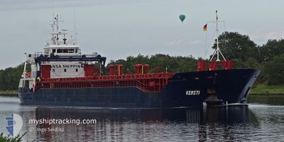
KERSTI
General Cargo
Current Trip
| Time Travelled | 5 days |
|---|---|
| Remaining Time | --- |
| Distance Travelled | 984.96 nm |
| Remaining Distance | --- |
| AVG Speed | 10.4 Knots |
| MAX Speed | 12.3 Knots |
| AVG Wind | 10.8 knots |
| MAX Wind | 30.8 knots |
| MIN Temp | -4°C / 24.8°F |
| MAX Temp | 5.4°C / 41.72°F |
| Draught | 5.3 m |
| Position Received | 7 h, 9 m ago |
Current Position
| Longitude | --- |
|---|---|
| Latitude | --- |
| Status | Under way using engine |
| Speed | 9.6 Knots |
| Course | 226.2° |
| Area | Baltic Sea |
| Station | T-AIS |
| Position Received | 7 h, 9 m ago |
Info
Information
The current position of KERSTI is in Baltic Sea with coordinates 59.27339° / 21.89992° as reported on 2024-12-15 21:57 by AIS to our vessel tracker app. The vessel's current speed is 9.6 Knots and is heading at the port of FREDERIKSVAERK. The estimated time of arrival as calculated by MyShipTracking vessel tracking app is 2024-12-18 08:00 LT
The vessel KERSTI (IMO: 9342138, MMSI: 249145000) is a General Cargo that was built in 2006 ( 18 years old ). It's sailing under the flag of [MT] Malta.
In this page you can find informations about the vessels current position, last detected port calls, and current voyage information. If the vessels is not in coverage by AIS you will find the latest position.
The current position of KERSTI is detected by our AIS receivers and we are not responsible for the reliability of the data. The last position was recorded while the vessel was in Coverage by the Ais receivers of our vessel tracking app.
The current draught of KERSTI as reported by AIS is 5.3 meters
Weather
| Temperature | 8.6°C / 47.48°F |
|---|---|
| Wind Speed | 35 knots |
| Direction | 279° W |
| Pressure | 980.8 hPa |
| Humidity | 75.9 % |
| Cloud Coverage | 98 % |
Featured Company
Last Port Calls
| Port | Arrival | Departure | Time In Port |
|---|---|---|---|
| 2024-12-10 08:27 | 2024-12-10 15:50 | 7 h | |
| 2024-12-05 18:04 | |||
| 2024-12-02 08:36 | 2024-12-02 16:07 | 7 h | |
| 2024-11-27 18:44 | 2024-11-28 22:47 | 1 d | |
| 2024-11-23 08:41 | 2024-11-24 13:51 | 1 d | |
| 2024-11-15 07:36 | 2024-11-15 15:13 | 7 h | |
| 2024-11-10 18:16 | 2024-11-11 20:32 | 1 d | |
| 2024-11-07 08:14 | 2024-11-07 15:34 | 7 h | |
| 2024-11-02 19:36 | 2024-11-03 23:56 | 1 d | |
| 2024-10-30 08:15 | 2024-10-30 15:51 | 7 h |
Most Visited Ports (Last year)
| Port | Arrivals | |
|---|---|---|
| 19 | ||
| 17 | ||
| 3 | ||
| 2 | ||
| 2 | ||
| 2 |
Last Trips
| Origin | Departure | Destination | Arrival | Distance | |
|---|---|---|---|---|---|
| 2024-12-02 16:07 | 2024-12-05 18:04 | 777.20 nm | |||
| 2024-11-28 22:47 | 2024-12-02 08:36 | 715.88 nm | |||
| 2024-11-24 13:51 | 2024-11-27 18:44 | 767.98 nm | |||
| 2024-11-15 15:13 | 2024-11-23 08:41 | 1487.15 nm | |||
| 2024-11-11 20:32 | 2024-11-15 07:36 | 764.46 nm | |||
| 2024-11-07 15:34 | 2024-11-10 18:16 | 767.49 nm | |||
| 2024-11-03 23:56 | 2024-11-07 08:14 | 764.50 nm | |||
| 2024-10-30 15:51 | 2024-11-02 19:36 | 766.52 nm | |||
| 2024-10-26 20:14 | 2024-10-30 08:15 | 762.94 nm | |||
| 2024-10-22 16:27 | 2024-10-25 17:57 | 767.52 nm |
Events
| Time | Event | Details | Position / Dest | Info |
|---|---|---|---|---|
| 2024-12-15 21:59 | Status Changed | Default Under way using engine |
59.26937 / 21.89194
DKFDV
|
Speed: 9.6 kn Course: 226.2° |
| 2024-12-15 21:57 | OUT of Coverage |
59.27339 / 21.89992
Baltic Sea
DKFDV
|
Speed: 9.6 kn Course: 226.2° |
|
| 2024-12-15 21:53 | Detected in Sea | Estonian part of the Baltic Sea |
59.27977 / 21.91240
Baltic Sea
DKFDV
|
Speed: 9.4 kn Course: 223.8° |
| 2024-12-15 21:53 | Status Changed | Under way using engine Default |
59.27977 / 21.91240
DKFDV
|
Speed: 9.6 kn Course: 232° |
| 2024-12-15 21:44 | IN Coverage |
59.27977 / 21.91240
Baltic Sea
DKFDV
|
Speed: 9.4 kn Course: 223.8° |
|
| 2024-12-15 19:43 | Status Changed | Default Under way using engine |
59.48260 / 22.48594
DKFDV
|
Speed: 10.1 kn Course: 251° |
| 2024-12-15 19:33 | OUT of Coverage |
59.49145 / 22.53894
Baltic Sea
DKFDV
|
Speed: 10.1 kn Course: 251° |
|
| 2024-12-15 19:30 | Status Changed | Under way using engine Default |
59.49429 / 22.55550
DKFDV
|
Speed: 10.2 kn Course: 253° |
| 2024-12-15 19:27 | Status Changed | Default Under way using engine |
59.49711 / 22.57245
DKFDV
|
Speed: 10.3 kn Course: 253.4° |
| 2024-12-15 17:49 | Detected in Sea | Finnish part of the Baltic Sea |
59.58353 / 23.10521
Baltic Sea
DKFDV
|
Speed: 10.6 kn Course: 253.1° |