
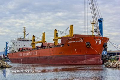
KAPTAN ARIFBAYRAKTAR
Bulk Carrier
Current Trip
| Time Travelled | --- |
|---|---|
| Remaining Time | --- |
| Distance Travelled | 1792.61 nm |
| Remaining Distance | --- |
| AVG Speed | 13.3 Knots |
| MAX Speed | 17 Knots |
| AVG Wind | 4.6 knots |
| MAX Wind | 20 knots |
| MIN Temp | 22.3°C / 72.14°F |
| MAX Temp | 36.2°C / 97.16°F |
| Draught | 12.6 m |
| Position Received | 7 d ago |
Current Position
| Longitude | -61.71450° |
|---|---|
| Latitude | 10.63800° |
| Status | Under way using engine |
| Speed | 10.6 Knots |
| Course | 274° |
| Area | Caribbean Sea |
| Station | T-AIS |
| Position Received | 7 d ago |
Info
Information
The current position of KAPTAN ARIFBAYRAKTAR is in Caribbean Sea with coordinates 10.63800° / -61.71450° as reported on 2024-04-30 20:32 by AIS to our vessel tracker app. The vessel's current speed is 10.6 Knots and is heading at the port of CHAGUARAMAS.
The vessel KAPTAN ARIFBAYRAKTAR (IMO: 9449560, MMSI: 215116000) is a Bulk Carrier that was built in 2010 ( 14 years old ). It's sailing under the flag of [MT] Malta.
In this page you can find informations about the vessels current position, last detected port calls, and current voyage information. If the vessels is not in coverage by AIS you will find the latest position.
The current position of KAPTAN ARIFBAYRAKTAR is detected by our AIS receivers and we are not responsible for the reliability of the data. The last position was recorded while the vessel was in Coverage by the Ais receivers of our vessel tracking app.
The current draught of KAPTAN ARIFBAYRAKTAR as reported by AIS is 12.6 meters
Weather
| Temperature | 28.4°C / 83.12°F |
|---|---|
| Wind Speed | 17 knots |
| Direction | 111° ESE |
| Pressure | 1009.4 hPa |
| Humidity | 78.7 % |
| Cloud Coverage | 60 % |
Featured Company
Last Port Calls
Most Visited Ports (Last year)
| Port | Arrivals | |
|---|---|---|
| 7 | ||
| 2 | ||
| 1 | ||
| 1 | ||
| 1 | ||
| 1 |
Last Trips
| Origin | Departure | Destination | Arrival | Distance |
|---|
Events
| Time | Event | Details | Position / Dest | Info |
|---|---|---|---|---|
| 2024-04-30 20:37 | Status Changed | Default Under way using engine |
10.63983 / -61.73150
TTCHA
|
Speed: 10.6 kn Course: 274° |
| 2024-04-30 20:32 | OUT of Coverage |
10.63800 / -61.71450
Caribbean Sea
|
Speed: 10.6 kn Course: 274° |
|
| 2024-04-30 20:09 | Status Changed | Under way using engine Default |
10.63350 / -61.64900
TTCHA
|
Speed: 7.6 kn Course: 256° |
| 2024-04-30 20:02 | Status Changed | Default Under way using engine |
10.63683 / -61.63600
TTCHA
|
Speed: 2.3 kn Course: 275° |
| 2024-04-30 20:02 | START Moving | 2.25 nm, South of CHAGUARAMAS |
10.63683 / -61.63600
TTCHA
|
Speed: 5.6 kn Course: 256° |
| 2024-04-30 19:52 | Status Changed | Under way using engine Default |
10.63617 / -61.62817
TTCHA
|
Speed: 1.5 kn Course: 350° |
| 2024-04-30 19:34 | Status Changed | Default At anchor |
10.63433 / -61.62933
TTCHA
|
Speed: 0.2 kn Course: 8° |
| 2024-04-30 19:28 | Status Changed | At anchor Default |
10.63400 / -61.62950
TTCHA
|
Speed: 0.2 kn Course: 12° |
| 2024-04-30 19:22 | IN Coverage |
10.63400 / -61.62950
Caribbean Sea
|
Speed: 0.2 kn Course: 29° |
|
| 2024-04-30 12:04 | OUT of Coverage |
10.63533 / -61.62750
Caribbean Sea
|
Speed: Course: 256° |