
KAPONTE
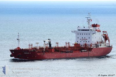
Oil/Chemical Tanker
Current Trip
| Time Travelled | 9 days |
|---|---|
| Remaining Time | --- |
| Distance Travelled | 39.08 nm |
| Remaining Distance | --- |
| AVG Speed | 7.8 Knots |
| MAX Speed | 9.3 Knots |
| AVG Wind | 7.3 knots |
| MAX Wind | 13.9 knots |
| MIN Temp | 26.5°C / 79.7°F |
| MAX Temp | 29.7°C / 85.46°F |
| Draught | 7.8 m |
| Position Received | 2023-11-04 10:46 |
Current Position
| Longitude | -16.81194° |
|---|---|
| Latitude | 13.53481° |
| Status | Under way using engine |
| Speed | 8.1 Knots |
| Course | 65.8° |
| Area | North Atlantic Ocean |
| Station | T-AIS |
| Position Received | 2023-11-04 10:46 |
Info
Information
The current position of KAPONTE is in North Atlantic Ocean with coordinates 13.53481° / -16.81194° as reported on 2023-11-04 10:46 by AIS to our vessel tracker app. The vessel's current speed is 8.1 Knots and is heading at the port of BANJUL.
The vessel KAPONTE (IMO: 9322152, MMSI: 538002543) is a Oil/Chemical Tanker that was built in 2006 ( 18 years old ). It's sailing under the flag of [MH] Marshall Is.
In this page you can find informations about the vessels current position, last detected port calls, and current voyage information. If the vessels is not in coverage by AIS you will find the latest position.
The current position of KAPONTE is detected by our AIS receivers and we are not responsible for the reliability of the data. The last position was recorded while the vessel was in Coverage by the Ais receivers of our vessel tracking app.
The current draught of KAPONTE as reported by AIS is 7.8 meters
Weather
| Temperature | 28.6°C / 83.48°F |
|---|---|
| Wind Speed | 5 knots |
| Direction | 223° SW |
| Pressure | 1005.9 hPa |
| Humidity | 71.9 % |
| Cloud Coverage | 100 % |
Featured Company
Last Port Calls
| Port | Arrival | Departure | Time In Port |
|---|---|---|---|
| 2024-04-20 08:22 | 2024-04-21 08:17 | 23 h | |
| 2024-04-17 14:10 | 2024-04-18 11:40 | 21 h | |
| 2024-04-14 07:52 | 2024-04-15 19:00 | 1 d | |
| 2024-04-08 19:35 | 2024-04-09 07:38 | 12 h | |
| 2024-04-06 16:44 | 2024-04-08 09:25 | 1 d | |
| 2024-03-23 07:37 | |||
| 2024-03-08 16:32 | 2024-03-09 16:03 | 23 h | |
| 2024-02-24 16:39 | 2024-02-26 06:54 | 1 d | |
| 2024-02-23 09:39 | 2024-02-24 07:27 | 21 h | |
| 2024-02-20 07:33 | 2024-02-21 07:43 | 1 d |
Last Trips
| Origin | Departure | Destination | Arrival | Distance | |
|---|---|---|---|---|---|
| 2024-04-18 12:40 | 2024-04-20 09:22 | 83.30 nm | |||
| 2024-04-15 20:00 | 2024-04-17 15:10 | 95.16 nm | |||
| 2024-04-09 08:38 | 2024-04-14 08:52 | 23.27 nm | |||
| 2024-04-08 10:25 | 2024-04-08 20:35 | 89.24 nm | |||
| 2024-03-23 08:37 | 2024-04-06 17:44 | 129.32 nm | |||
| 2024-02-26 07:54 | 2024-03-08 17:32 | 96.03 nm | |||
| 2024-02-24 08:27 | 2024-02-24 17:39 | 88.09 nm | |||
| 2024-02-21 08:43 | 2024-02-23 10:39 | 12.66 nm | |||
| 2024-02-19 08:37 | 2024-02-20 08:33 | 75.00 nm | |||
| 2024-02-13 16:35 | 2024-02-17 19:03 | 11.14 nm |
Events
| Time | Event | Details | Position / Dest | Info |
|---|---|---|---|---|
| 2024-04-30 14:07 | STOP Moving | 5.26 nm, North of GENTIL |
-.62031 / 8.81026
BANJUL GAMBIA
|
Speed: Course: 143° |
| 2024-04-30 11:03 | START Moving | 4.16 nm, North of GENTIL |
-.63667 / 8.79833
BANJUL GAMBIA
|
Speed: 5 kn Course: 45° |
| 2024-04-21 09:06 | STOP Moving | 4.04 nm, North of GENTIL |
-.63833 / 8.79333
BANJUL GAMBIA
|
Speed: Course: -1° |
| 2024-04-21 08:18 | START Moving | 1.84 nm, North of GENTIL |
-.67500 / 8.79000
BANJUL GAMBIA
|
Speed: 7 kn Course: -1° |
| 2024-04-21 08:17 | PORT DEPARTURE |
|
-.67500 / 8.79000
BANJUL GAMBIA
|
Speed: 2.7 kn Course: 82° |