
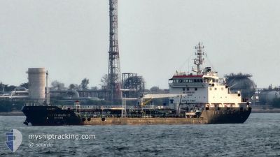
KAI EI MARU 15
Tanker
Current Trip
AEBC
| Time Travelled | 8 days |
|---|---|
| Remaining Time | --- |
| Distance Travelled | 190.47 nm |
| Remaining Distance | --- |
| AVG Speed | 8.2 Knots |
| MAX Speed | 13.3 Knots |
| AVG Wind | 11.2 knots |
| MAX Wind | 16 knots |
| MIN Temp | 25°C / 77°F |
| MAX Temp | 29°C / 84.2°F |
| Draught | 6.5 m |
| Position Received | 3 h, 9 m ago |
Current Position
| Longitude | --- |
|---|---|
| Latitude | --- |
| Status | Moored |
| Speed | 0.2 Knots |
| Course | 3° |
| Area | Singapore Strait |
| Station | T-AIS |
| Position Received | 3 h, 9 m ago |
Info
Information
The current position of KAI EI MARU 15 is in Singapore Strait with coordinates 1.26324° / 103.93571° as reported on 2025-03-02 23:46 by AIS to our vessel tracker app. The vessel's current speed is 0.2 Knots
The vessel KAI EI MARU 15 (IMO: 9812353, MMSI: 563021100) is a Tanker It's sailing under the flag of [SG] Singapore.
In this page you can find informations about the vessels current position, last detected port calls, and current voyage information. If the vessels is not in coverage by AIS you will find the latest position.
The current position of KAI EI MARU 15 is detected by our AIS receivers and we are not responsible for the reliability of the data. The last position was recorded while the vessel was in Coverage by the Ais receivers of our vessel tracking app.
The current draught of KAI EI MARU 15 as reported by AIS is 6.5 meters
Weather
| Temperature | 26.6°C / 79.88°F |
|---|---|
| Wind Speed | 8 knots |
| Direction | 13° NNE |
| Pressure | 1010.8 hPa |
| Humidity | 79.1 % |
| Cloud Coverage | 69 % |
Featured Company
Last Port Calls
| Port | Arrival | Departure | Time In Port |
|---|---|---|---|
| 2025-02-22 18:49 | 2025-02-23 02:28 | 7 h | |
| 2025-02-10 08:07 | 2025-02-10 12:57 | 4 h | |
| 2025-02-09 14:20 | 2025-02-10 04:28 | 14 h | |
| 2025-02-03 13:29 | 2025-02-03 21:56 | 8 h | |
| 2025-02-02 23:07 | 2025-02-03 12:18 | 13 h | |
| 2025-02-01 03:20 | 2025-02-01 18:55 | 15 h | |
| 2025-01-29 18:41 | 2025-01-30 00:44 | 6 h | |
| 2025-01-26 05:21 | 2025-01-26 22:22 | 17 h | |
| 2025-01-25 07:02 | 2025-01-25 14:31 | 7 h | |
| 2025-01-19 17:51 | 2025-01-20 02:07 | 8 h |
Most Visited Ports (Last year)
| Port | Arrivals | |
|---|---|---|
| 65 | ||
| 61 | ||
| 8 | ||
| 2 | ||
| 2 | ||
| 1 |
Last Trips
| Origin | Departure | Destination | Arrival | Distance | |
|---|---|---|---|---|---|
| 2025-02-10 12:57 | 2025-02-22 18:49 | 306.22 nm | |||
| 2025-02-10 04:28 | 2025-02-10 08:07 | 9.25 nm | |||
| 2025-02-03 21:56 | 2025-02-09 14:20 | 226.55 nm | |||
| 2025-02-03 12:18 | 2025-02-03 13:29 | 8.52 nm | |||
| 2025-02-01 18:55 | 2025-02-02 23:07 | 40.94 nm | |||
| 2025-01-30 00:44 | 2025-02-01 03:20 | 70.29 nm | |||
| 2025-01-26 22:22 | 2025-01-29 18:41 | 90.20 nm | |||
| 2025-01-25 14:31 | 2025-01-26 05:21 | 37.85 nm | |||
| 2025-01-20 02:07 | 2025-01-25 07:02 | 139.72 nm | |||
| 2025-01-18 09:44 | 2025-01-19 17:51 | 45.06 nm |
Events
| Time | Event | Details | Position / Dest | Info |
|---|---|---|---|---|
| 2025-03-03 00:25 | Status Changed | Default Moored |
1.26384 / 103.93420
AEBC
|
Speed: 0.2 kn Course: 3° |
| 2025-03-02 23:46 | OUT of Coverage |
1.26324 / 103.93571
Singapore Strait
|
Speed: 0.2 kn Course: 334.4° |
|
| 2025-03-02 23:34 | Status Changed | Moored Under way using engine |
1.26325 / 103.93606
AEBC
|
Speed: 0.1 kn Course: 355° |
| 2025-03-02 21:55 | STOP Moving | 5.13 nm, East of SINGAPORE |
1.26328 / 103.93982
AEBC
|
Speed: 0.3 kn Course: 289° |
| 2025-03-02 21:26 | START Moving | 2.26 nm, West of TANAH MERAH |
1.29940 / 103.98246
AEBC
|
Speed: 5.3 kn Course: 203.1° |
| 2025-03-02 21:24 | Destination Changed | AEBC AEPC |
1.30119 / 103.98356
AEBC
|
Speed: 2 kn Course: 246° |
| 2025-03-02 21:24 | ETA Changed | 2025/03/02 06:30 2025/03/02 18:30 |
1.30119 / 103.98356
AEBC
|
Speed: 2 kn Course: 246° |
| 2025-03-02 21:18 | Status Changed | Under way using engine At anchor |
1.30079 / 103.98439
AEPC
|
Speed: 0.1 kn Course: 298° |
| 2025-03-02 18:42 | Status Changed | At anchor Default |
1.30006 / 103.98316
AEPC
|
Speed: 0.1 kn Course: 10° |
| 2025-03-02 18:39 | Status Changed | Default At anchor |
1.30011 / 103.98309
AEPC
|
Speed: 0.1 kn Course: 16° |