
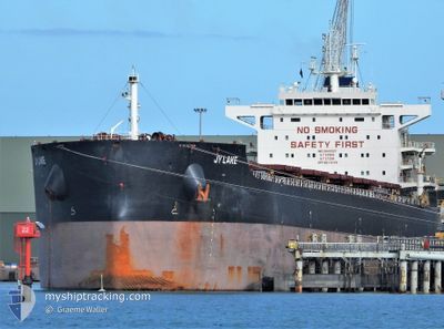
JY LAKE
Cargo
Current Trip
| Time Travelled | --- |
|---|---|
| Remaining Time | --- |
| Distance Travelled | 14417.95 nm |
| Remaining Distance | --- |
| AVG Speed | 10.4 Knots |
| MAX Speed | 13.4 Knots |
| AVG Wind | 11.8 knots |
| MAX Wind | 27 knots |
| MIN Temp | 15.3°C / 59.54°F |
| MAX Temp | 30°C / 86°F |
| Draught | 13.4 m |
| Position Received | 7 d ago |
Current Position
| Longitude | 104.56323° |
|---|---|
| Latitude | 1.48742° |
| Status | Under way using engine |
| Speed | 12 Knots |
| Course | 48.3° |
| Area | South China Sea |
| Station | T-AIS |
| Position Received | 7 d ago |
Info
Information
The current position of JY LAKE is in South China Sea with coordinates 1.48742° / 104.56323° as reported on 2024-04-19 02:15 by AIS to our vessel tracker app. The vessel's current speed is 12 Knots
The vessel JY LAKE (IMO: 9845257, MMSI: 636019109) is a Cargo It's sailing under the flag of [LR] Liberia.
In this page you can find informations about the vessels current position, last detected port calls, and current voyage information. If the vessels is not in coverage by AIS you will find the latest position.
The current position of JY LAKE is detected by our AIS receivers and we are not responsible for the reliability of the data. The last position was recorded while the vessel was in Coverage by the Ais receivers of our vessel tracking app.
The current draught of JY LAKE as reported by AIS is 13.4 meters
Weather
| Temperature | 16.4°C / 61.52°F |
|---|---|
| Wind Speed | 7 knots |
| Direction | 105° ESE |
| Pressure | 1008.6 hPa |
| Humidity | 96 % |
| Cloud Coverage | 100 % |
Featured Company
Last Port Calls
| Port | Arrival | Departure | Time In Port |
|---|---|---|---|
| 2024-02-21 18:53 | 2024-02-21 23:57 | 5 h |
Last Trips
| Origin | Departure | Destination | Arrival | Distance | |
|---|---|---|---|---|---|
| 2024-01-30 22:26 | 2024-02-21 12:53 | 5298.91 nm |
Events
| Time | Event | Details | Position / Dest | Info |
|---|---|---|---|---|
| 2024-04-26 07:39 | STOP Moving |
29.74965 / 122.71888
CN ZOS
|
Speed: 0.2 kn Course: 302° |
|
| 2024-04-25 23:06 | START Moving |
28.45667 / 122.31500
CN ZOS
|
Speed: 8 kn Course: 46° |
|
| 2024-04-25 22:09 | STOP Moving |
28.44177 / 122.30775
CN ZOS
|
Speed: Course: 90° |
|
| 2024-04-19 02:15 | OUT of Coverage |
1.48742 / 104.56323
South China Sea
CN ZOS
|
Speed: 12 kn Course: 48.3° |
|
| 2024-04-19 01:07 | Detected in Sea | Malaysian part of the South China Sea |
1.34175 / 104.39252
South China Sea
CN ZOS
|
Speed: 11.9 kn Course: 50.4° |
| 2024-04-18 23:41 | Change Sea Area | Malaysian part of the Singapore Strait Indonesian part of the Singapore Strait |
1.26101 / 104.13957
Singapore Strait
CN ZOS
|
Speed: 11.1 kn Course: 83.4° |
| 2024-04-18 22:56 | Change Sea Area | Indonesian part of the Singapore Strait Singaporean part of the Singapore Strait |
1.25917 / 104.01520
Singapore Strait
CN ZOS
|
Speed: 8.2 kn Course: 116.2° |
| 2024-04-18 22:22 | START Moving | 3.79 nm, South West of TANAH MERAH |
1.27498 / 103.96680
CN ZOS
|
Speed: 3.1 kn Course: 104° |
| 2024-04-18 22:14 | Status Changed | Under way using engine At anchor |
1.27684 / 103.96305
CN ZOS
|
Speed: 0.6 kn Course: 90° |
| 2024-04-18 21:55 | Draught Changed | 13.4 13 |
1.27629 / 103.96144
CN ZOS
|
Speed: 0.1 kn Course: 81° |