
JSP RIDER
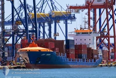
Container Ship
Current Trip
| Time Travelled | 1 day |
|---|---|
| Remaining Time | 4 days |
| Distance Travelled | 301.72 nm |
| Remaining Distance | 667.18 nm |
| AVG Speed | 9.4 Knots |
| MAX Speed | 16.5 Knots |
| AVG Wind | 8 knots |
| MAX Wind | 16.9 knots |
| MIN Temp | 2.7°C / 36.86°F |
| MAX Temp | 8.3°C / 46.94°F |
| Draught | 6.2 m |
| Position Received | Now |
Current Position
| Longitude | 9.54660° |
|---|---|
| Latitude | 54.19624° |
| Status | Under way using engine |
| Speed | 7 Knots |
| Course | 59.6° |
| Area | North Sea |
| Station | T-AIS |
| Position Received | Now |
Info
Information
The current position of JSP RIDER is in North Sea with coordinates 54.19624° / 9.54660° as reported on 2024-04-27 00:50 by AIS to our vessel tracker app. The vessel's current speed is 7 Knots and is heading at the port of HELSINKI. The estimated time of arrival as calculated by MyShipTracking vessel tracking app is 2024-05-01 08:17 LT
The vessel JSP RIDER (IMO: 9322566, MMSI: 304922000) is a Container Ship that was built in 2006 ( 18 years old ). It's sailing under the flag of [AG] Antigua Barbuda.
In this page you can find informations about the vessels current position, last detected port calls, and current voyage information. If the vessels is not in coverage by AIS you will find the latest position.
The current position of JSP RIDER is detected by our AIS receivers and we are not responsible for the reliability of the data. The last position was recorded while the vessel was in Coverage by the Ais receivers of our vessel tracking app.
The current draught of JSP RIDER as reported by AIS is 6.2 meters
Weather
| Temperature | 3°C / 37.4°F |
|---|---|
| Wind Speed | 4 knots |
| Direction | 178° S |
| Pressure | 1008 hPa |
| Humidity | 91 % |
| Cloud Coverage | 20 % |
Featured Company
Last Port Calls
| Port | Arrival | Departure | Time In Port |
|---|---|---|---|
| 2024-04-24 23:25 | 2024-04-25 20:30 | 21 h | |
| 2024-04-23 00:02 | 2024-04-23 15:02 | 15 h | |
| 2024-04-19 10:06 | 2024-04-19 17:02 | 6 h | |
| 2024-04-17 18:01 | 2024-04-18 08:45 | 14 h | |
| 2024-04-16 07:02 | 2024-04-16 23:19 | 16 h | |
| 2024-04-12 03:49 | 2024-04-12 07:33 | 3 h | |
| 2024-04-11 16:13 | 2024-04-12 03:22 | 11 h | |
| 2024-04-10 23:25 | |||
| 2024-04-09 04:17 | 2024-04-09 16:04 | 11 h | |
| 2024-04-05 08:11 | 2024-04-05 15:20 | 7 h |
Most Visited Ports (Last year)
| Port | Arrivals | |
|---|---|---|
| 22 | ||
| 10 | ||
| 10 | ||
| 9 | ||
| 9 | ||
| 9 |
Last Trips
| Origin | Departure | Destination | Arrival | Distance | |
|---|---|---|---|---|---|
| 2024-04-23 16:02 | 2024-04-25 01:25 | 207.56 nm | |||
| 2024-04-19 20:02 | 2024-04-23 01:02 | 925.44 nm | |||
| 2024-04-18 11:45 | 2024-04-19 13:06 | 165.81 nm | |||
| 2024-04-17 02:19 | 2024-04-17 21:01 | 318.29 nm | |||
| 2024-04-12 09:33 | 2024-04-16 10:02 | 983.69 nm | |||
| 2024-04-12 05:22 | 2024-04-12 05:49 | 2.79 nm | |||
| 2024-04-09 17:04 | 2024-04-11 18:13 | 211.45 nm | |||
| 2024-04-09 17:04 | 2024-04-11 01:25 | 208.76 nm | |||
| 2024-04-05 18:20 | 2024-04-09 05:17 | 929.79 nm | |||
| 2024-04-04 07:45 | 2024-04-05 11:11 | 245.09 nm |
Events
| Time | Event | Details | Position / Dest | Info |
|---|---|---|---|---|
| 2024-04-26 23:47 | START Moving | 0.39 nm, South West of FISCHERHUTTE |
54.14984 / 9.36457
FIHEL
|
Speed: 7.2 kn Course: 57.4° |
| 2024-04-26 23:37 | STOP Moving | 0.53 nm, South West of FISCHERHUTTE |
54.14855 / 9.36128
FIHEL
|
Speed: 0.3 kn Course: 57° |
| 2024-04-26 20:52 | START Moving | 0.65 nm, South West of BRUNSBUETTEL |
53.89517 / 9.14710
FIHEL
|
Speed: 3.1 kn Course: 48° |
| 2024-04-26 20:23 | STOP Moving | 0.8 nm, South West of BRUNSBUETTEL |
53.89361 / 9.14405
FIHEL
|
Speed: 0.3 kn Course: 47° |
| 2024-04-26 11:40 | Change Sea Area | German part of the North Sea Dutch part of the North Sea |
53.78343 / 6.70314
North Sea
FIHEL
|
Speed: 12.3 kn Course: 76.6° |
| 2024-04-26 11:39 | Status Changed | Under way using engine Default |
53.78248 / 6.69656
FIHEL
|
Speed: 12.3 kn Course: 76° |
| 2024-04-26 11:24 | IN Coverage |
53.78343 / 6.70314
North Sea
FIHEL
|
Speed: 12.3 kn Course: 76.6° |
|
| 2024-04-26 09:56 | Status Changed | Default Under way using engine |
53.68340 / 6.11127
FIHEL
|
Speed: 12.9 kn Course: 70.8° |
| 2024-04-26 09:52 | OUT of Coverage |
53.67899 / 6.08821
North Sea
FIHEL
|
Speed: 12.9 kn Course: 70.8° |
|
| 2024-04-26 04:25 | Status Changed | Under way using engine Default |
53.09190 / 4.46265
FIHEL
|
Speed: 13 kn Course: 31° |