
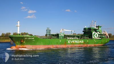
LEKVAR
Tanker
Current Trip
| Time Travelled | 1 day |
|---|---|
| Remaining Time | 18 h, 32 mins |
| Distance Travelled | 318.78 nm |
| Remaining Distance | 638.61 nm |
| AVG Speed | 10.5 Knots |
| MAX Speed | 13.7 Knots |
| AVG Wind | 14.7 knots |
| MAX Wind | 27.6 knots |
| MIN Temp | 11.9°C / 53.42°F |
| MAX Temp | 15.1°C / 59.18°F |
| Draught | 6.2 m |
| Position Received | 1 d ago |
Current Position
| Longitude | 13.90882° |
|---|---|
| Latitude | 36.02032° |
| Status | Under way using engine |
| Speed | 11.4 Knots |
| Course | 306.4° |
| Area | Mediterranean Sea - Eastern Basin |
| Station | T-AIS |
| Position Received | 1 d ago |
Info
Information
The current position of LEKVAR is in Mediterranean Sea - Eastern Basin with coordinates 36.02032° / 13.90882° as reported on 2024-04-24 16:55 by AIS to our vessel tracker app. The vessel's current speed is 11.4 Knots and is heading at the port of BARCELONA. The estimated time of arrival as calculated by MyShipTracking vessel tracking app is 2024-04-26 23:27 LT
The vessel LEKVAR (IMO: 9578036, MMSI: 566725000) is a Tanker It's sailing under the flag of [SG] Singapore.
In this page you can find informations about the vessels current position, last detected port calls, and current voyage information. If the vessels is not in coverage by AIS you will find the latest position.
The current position of LEKVAR is detected by our AIS receivers and we are not responsible for the reliability of the data. The last position was recorded while the vessel was in Coverage by the Ais receivers of our vessel tracking app.
The current draught of LEKVAR as reported by AIS is 6.2 meters
Weather
| Temperature | 15.2°C / 59.36°F |
|---|---|
| Wind Speed | 14 knots |
| Direction | 107° ESE |
| Pressure | 1007.9 hPa |
| Humidity | 66.3 % |
| Cloud Coverage | 100 % |
Featured Company
Last Port Calls
| Port | Arrival | Departure | Time In Port |
|---|---|---|---|
| 2024-04-23 11:46 | 2024-04-24 13:00 | 1 d | |
| 2024-04-19 16:20 | 2024-04-20 17:36 | 1 d | |
| 2024-04-15 17:55 | 2024-04-16 10:48 | 16 h | |
| 2024-03-31 19:18 | 2024-04-02 01:49 | 1 d | |
| 2024-03-27 15:17 | 2024-03-27 19:13 | 3 h | |
| 2024-03-26 01:05 | 2024-03-26 20:09 | 19 h | |
| 2024-03-18 13:49 | 2024-03-19 07:37 | 17 h | |
| 2024-03-04 07:24 | 2024-03-04 22:36 | 15 h | |
| 2024-02-24 23:55 | |||
| 2024-02-13 10:39 | 2024-02-24 09:09 | 10 d |
Most Visited Ports (Last year)
| Port | Arrivals | |
|---|---|---|
| 27 | ||
| 14 | ||
| 9 | ||
| 4 | ||
| 1 | ||
| 1 |
Last Trips
| Origin | Departure | Destination | Arrival | Distance | |
|---|---|---|---|---|---|
| 2024-04-20 19:36 | 2024-04-23 13:46 | 720.53 nm | |||
| 2024-04-16 11:48 | 2024-04-19 18:20 | 899.57 nm | |||
| 2024-04-02 03:49 | 2024-04-15 18:55 | 513.90 nm | |||
| 2024-03-27 20:13 | 2024-03-31 21:18 | 805.40 nm | |||
| 2024-03-26 21:09 | 2024-03-27 16:17 | 195.70 nm | |||
| 2024-03-19 08:37 | 2024-03-26 02:05 | 189.09 nm | |||
| 2024-03-04 23:36 | 2024-03-18 14:49 | 1708.56 nm | |||
| 2024-02-25 00:55 | 2024-03-04 08:24 | 185.69 nm | |||
| 2024-02-12 11:29 | 2024-02-13 11:39 | 195.12 nm | |||
| 2024-02-11 01:27 | 2024-02-11 20:08 | 190.41 nm |
Events
| Time | Event | Details | Position / Dest | Info |
|---|---|---|---|---|
| 2024-04-24 16:55 | OUT of Coverage |
36.02032 / 13.90882
Mediterranean Sea - Eastern Basin
ESBCN
|
Speed: 11.4 kn Course: 306.4° |
|
| 2024-04-24 16:23 | Status Changed | Under way using engine Default |
35.96543 / 14.00792
ESBCN
|
Speed: 10.7 kn Course: 315° |
| 2024-04-24 15:36 | Status Changed | Default Under way using engine |
35.86637 / 14.12510
ESBCN
|
Speed: 10.8 kn Course: 312.6° |
| 2024-04-24 14:13 | Draught Changed | 6.2 6.8 |
35.70497 / 14.38557
ESBCN
|
Speed: 12.9 kn Course: 283.6° |
| 2024-04-24 14:13 | Destination Changed | ESBCN MTMAR |
35.70497 / 14.38557
ESBCN
|
Speed: 12.9 kn Course: 283.6° |
| 2024-04-24 14:13 | ETA Changed | 2024/04/26 23:00 2024/04/23 00:30 |
35.70497 / 14.38557
ESBCN
|
Speed: 12.9 kn Course: 283.6° |
| 2024-04-24 14:07 | Status Changed | Under way using engine Default |
35.70143 / 14.40893
MTMAR
|
Speed: 13.7 kn Course: 269° |
| 2024-04-24 14:01 | IN Coverage |
35.70143 / 14.40893
Mediterranean Sea - Eastern Basin
|
Speed: 13.6 kn Course: 277° |
|
| 2024-04-24 13:06 | START Moving | 1.16 nm, South East of MARSAXLOKK |
35.80883 / 14.56210
MTMAR
|
Speed: 9.1 kn Course: 140° |
| 2024-04-24 13:00 | PORT DEPARTURE |
|
35.80883 / 14.56210
MTMAR
|
Speed: 0.1 kn Course: 47° |