
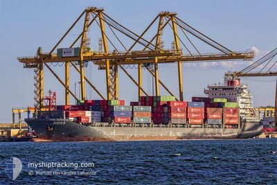
JOSITA B
Cargo A
Current Trip
| Time Travelled | 1 day |
|---|---|
| Remaining Time | 1 day |
| Distance Travelled | 449.33 nm |
| Remaining Distance | 559.73 nm |
| AVG Speed | 11.7 Knots |
| MAX Speed | 17 Knots |
| AVG Wind | 10 knots |
| MAX Wind | 19.4 knots |
| MIN Temp | 17.8°C / 64.04°F |
| MAX Temp | 19.4°C / 66.92°F |
| Draught | 7.8 m |
| Position Received | 2 h, 45 m ago |
Current Position
| Longitude | 6.61681° |
|---|---|
| Latitude | 37.73505° |
| Status | Under way using engine |
| Speed | 12 Knots |
| Course | 268.8° |
| Area | Mediterranean Sea - Western Basin |
| Station | T-AIS |
| Position Received | 2 h, 45 m ago |
Info
Information
The current position of JOSITA B is in Mediterranean Sea - Western Basin with coordinates 37.73505° / 6.61681° as reported on 2024-05-13 05:45 by AIS to our vessel tracker app. The vessel's current speed is 12 Knots and is heading at the port of ALGECIRAS. The estimated time of arrival as calculated by MyShipTracking vessel tracking app is 2024-05-15 07:41 LT
The vessel JOSITA B (IMO: 9673630, MMSI: 229966000) is a Cargo A It's sailing under the flag of [MT] Malta.
In this page you can find informations about the vessels current position, last detected port calls, and current voyage information. If the vessels is not in coverage by AIS you will find the latest position.
The current position of JOSITA B is detected by our AIS receivers and we are not responsible for the reliability of the data. The last position was recorded while the vessel was in Coverage by the Ais receivers of our vessel tracking app.
The current draught of JOSITA B as reported by AIS is 7.8 meters
Weather
| Temperature | 18.4°C / 65.12°F |
|---|---|
| Wind Speed | 10 knots |
| Direction | 101° E |
| Pressure | 1013.5 hPa |
| Humidity | 90.3 % |
| Cloud Coverage | 100 % |
Featured Company
Last Port Calls
| Port | Arrival | Departure | Time In Port |
|---|---|---|---|
| 2024-05-11 09:44 | 2024-05-11 18:27 | 8 h | |
| 2024-05-07 05:28 | 2024-05-10 15:12 | 3 d | |
| 2024-05-02 01:54 | 2024-05-03 18:14 | 1 d | |
| 2024-04-13 21:22 | 2024-04-14 04:47 | 7 h | |
| 2024-04-11 15:11 | 2024-04-12 04:19 | 13 h | |
| 2024-04-06 01:01 | 2024-04-06 12:34 | 11 h | |
| 2024-03-27 09:57 | 2024-03-28 00:34 | 14 h | |
| 2024-03-26 13:09 | 2024-03-27 05:23 | 16 h | |
| 2024-03-24 19:41 | 2024-03-25 15:52 | 20 h | |
| 2024-03-23 10:06 | 2024-03-23 18:40 | 8 h |
Most Visited Ports (Last year)
| Port | Arrivals | |
|---|---|---|
| 21 | ||
| 18 | ||
| 16 | ||
| 13 | ||
| 12 | ||
| 12 |
Last Trips
| Origin | Departure | Destination | Arrival | Distance | |
|---|---|---|---|---|---|
| 2024-05-10 16:12 | 2024-05-11 11:44 | 231.16 nm | |||
| 2024-05-03 19:14 | 2024-05-07 06:28 | 597.12 nm | |||
| 2024-04-14 06:47 | 2024-05-02 02:54 | 930.30 nm | |||
| 2024-04-12 06:19 | 2024-04-13 23:22 | 532.35 nm | |||
| 2024-04-06 14:34 | 2024-04-11 17:11 | 451.61 nm | |||
| 2024-03-28 01:34 | 2024-04-06 03:01 | 1009.99 nm | |||
| 2024-03-27 06:23 | 2024-03-27 10:57 | 53.60 nm | |||
| 2024-03-25 16:52 | 2024-03-26 14:09 | 197.00 nm | |||
| 2024-03-23 19:40 | 2024-03-24 20:41 | 220.26 nm | |||
| 2024-03-20 12:34 | 2024-03-23 11:06 | 857.94 nm |
Events
| Time | Event | Details | Position / Dest | Info |
|---|---|---|---|---|
| 2024-05-13 05:52 | Status Changed | Default Under way using engine |
37.73481 / 6.58596
ES ALG
|
Speed: 12 kn Course: 268.8° |
| 2024-05-13 05:45 | OUT of Coverage |
37.73505 / 6.61681
Mediterranean Sea - Western Basin
ES ALG
|
Speed: 12 kn Course: 268.8° |
|
| 2024-05-13 05:03 | Change Sea Area | Algerian part of the Mediterranean Sea - Western Basin Tunisian part of the Mediterranean Sea - Western Basin |
37.73751 / 6.79322
Mediterranean Sea - Western Basin
ES ALG
|
Speed: 12 kn Course: 268.7° |
| 2024-05-13 05:02 | Status Changed | Under way using engine Default |
37.73761 / 6.79817
ES ALG
|
Speed: 12 kn Course: 269° |
| 2024-05-13 04:54 | IN Coverage |
37.73751 / 6.79322
Mediterranean Sea - Western Basin
ES ALG
|
Speed: 12 kn Course: 268.7° |
|
| 2024-05-12 22:57 | Status Changed | Default Under way using engine |
37.73290 / 8.32822
ES ALG
|
Speed: 12 kn Course: 266.4° |
| 2024-05-12 22:51 | OUT of Coverage |
37.73438 / 8.35362
Mediterranean Sea - Western Basin
ES ALG
|
Speed: 12 kn Course: 266.4° |
|
| 2024-05-12 22:26 | Status Changed | Under way using engine Default |
37.73799 / 8.45565
ES ALG
|
Speed: 11.8 kn Course: 268° |
| 2024-05-12 22:25 | Status Changed | Default Under way using engine |
37.73815 / 8.46255
ES ALG
|
Speed: 11.8 kn Course: 268.3° |
| 2024-05-12 22:17 | Status Changed | Under way using engine Default |
37.73894 / 8.49217
ES ALG
|
Speed: 11.7 kn Course: 273° |