
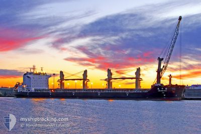
JIU HUA HAI
Bulk Carrier
Current Trip
VILA DO CONDE
| Time Travelled | 4 days |
|---|---|
| Remaining Time | --- |
| Distance Travelled | 1359.93 nm |
| Remaining Distance | --- |
| AVG Speed | 11.6 Knots |
| MAX Speed | 17.4 Knots |
| AVG Wind | 9.2 knots |
| MAX Wind | 17.4 knots |
| MIN Temp | 24.8°C / 76.64°F |
| MAX Temp | 29°C / 84.2°F |
| Draught | 11.6 m |
| Position Received | 1 d ago |
Current Position
| Longitude | -34.74942° |
|---|---|
| Latitude | -5.39280° |
| Status | Under way using engine |
| Speed | 11.2 Knots |
| Course | 159.6° |
| Area | South Atlantic Ocean |
| Station | T-AIS |
| Position Received | 1 d ago |
Info
Information
The current position of JIU HUA HAI is in South Atlantic Ocean with coordinates -5.39280° / -34.74942° as reported on 2024-04-29 23:08 by AIS to our vessel tracker app. The vessel's current speed is 11.2 Knots
The vessel JIU HUA HAI (IMO: 9466520, MMSI: 413330000) is a Bulk Carrier that was built in 2008 ( 16 years old ). It's sailing under the flag of [CN] China.
In this page you can find informations about the vessels current position, last detected port calls, and current voyage information. If the vessels is not in coverage by AIS you will find the latest position.
The current position of JIU HUA HAI is detected by our AIS receivers and we are not responsible for the reliability of the data. The last position was recorded while the vessel was in Coverage by the Ais receivers of our vessel tracking app.
The current draught of JIU HUA HAI as reported by AIS is 11.6 meters
Weather
| Temperature | 27.8°C / 82.04°F |
|---|---|
| Wind Speed | 16 knots |
| Direction | 128° SE |
| Pressure | 1011.9 hPa |
| Humidity | 78.4 % |
| Cloud Coverage | 87 % |
Featured Company
Last Port Calls
| Port | Arrival | Departure | Time In Port |
|---|---|---|---|
| 2024-04-22 23:26 | 2024-04-26 14:07 | 3 d | |
| 2024-04-17 09:20 | 2024-04-18 05:07 | 19 h | |
| 2024-04-08 13:54 | 2024-04-11 21:31 | 3 d | |
| 2024-04-03 15:19 | 2024-04-04 21:28 | 1 d | |
| 2024-03-28 00:58 | 2024-03-31 05:30 | 3 d | |
| 2024-03-22 01:53 | 2024-03-22 04:40 | 2 h | |
| 2024-03-13 15:49 | 2024-03-18 10:33 | 4 d | |
| 2024-03-08 04:57 | 2024-03-08 18:13 | 13 h | |
| 2024-03-01 14:39 | 2024-03-04 22:43 | 3 d |
Most Visited Ports (Last year)
| Port | Arrivals | |
|---|---|---|
| 5 | ||
| 5 | ||
| 2 | ||
| 2 | ||
| 2 | ||
| 2 |
Last Trips
| Origin | Departure | Destination | Arrival | Distance | |
|---|---|---|---|---|---|
| 2024-04-18 02:07 | 2024-04-22 20:26 | 848.76 nm | |||
| 2024-04-11 18:31 | 2024-04-17 06:20 | 853.36 nm | |||
| 2024-04-04 18:28 | 2024-04-08 10:54 | 857.39 nm | |||
| 2024-03-31 02:30 | 2024-04-03 12:19 | 837.49 nm | |||
| 2024-03-22 01:40 | 2024-03-27 21:58 | 888.49 nm | |||
| 2024-03-18 07:33 | 2024-03-21 22:53 | 832.15 nm | |||
| 2024-03-08 15:13 | 2024-03-13 12:49 | 863.98 nm | |||
| 2024-03-04 19:43 | 2024-03-08 01:57 | 671.69 nm | |||
| 2024-02-26 04:17 | 2024-03-01 11:39 | 862.85 nm |
Events
| Time | Event | Details | Position / Dest | Info |
|---|---|---|---|---|
| 2024-04-29 23:10 | Status Changed | Default Under way using engine |
-5.39833 / -34.74667
VILA DO CONDE
|
Speed: 11.2 kn Course: 159.6° |
| 2024-04-29 23:08 | OUT of Coverage |
-5.39280 / -34.74942
South Atlantic Ocean
|
Speed: 11.2 kn Course: 159.6° |
|
| 2024-04-29 21:07 | Status Changed | Under way using engine Default |
-5.02285 / -34.87391
VILA DO CONDE
|
Speed: 11 kn Course: 160° |
| 2024-04-29 21:04 | Status Changed | Default Under way using engine |
-5.01500 / -34.87500
VILA DO CONDE
|
Speed: 11.2 kn Course: 162.1° |
| 2024-04-29 20:19 | Change Sea Area | Brazilian part of the South Atlantic Ocean Brazilian part of the North Atlantic Ocean |
-4.87812 / -34.92126
South Atlantic Ocean
|
Speed: 11.5 kn Course: 163.9° |
| 2024-04-29 20:19 | Status Changed | Under way using engine Default |
-4.87812 / -34.92126
VILA DO CONDE
|
Speed: 11 kn Course: 162° |
| 2024-04-29 20:16 | IN Coverage |
-4.87812 / -34.92126
South Atlantic Ocean
|
Speed: 11.5 kn Course: 163.9° |
|
| 2024-04-26 14:07 | PORT DEPARTURE |
|
-1.50833 / -48.74333
VILA DO CONDE
|
Speed: 9 kn Course: 24° |
| 2024-04-26 13:55 | START Moving |
-1.53500 / -48.75500
[BR] VILA DO CONDE
|
Speed: 4 kn Course: -1° |
|
| 2024-04-22 23:26 | PORT ARRIVAL |
|
-1.54014 / -48.75972
[BR] VILA DO CONDE
|
Speed: 1.9 kn Course: 78° |