
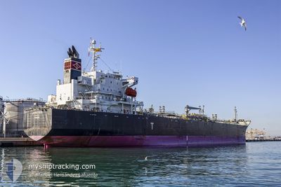
JIPRO ISIS
Oil/Chemical Tanker
Current Trip
| Time Travelled | 4 days |
|---|---|
| Remaining Time | --- |
| Distance Travelled | 1376.29 nm |
| Remaining Distance | --- |
| AVG Speed | 14.1 Knots |
| MAX Speed | 16.8 Knots |
| AVG Wind | 9.5 knots |
| MAX Wind | 18.8 knots |
| MIN Temp | 22.1°C / 71.78°F |
| MAX Temp | 29.1°C / 84.38°F |
| Draught | 11.5 m |
| Position Received | 20 h, 15 m ago |
Current Position
| Longitude | -77.66294° |
|---|---|
| Latitude | 27.82946° |
| Status | Under way using engine |
| Speed | 13.9 Knots |
| Course | 83.5° |
| Area | North Atlantic Ocean |
| Station | T-AIS |
| Position Received | 20 h, 15 m ago |
Info
Information
The current position of JIPRO ISIS is in North Atlantic Ocean with coordinates 27.82946° / -77.66294° as reported on 2024-05-11 15:38 by AIS to our vessel tracker app. The vessel's current speed is 13.9 Knots and is heading at the port of ROTTERDAM. The estimated time of arrival as calculated by MyShipTracking vessel tracking app is 2024-05-25 05:00 LT
The vessel JIPRO ISIS (IMO: 9370719, MMSI: 370069000) is a Oil/Chemical Tanker that was built in 2008 ( 16 years old ). It's sailing under the flag of [PA] Panama.
In this page you can find informations about the vessels current position, last detected port calls, and current voyage information. If the vessels is not in coverage by AIS you will find the latest position.
The current position of JIPRO ISIS is detected by our AIS receivers and we are not responsible for the reliability of the data. The last position was recorded while the vessel was in Coverage by the Ais receivers of our vessel tracking app.
The current draught of JIPRO ISIS as reported by AIS is 11.5 meters
Weather
| Temperature | 22.1°C / 71.78°F |
|---|---|
| Wind Speed | 10 knots |
| Direction | 23° NNE |
| Pressure | 1013.7 hPa |
| Humidity | 69.4 % |
| Cloud Coverage | 1 % |
Featured Company
Last Port Calls
| Port | Arrival | Departure | Time In Port |
|---|---|---|---|
| 2024-05-06 09:46 | 2024-05-08 04:58 | 1 d | |
| 2024-03-31 22:27 | 2024-04-02 11:18 | 1 d | |
| 2024-03-28 15:24 | 2024-03-31 21:01 | 3 d | |
| 2024-03-20 04:04 | 2024-03-20 11:40 | 7 h |
Most Visited Ports (Last year)
| Port | Arrivals | |
|---|---|---|
| 8 | ||
| 6 | ||
| 2 | ||
| 1 | ||
| 1 | ||
| 1 |
Last Trips
| Origin | Departure | Destination | Arrival | Distance | |
|---|---|---|---|---|---|
| 2024-04-02 13:18 | 2024-05-06 04:46 | 6420.52 nm | |||
| 2024-03-31 23:01 | 2024-04-01 00:27 | 15.96 nm | |||
| 2024-03-20 11:40 | 2024-03-28 16:24 | 1804.90 nm | |||
| 2024-02-18 00:56 | 2024-03-20 04:04 | 9122.53 nm |
Events
| Time | Event | Details | Position / Dest | Info |
|---|---|---|---|---|
| 2024-05-11 15:45 | Status Changed | Default Under way using engine |
27.83351 / -77.63106
USLU8 => NLRTM
|
Speed: 13.9 kn Course: 83.5° |
| 2024-05-11 15:38 | OUT of Coverage |
27.82946 / -77.66294
North Atlantic Ocean
USLU8 => NLRTM
|
Speed: 13.9 kn Course: 83.5° |
|
| 2024-05-11 14:56 | Status Changed | Under way using engine Default |
27.80508 / -77.84377
USLU8 => NLRTM
|
Speed: 13.7 kn Course: 83° |
| 2024-05-11 14:45 | Status Changed | Default Under way using engine |
27.79840 / -77.88955
USLU8 => NLRTM
|
Speed: 13.7 kn Course: 78.4° |
| 2024-05-11 10:26 | Status Changed | Under way using engine Default |
27.67356 / -79.00751
USLU8 => NLRTM
|
Speed: 13.9 kn Course: 39° |
| 2024-05-11 10:26 | IN Coverage |
27.67356 / -79.00751
North Atlantic Ocean
USLU8 => NLRTM
|
Speed: 14.3 kn Course: 83.4° |
|
| 2024-05-11 04:36 | Status Changed | Default Under way using engine |
26.41604 / -79.39706
USLU8 => NLRTM
|
Speed: 14.7 kn Course: 4.4° |
| 2024-05-11 04:33 | Status Changed | Under way using engine Default |
26.40165 / -79.39793
USLU8 => NLRTM
|
Speed: 14.8 kn Course: 4° |
| 2024-05-11 04:33 | OUT of Coverage |
26.40165 / -79.39793
North Atlantic Ocean
USLU8 => NLRTM
|
Speed: 14.7 kn Course: 4.4° |
|
| 2024-05-11 04:30 | Status Changed | Default Under way using engine |
26.39091 / -79.39827
USLU8 => NLRTM
|
Speed: 14.7 kn Course: 6.5° |