
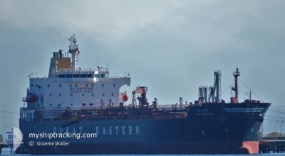
JAG PRAKASH
Oil/Chemical Tanker
Current Trip
| Time Travelled | 1 day |
|---|---|
| Remaining Time | --- |
| Distance Travelled | 384.16 nm |
| Remaining Distance | --- |
| AVG Speed | 11.2 Knots |
| MAX Speed | 13.7 Knots |
| AVG Wind | 8.6 knots |
| MAX Wind | 13.8 knots |
| MIN Temp | 20.4°C / 68.72°F |
| MAX Temp | 25.3°C / 77.54°F |
| Draught | 7.2 m |
| Position Received | 2025-11-13 14:09 |
Current Position
| Longitude | --- |
|---|---|
| Latitude | --- |
| Status | Under way using engine |
| Speed | 12.6 Knots |
| Course | 43° |
| Area | Indian Ocean |
| Station | T-AIS |
| Position Received | 2025-11-13 14:09 |
Info
Information
The current position of JAG PRAKASH is in Indian Ocean with coordinates -28.99703° / 32.53032° as reported on 2025-11-13 14:09 by AIS to our vessel tracker app. The vessel's current speed is 12.6 Knots and is heading at the port of KHORFAKKAN.
The vessel JAG PRAKASH (IMO: 9315721, MMSI: 419667000) is a Oil/Chemical Tanker that was built in 2007 ( 19 years old ). It's sailing under the flag of [IN] India.
In this page you can find informations about the vessels current position, last detected port calls, and current voyage information. If the vessels is not in coverage by AIS you will find the latest position.
The current position of JAG PRAKASH is detected by our AIS receivers and we are not responsible for the reliability of the data. The last position was recorded while the vessel was in Coverage by the Ais receivers of our vessel tracking app.
The current draught of JAG PRAKASH as reported by AIS is 7.2 meters
Weather
| Temperature | 24.8°C / 76.64°F |
|---|---|
| Wind Speed | 6 knots |
| Direction | 50° NE |
| Pressure | 1015.3 hPa |
| Humidity | 67.9 % |
| Cloud Coverage | --- |
Featured Company
Last Trips
| Origin | Departure | Destination | Arrival | Distance | |
|---|---|---|---|---|---|
| 2025-12-25 15:40 | 2026-01-01 22:10 | 1032.93 nm | |||
| 2025-12-19 11:48 | 2025-12-24 13:40 | 624.04 nm | |||
| 2025-12-02 23:15 | 2025-12-16 23:54 | 477.48 nm | |||
| 2025-11-13 08:27 | 2025-12-01 04:55 | 4052.69 nm | |||
| 2025-10-26 03:57 | 2025-11-10 04:05 | 4365.61 nm |
Events
| Time | Event | Details | Position / Dest | Info |
|---|---|---|---|---|
| 2026-01-06 01:25 | STOP Moving | 21.27 nm, West of MUMBAI |
19.10800 / 72.52062
AEKLF
|
Speed: 0.3 kn Course: 12° |
| 2026-01-04 14:33 | START Moving | 1.29 nm, East of MUNDRA |
22.72783 / 69.71045
AEKLF
|
Speed: 3.4 kn Course: 182° |
| 2026-01-04 14:33 | PORT DEPARTURE |
|
22.72783 / 69.71045
AEKLF
|
Speed: 1.4 kn Course: 241° |
| 2026-01-01 16:51 | STOP Moving |
22.73102 / 69.70887
[IN] MUNDRA
|
Speed: 0.2 kn Course: 255° |
|
| 2026-01-01 16:40 | PORT ARRIVAL |
|
22.73167 / 69.71159
[IN] MUNDRA
|
Speed: 2.9 kn Course: 287° |
| 2026-01-01 15:39 | START Moving | 3.91 nm, South of MUNDRA |
22.67520 / 69.71545
AEKLF
|
Speed: 6.4 kn Course: 29° |
| 2026-01-01 13:56 | STOP Moving | 4.16 nm, South of MUNDRA |
22.67042 / 69.71463
AEKLF
|
Speed: 0.3 kn Course: 245° |
| 2026-01-01 13:22 | START Moving | 4.38 nm, South of MUNDRA |
22.66265 / 69.69425
AEKLF
|
Speed: 4.9 kn Course: 86° |
| 2026-01-01 11:18 | STOP Moving | 4.51 nm, South of MUNDRA |
22.66038 / 69.69135
AEKLF
|
Speed: 0.3 kn Course: 64° |
| 2025-12-31 00:45 | START Moving | 2.12 nm, West of NHAVA SHEVA |
18.94942 / 72.90918
AEKLF
|
Speed: 4.6 kn Course: 193° |