
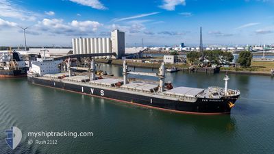
IVS PHOENIX
Cargo
Current Trip
SG SIN PEBG C
| Time Travelled | 9 days |
|---|---|
| Remaining Time | --- |
| Distance Travelled | 1918.44 nm |
| Remaining Distance | --- |
| AVG Speed | 11.1 Knots |
| MAX Speed | 15.5 Knots |
| AVG Wind | 16.8 knots |
| MAX Wind | 30 knots |
| MIN Temp | 14°C / 57.2°F |
| MAX Temp | 28.9°C / 84.02°F |
| Draught | 12.5 m |
| Position Received | 10 m ago |
Current Position
| Longitude | --- |
|---|---|
| Latitude | --- |
| Status | At anchor |
| Speed | 0.1 Knots |
| Course | 326° |
| Area | Singapore Strait |
| Station | T-AIS |
| Position Received | 10 m ago |
Info
Information
The current position of IVS PHOENIX is in Singapore Strait with coordinates 1.28425° / 103.99256° as reported on 2025-12-21 04:09 by AIS to our vessel tracker app. The vessel's current speed is 0.1 Knots
The vessel IVS PHOENIX (IMO: 9774862, MMSI: 538009610) is a Cargo It's sailing under the flag of [MH] Marshall Is.
In this page you can find informations about the vessels current position, last detected port calls, and current voyage information. If the vessels is not in coverage by AIS you will find the latest position.
The current position of IVS PHOENIX is detected by our AIS receivers and we are not responsible for the reliability of the data. The last position was recorded while the vessel was in Coverage by the Ais receivers of our vessel tracking app.
The current draught of IVS PHOENIX as reported by AIS is 12.5 meters
Weather
| Temperature | 28.9°C / 84.02°F |
|---|---|
| Wind Speed | 12 knots |
| Direction | 15° NNE |
| Pressure | 1009.1 hPa |
| Humidity | 73 % |
| Cloud Coverage | 95 % |
Featured Company
Last Port Calls
| Port | Arrival | Departure | Time In Port |
|---|---|---|---|
| 2025-12-03 10:25 | 2025-12-11 18:57 | 8 d | |
| 2025-10-20 16:53 | 2025-10-21 15:53 | 23 h | |
| 2025-10-07 17:09 | 2025-10-15 20:21 | 8 d |
Last Trips
| Origin | Departure | Destination | Arrival | Distance | |
|---|---|---|---|---|---|
| 2025-10-21 15:53 | 2025-12-03 10:25 | 8569.59 nm | |||
| 2025-10-15 20:21 | 2025-10-20 16:53 | 807.32 nm | |||
| 2025-09-15 14:48 | 2025-10-07 17:09 | 6233.08 nm |
Events
| Time | Event | Details | Position / Dest | Info |
|---|---|---|---|---|
| 2025-12-21 02:15 | STOP Moving | 2.35 nm, South West of TANAH MERAH |
1.28532 / 103.98936
SG SIN PEBG C
|
Speed: 0.2 kn Course: 57° |
| 2025-12-21 02:03 | Status Changed | At anchor Under way using engine |
1.28602 / 103.98945
SG SIN PEBG C
|
Speed: 0.5 kn Course: 111° |
| 2025-12-21 00:21 | Change Sea Area | Singaporean part of the Singapore Strait Malaysian part of the Singapore Strait |
1.27470 / 104.05735
Singapore Strait
SG SIN PEBG C
|
Speed: 6.3 kn Course: 266.4° |
| 2025-12-21 00:08 | Draught Changed | 12.5 12.4 |
1.27673 / 104.08336
SG SIN PEBG C
|
Speed: 7.5 kn Course: 264° |
| 2025-12-21 00:08 | Destination Changed | SG SIN PEBG C SGP |
1.27673 / 104.08336
SG SIN PEBG C
|
Speed: 7.5 kn Course: 264° |
| 2025-12-21 00:08 | ETA Changed | 2025/12/21 01:15 2025/12/21 03:00 |
1.27673 / 104.08336
SG SIN PEBG C
|
Speed: 7.5 kn Course: 264° |
| 2025-12-20 22:40 | Detected in Sea | Malaysian part of the Singapore Strait |
1.30577 / 104.28345
Singapore Strait
SGP
|
Speed: 8.2 kn Course: 257.5° |
| 2025-12-20 22:40 | IN Coverage |
1.30577 / 104.28345
Singapore Strait
SGP
|
Speed: 8.2 kn Course: 257.5° |
|
| 2025-12-20 03:12 | OUT of Coverage |
4.59225 / 106.34914
South China Sea
SGP
|
Speed: 12.7 kn Course: 214.9° |
|
| 2025-12-20 02:43 | Change Sea Area | Indonesian part of the South China Sea Chinese part of the South China Sea |
4.67403 / 106.40646
South China Sea
SGP
|
Speed: 12.8 kn Course: 214.1° |