
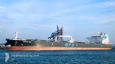
IBERIAN SEA
Tanker
Current Trip
| Time Travelled | 16 days |
|---|---|
| Remaining Time | 13 h, 50 mins |
| Distance Travelled | 4791.06 nm |
| Remaining Distance | 143.33 nm |
| AVG Speed | 11.6 Knots |
| MAX Speed | 15.5 Knots |
| AVG Wind | 17 knots |
| MAX Wind | 37 knots |
| MIN Temp | -0.1°C / 31.82°F |
| MAX Temp | 16.2°C / 61.16°F |
| Draught | 8.8 m |
| Position Received | 1 m ago |
Current Position
| Longitude | --- |
|---|---|
| Latitude | --- |
| Status | Under way using engine |
| Speed | 10 Knots |
| Course | 89.8° |
| Area | North Pacific Ocean |
| Station | T-AIS |
| Position Received | 1 m ago |
Info
Information
The current position of IBERIAN SEA is in North Pacific Ocean with coordinates 48.47672° / -124.75409° as reported on 2025-03-03 01:37 by AIS to our vessel tracker app. The vessel's current speed is 10 Knots and is heading at the port of VANCOUVER. The estimated time of arrival as calculated by MyShipTracking vessel tracking app is 2025-03-03 07:29 LT
The vessel IBERIAN SEA (IMO: 9815604, MMSI: 636018670) is a Tanker It's sailing under the flag of [LR] Liberia.
In this page you can find informations about the vessels current position, last detected port calls, and current voyage information. If the vessels is not in coverage by AIS you will find the latest position.
The current position of IBERIAN SEA is detected by our AIS receivers and we are not responsible for the reliability of the data. The last position was recorded while the vessel was in Coverage by the Ais receivers of our vessel tracking app.
The current draught of IBERIAN SEA as reported by AIS is 8.8 meters
Weather
| Temperature | 9°C / 48.2°F |
|---|---|
| Wind Speed | 6 knots |
| Direction | 281° W |
| Pressure | 1014.7 hPa |
| Humidity | 87.4 % |
| Cloud Coverage | 98 % |
Featured Company
Most Visited Ports (Last year)
| Port | Arrivals | |
|---|---|---|
| 7 | ||
| 1 | ||
| 1 | ||
| 1 | ||
| 1 |
Events
| Time | Event | Details | Position / Dest | Info |
|---|---|---|---|---|
| 2025-03-03 01:36 | Status Changed | Under way using engine Default |
48.47667 / -124.75973
CA VAN
|
Speed: 9.8 kn Course: 88° |
| 2025-03-03 01:24 | Status Changed | Default Under way using engine |
48.47570 / -124.80999
CA VAN
|
Speed: 9.9 kn Course: 85.4° |
| 2025-03-03 01:18 | Status Changed | Under way using engine Default |
48.47424 / -124.83385
CA VAN
|
Speed: 10 kn Course: 88° |
| 2025-03-03 00:51 | Status Changed | Default Under way using engine |
48.47456 / -124.94399
CA VAN
|
Speed: 10.4 kn Course: 88.3° |
| 2025-03-03 00:46 | Status Changed | Under way using engine Default |
48.47437 / -124.96594
CA VAN
|
Speed: 10.4 kn Course: 88° |
| 2025-03-03 00:40 | Status Changed | Default Under way using engine |
48.47362 / -124.99485
CA VAN
|
Speed: 10.3 kn Course: 84.6° |
| 2025-03-03 00:17 | Detected in Sea | United States part of the North Pacific Ocean |
48.46800 / -125.09233
North Pacific Ocean
CA VAN
|
Speed: 9.7 kn Course: 83.1° |
| 2025-03-02 23:08 | Status Changed | Under way using engine Default |
48.45927 / -125.37784
CA VAN
|
Speed: 9.8 kn Course: 77° |
| 2025-03-02 23:03 | Status Changed | Default Under way using engine |
48.45707 / -125.39716
CA VAN
|
Speed: 11.2 kn Course: 79.9° |
| 2025-03-02 19:09 | Status Changed | Under way using engine Default |
48.39370 / -126.41927
CA VAN
|
Speed: 11.4 kn Course: 95° |