
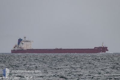
HORUS
Bulk Carrier
Current Trip
| Time Travelled | --- |
|---|---|
| Remaining Time | --- |
| Distance Travelled | 5956.46 nm |
| Remaining Distance | --- |
| AVG Speed | 10.6 Knots |
| MAX Speed | 13.7 Knots |
| AVG Wind | 9.6 knots |
| MAX Wind | 26.7 knots |
| MIN Temp | 9.8°C / 49.64°F |
| MAX Temp | 28.7°C / 83.66°F |
| Draught | 7 m |
| Position Received | 4 h, 2 m ago |
Current Position
| Longitude | --- |
|---|---|
| Latitude | --- |
| Status | Under way using engine |
| Speed | 11.2 Knots |
| Course | 306.1° |
| Area | Mediterranean Sea - Eastern Basin |
| Station | T-AIS |
| Position Received | 4 h, 2 m ago |
Info
Information
The current position of HORUS is in Mediterranean Sea - Eastern Basin with coordinates 35.93389° / 13.70552° as reported on 2025-03-05 00:59 by AIS to our vessel tracker app. The vessel's current speed is 11.2 Knots and is heading at the port of MURMANSK. The estimated time of arrival as calculated by MyShipTracking vessel tracking app is 2025-03-18 15:00 LT
The vessel HORUS (IMO: 9635690, MMSI: 538010108) is a Bulk Carrier that was built in 2012 ( 13 years old ). It's sailing under the flag of [MH] Marshall Is.
In this page you can find informations about the vessels current position, last detected port calls, and current voyage information. If the vessels is not in coverage by AIS you will find the latest position.
The current position of HORUS is detected by our AIS receivers and we are not responsible for the reliability of the data. The last position was recorded while the vessel was in Coverage by the Ais receivers of our vessel tracking app.
The current draught of HORUS as reported by AIS is 7 meters
Weather
| Temperature | 14°C / 57.2°F |
|---|---|
| Wind Speed | 13 knots |
| Direction | 68° ENE |
| Pressure | 1023 hPa |
| Humidity | 75.5 % |
| Cloud Coverage | --- |
Featured Company
Last Port Calls
| Port | Arrival | Departure | Time In Port |
|---|---|---|---|
| 2025-03-01 04:16 | 2025-03-01 13:19 | 9 h | |
| 2025-01-10 05:36 | 2025-01-10 14:37 | 9 h |
Last Trips
| Origin | Departure | Destination | Arrival | Distance | |
|---|---|---|---|---|---|
| 2024-12-20 23:51 | 2025-03-01 06:16 | 4877.18 nm | |||
| 2024-12-20 23:51 | 2025-01-10 07:36 | 4777.89 nm |
Events
| Time | Event | Details | Position / Dest | Info |
|---|---|---|---|---|
| 2025-03-05 01:23 | Status Changed | Default Under way using engine |
35.97841 / 13.63079
MURMANSK
|
Speed: 11.2 kn Course: 306.1° |
| 2025-03-05 00:59 | OUT of Coverage |
35.93389 / 13.70552
Mediterranean Sea - Eastern Basin
MURMANSK
|
Speed: 11.2 kn Course: 306.1° |
|
| 2025-03-04 23:43 | Status Changed | Under way using engine Default |
35.78031 / 13.94059
MURMANSK
|
Speed: 12.2 kn Course: 309° |
| 2025-03-04 23:27 | Status Changed | Default Under way using engine |
35.74614 / 13.99046
MURMANSK
|
Speed: 12.4 kn Course: 308.1° |
| 2025-03-04 22:43 | Status Changed | Under way using engine Default |
35.65328 / 14.13470
MURMANSK
|
Speed: 12.4 kn Course: 305° |
| 2025-03-04 22:11 | Status Changed | Default Under way using engine |
35.59613 / 14.24792
MURMANSK
|
Speed: 12.8 kn Course: 284.6° |
| 2025-03-04 21:47 | Status Changed | Under way using engine Default |
35.57740 / 14.35396
MURMANSK
|
Speed: 13.2 kn Course: 280° |
| 2025-03-04 21:42 | Status Changed | Default Under way using engine |
35.57431 / 14.37586
MURMANSK
|
Speed: 12.9 kn Course: 280.6° |
| 2025-03-04 21:29 | Destination Changed | MURMANSK SUEZ |
35.56590 / 14.43395
MURMANSK
|
Speed: 12.3 kn Course: 281.1° |
| 2025-03-04 21:29 | ETA Changed | 2025/03/18 15:00 2026/02/28 06:30 |
35.56590 / 14.43395
MURMANSK
|
Speed: 12.3 kn Course: 281.1° |