
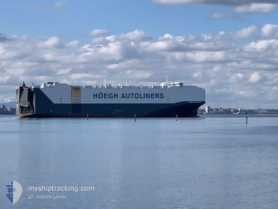
HOEGH TRAPPER
Cargo
Current Trip
| Time Travelled | 6 days |
|---|---|
| Remaining Time | 11 mins |
| Distance Travelled | 2357.03 nm |
| Remaining Distance | 3.56 nm |
| AVG Speed | 15.1 Knots |
| MAX Speed | 17.7 Knots |
| AVG Wind | 11.5 knots |
| MAX Wind | 24 knots |
| MIN Temp | 4.3°C / 39.74°F |
| MAX Temp | 27.8°C / 82.04°F |
| Draught | 9.9 m |
| Position Received | 1 m ago |
Current Position
| Longitude | --- |
|---|---|
| Latitude | --- |
| Status | Under way using engine |
| Speed | 6.1 Knots |
| Course | 293.3° |
| Area | Singapore Strait |
| Station | T-AIS |
| Position Received | 1 m ago |
Info
Information
The current position of HOEGH TRAPPER is in Singapore Strait with coordinates 1.22811° / 103.89247° as reported on 2025-03-14 06:17 by AIS to our vessel tracker app. The vessel's current speed is 6.1 Knots and is heading at the port of SINGAPORE. The estimated time of arrival as calculated by MyShipTracking vessel tracking app is 2025-03-14 14:29 LT
The vessel HOEGH TRAPPER (IMO: 9706918, MMSI: 258872000) is a Cargo It's sailing under the flag of [NO] Norway.
In this page you can find informations about the vessels current position, last detected port calls, and current voyage information. If the vessels is not in coverage by AIS you will find the latest position.
The current position of HOEGH TRAPPER is detected by our AIS receivers and we are not responsible for the reliability of the data. The last position was recorded while the vessel was in Coverage by the Ais receivers of our vessel tracking app.
The current draught of HOEGH TRAPPER as reported by AIS is 9.9 meters
Weather
| Temperature | 27.8°C / 82.04°F |
|---|---|
| Wind Speed | 3 knots |
| Direction | 54° NE |
| Pressure | 1009.7 hPa |
| Humidity | 72.9 % |
| Cloud Coverage | 100 % |
Featured Company
Last Port Calls
| Port | Arrival | Departure | Time In Port |
|---|---|---|---|
| 2025-03-07 18:43 | 2025-03-08 06:33 | 11 h | |
| 2025-03-05 16:13 | 2025-03-06 04:09 | 11 h | |
| 2025-03-01 06:57 | 2025-03-01 16:49 | 9 h | |
| 2025-02-26 10:16 | 2025-02-27 18:34 | 1 d | |
| 2025-02-25 08:10 | 2025-02-25 17:41 | 9 h | |
| 2025-02-24 06:41 | 2025-02-24 17:32 | 10 h | |
| 2025-02-22 13:05 | 2025-02-23 17:01 | 1 d | |
| 2025-02-10 10:22 | 2025-02-12 03:14 | 1 d | |
| 2025-01-25 00:34 | 2025-01-27 07:49 | 2 d | |
| 2025-01-13 09:41 | 2025-01-15 02:23 | 1 d |
Most Visited Ports (Last year)
| Port | Arrivals | |
|---|---|---|
| 3 | ||
| 3 | ||
| 3 | ||
| 3 | ||
| 3 | ||
| 2 |
Last Trips
| Origin | Departure | Destination | Arrival | Distance | |
|---|---|---|---|---|---|
| 2025-03-06 04:09 | 2025-03-07 18:43 | 461.03 nm | |||
| 2025-03-01 16:49 | 2025-03-05 16:13 | 1114.98 nm | |||
| 2025-02-27 18:34 | 2025-03-01 06:57 | 327.61 nm | |||
| 2025-02-25 17:41 | 2025-02-26 10:16 | 240.66 nm | |||
| 2025-02-24 17:32 | 2025-02-25 08:10 | 210.85 nm | |||
| 2025-02-23 17:01 | 2025-02-24 06:41 | 175.37 nm | |||
| 2025-02-12 03:14 | 2025-02-22 13:05 | 3959.54 nm | |||
| 2025-01-27 07:49 | 2025-02-10 10:22 | 1531.28 nm | |||
| 2025-01-15 02:23 | 2025-01-25 00:34 | 1428.75 nm | |||
| 2025-01-08 19:10 | 2025-01-13 09:41 | 1715.47 nm |
Events
| Time | Event | Details | Position / Dest | Info |
|---|---|---|---|---|
| 2025-03-14 05:08 | Change Sea Area | Singaporean part of the Singapore Strait Indonesian part of the Singapore Strait |
1.26107 / 104.00892
Singapore Strait
CN TAC>SGSIN PEBGA
|
Speed: 9.6 kn Course: 262.3° |
| 2025-03-14 04:58 | Draught Changed | 9.9 9.4 |
1.26439 / 104.03411
CN TAC>SGSIN PEBGA
|
Speed: 9.7 kn Course: 263.4° |
| 2025-03-14 04:58 | Destination Changed | CN TAC>SGSIN PEBGA JP OMZ>CN LYG |
1.26439 / 104.03411
CN TAC>SGSIN PEBGA
|
Speed: 9.7 kn Course: 263.4° |
| 2025-03-14 04:58 | ETA Changed | 2025/03/14 06:00 2025/03/04 21:00 |
1.26439 / 104.03411
CN TAC>SGSIN PEBGA
|
Speed: 9.7 kn Course: 263.4° |
| 2025-03-14 04:55 | Change Sea Area | Indonesian part of the Singapore Strait Japanese part of the Philippine Sea |
1.26554 / 104.04344
Singapore Strait
|
Speed: 9.6 kn Course: 263° |
| 2025-03-14 04:55 | Status Changed | Under way using engine Default |
1.26554 / 104.04344
JP OMZ>CN LYG
|
Speed: 9.5 kn Course: 263° |
| 2025-03-14 04:54 | Status Changed | Default Under way using engine |
1.26582 / 104.04570
JP OMZ>CN LYG
|
Speed: 9.7 kn Course: 263.5° |
| 2025-03-14 04:54 | IN Coverage |
1.26554 / 104.04344
Singapore Strait
|
Speed: 9.6 kn Course: 263° |
|
| 2025-03-14 04:53 | Status Changed | Under way using engine Default |
1.26614 / 104.04835
JP OMZ>CN LYG
|
Speed: 9.6 kn Course: 260° |
| 2025-03-07 22:33 | PORT DEPARTURE |
|
31.65120 / 121.21940
JP OMZ>CN LYG
|
Speed: 3.7 kn Course: 118° |