
HESTIA
Pleasure Craft
Current Trip
| Trip Time | --- |
|---|---|
| Trip Distance | --- |
| AVG Speed | --- |
| MAX Speed | --- |
| Draught | --- |
| AVG Wind | --- |
| MAX Wind | --- |
| MIN Temp | --- |
| MAX Temp | --- |
| Position Received | 8 d ago |
Current Position
| Longitude | --- |
|---|---|
| Latitude | --- |
| Status | Default |
| Speed | 0.2 Knots |
| Course | --- |
| Area | Caribbean Sea |
| Station | T-AIS |
| Position Received | 8 d ago |
Info
Information
The current position of HESTIA is in Caribbean Sea with coordinates 10.68058° / -61.63413° as reported on 2025-12-30 19:10 by AIS to our vessel tracker app. The vessel's current speed is 0.2 Knots and is currently inside the port of CHAGUARAMAS.
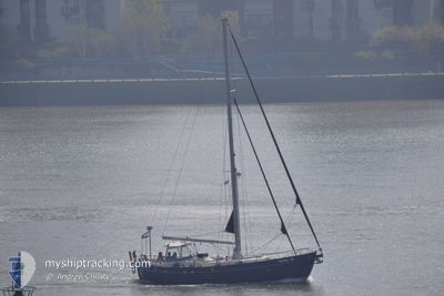
The vessel HESTIA (MMSI: 244070103) is a Pleasure Craft It's sailing under the flag of [NL] Netherlands.
In this page you can find informations about the vessels current position, last detected port calls, and current voyage information. If the vessels is not in coverage by AIS you will find the latest position.
The current position of HESTIA is detected by our AIS receivers and we are not responsible for the reliability of the data. The last position was recorded while the vessel was in Coverage by the Ais receivers of our vessel tracking app.
Weather
| Temperature | 26.7°C / 80.06°F |
|---|---|
| Wind Speed | 11 knots |
| Direction | 79° E |
| Pressure | 1012 hPa |
| Humidity | 79.1 % |
| Cloud Coverage | 40 % |
Featured Company
Last Port Calls
| Port | Arrival | Departure | Time In Port |
|---|---|---|---|
| 2025-12-29 14:26 |
Last Trips
| Origin | Departure | Destination | Arrival | Distance |
|---|
Events
| Time | Event | Details | Position / Dest | Info |
|---|---|---|---|---|
| 2025-12-30 19:10 | OUT of Coverage |
10.68058 / -61.63413
Caribbean Sea
[TT] CHAGUARAMAS
|
Speed: 0.2 kn Course: 511° |
|
| 2025-12-30 17:40 | IN Coverage |
10.67886 / -61.63651
Caribbean Sea
[TT] CHAGUARAMAS
|
Speed: 0.1 kn Course: 511° |
|
| 2025-12-29 18:35 | OUT of Coverage |
10.67870 / -61.63647
Caribbean Sea
[TT] CHAGUARAMAS
|
Speed: 0.1 kn Course: 511° |
|
| 2025-12-29 18:26 | STOP Moving |
10.67823 / -61.63613
[TT] CHAGUARAMAS
|
Speed: 0.1 kn Course: 511° |
|
| 2025-12-29 18:26 | PORT ARRIVAL |
|
10.67823 / -61.63613
[TT] CHAGUARAMAS
|
Speed: 1 kn Course: 511° |
| 2025-12-29 18:25 | Change Sea Area | Trinidad and Tobago part of the Caribbean Sea Spanish (Canary Islands) part of the North Atlantic Ocean |
10.67830 / -61.63584
Caribbean Sea
|
Speed: 2.2 kn Course: 262.2° |
| 2025-12-29 18:24 | IN Coverage |
10.67830 / -61.63584
Caribbean Sea
|
Speed: 2.2 kn Course: 262.2° |