
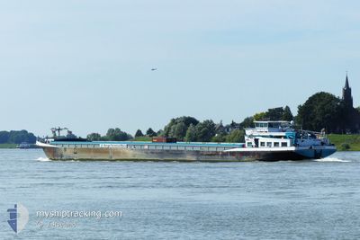
HERMINA
Cargo
Current Trip
| Time Travelled | 4 h, 51 mins |
|---|---|
| Remaining Time | 9 h, 3 mins |
| Distance Travelled | 29.47 nm |
| Remaining Distance | 82.37 nm |
| AVG Speed | 8.9 Knots |
| MAX Speed | 9.5 Knots |
| AVG Wind | 7 knots |
| MAX Wind | 7 knots |
| MIN Temp | 6.5°C / 43.7°F |
| MAX Temp | 9.3°C / 48.74°F |
| Draught | 4.1 m |
| Position Received | 1 m ago |
Current Position
| Longitude | --- |
|---|---|
| Latitude | --- |
| Status | Under way using engine |
| Speed | 9.4 Knots |
| Course | 328.3° |
| Area | North Sea |
| Station | T-AIS |
| Position Received | 1 m ago |
Info
Information
The current position of HERMINA is in North Sea with coordinates 51.48228° / 6.16964° as reported on 2025-12-14 15:53 by AIS to our vessel tracker app. The vessel's current speed is 9.4 Knots and is heading at the port of MOERDIJK. The estimated time of arrival as calculated by MyShipTracking vessel tracking app is 2025-12-15 01:57 LT
The vessel HERMINA (MMSI: 244750786) is a Cargo It's sailing under the flag of [NL] Netherlands.
In this page you can find informations about the vessels current position, last detected port calls, and current voyage information. If the vessels is not in coverage by AIS you will find the latest position.
The current position of HERMINA is detected by our AIS receivers and we are not responsible for the reliability of the data. The last position was recorded while the vessel was in Coverage by the Ais receivers of our vessel tracking app.
The current draught of HERMINA as reported by AIS is 4.1 meters
Weather
| Temperature | 7.1°C / 44.78°F |
|---|---|
| Wind Speed | 7 knots |
| Direction | 178° S |
| Pressure | 1022 hPa |
| Humidity | 87.5 % |
| Cloud Coverage | 10 % |
Featured Company
Last Port Calls
| Port | Arrival | Departure | Time In Port |
|---|---|---|---|
| 2025-12-13 12:58 | 2025-12-14 12:03 | 23 h | |
| 2025-12-12 13:39 | 2025-12-12 17:13 | 3 h | |
| 2025-12-12 12:20 | 2025-12-12 12:59 | 38 m | |
| 2025-12-12 10:38 | 2025-12-12 11:35 | 57 m | |
| 2025-12-11 22:50 | 2025-12-12 09:31 | 10 h | |
| 2025-12-11 14:54 | 2025-12-11 21:20 | 6 h | |
| 2025-12-11 01:49 | 2025-12-11 02:07 | 17 m | |
| 2025-12-10 14:38 | 2025-12-10 21:24 | 6 h | |
| 2025-12-10 08:50 | 2025-12-10 10:51 | 2 h | |
| 2025-12-09 07:54 | 2025-12-09 15:35 | 7 h |
Most Visited Ports (Last year)
| Port | Arrivals | |
|---|---|---|
| 210 | ||
| 98 | ||
| 94 | ||
| 91 | ||
| 40 | ||
| 25 |
Last Trips
| Origin | Departure | Destination | Arrival | Distance | |
|---|---|---|---|---|---|
| 2025-12-12 17:13 | 2025-12-13 12:58 | 119.15 nm | |||
| 2025-12-12 12:59 | 2025-12-12 13:39 | 3.95 nm | |||
| 2025-12-12 11:35 | 2025-12-12 12:20 | 5.24 nm | |||
| 2025-12-12 09:31 | 2025-12-12 10:38 | 7.66 nm | |||
| 2025-12-11 21:20 | 2025-12-11 22:50 | 13.99 nm | |||
| 2025-12-11 02:07 | 2025-12-11 14:54 | 94.99 nm | |||
| 2025-12-10 21:24 | 2025-12-11 01:49 | 24.28 nm | |||
| 2025-12-10 10:51 | 2025-12-10 14:38 | 10.27 nm | |||
| 2025-12-09 15:35 | 2025-12-10 08:50 | 95.33 nm | |||
| 2025-12-09 06:08 | 2025-12-09 07:54 | 14.23 nm |
Events
| Time | Event | Details | Position / Dest | Info |
|---|---|---|---|---|
| 2025-12-14 15:16 | Status Changed | Under way using engine Default |
51.39920 / 6.15116
PRINS WILLEM ALEXAND
|
Speed: 9 kn Course: 334° |
| 2025-12-14 15:12 | IN Coverage |
51.39920 / 6.15116
North Sea
PRINS WILLEM ALEXAND
|
Speed: 9.3 kn Course: 350.3° |
|
| 2025-12-14 13:06 | OUT of Coverage |
51.20087 / 5.95078
North Sea
PRINS WILLEM ALEXAND
|
Speed: 8 kn Course: 50.5° |
|
| 2025-12-14 12:58 | Status Changed | Under way using engine Default |
51.18919 / 5.93070
PRINS WILLEM ALEXAND
|
Speed: Course: -1° |
| 2025-12-14 12:58 | START Moving | 0.81 nm, West of OOLDERHUUSKE |
51.18919 / 5.93070
PRINS WILLEM ALEXAND
|
Speed: 7.3 kn Course: 38.1° |
| 2025-12-14 12:58 | IN Coverage |
51.18919 / 5.93070
North Sea
PRINS WILLEM ALEXAND
|
Speed: 7.3 kn Course: 38.1° |
|
| 2025-12-14 12:32 | STOP Moving | 1.73 nm, South West of OOLDERHUUSKE |
51.17333 / 5.91833
PRINS WILLEM ALEXAND
|
Speed: Course: -1° |
| 2025-12-14 11:20 | Status Changed | Default Under way using engine |
51.09500 / 5.83833
PRINS WILLEM ALEXAND
|
Speed: 7.9 kn Course: 28.8° |
| 2025-12-14 11:18 | OUT of Coverage |
51.09384 / 5.83792
North Sea
PRINS WILLEM ALEXAND
|
Speed: 7.9 kn Course: 28.8° |
|
| 2025-12-14 11:03 | PORT DEPARTURE |
|
51.06537 / 5.81352
PRINS WILLEM ALEXAND
|
Speed: 5.6 kn Course: 28.5° |