
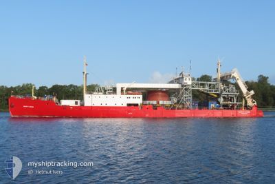
HENRY P. LADING
Cable Layer
Current Trip
| Trip Time | 3 days |
|---|---|
| Trip Distance | 464.34 nm |
| AVG Speed | 5.8 Knots |
| MAX Speed | 10 Knots |
| Draught | 2.5 m |
| AVG Wind | 14 knots |
| MAX Wind | 20.4 knots |
| MIN Temp | 7.2°C / 44.96°F |
| MAX Temp | 13°C / 55.4°F |
| Position Received | 1 m ago |
Current Position
| Longitude | 11.10209° |
|---|---|
| Latitude | 55.67496° |
| Status | Moored |
| Speed | |
| Course | 344° |
| Area | Kattegat |
| Station | T-AIS |
| Position Received | 1 m ago |
Info
Information
The current position of HENRY P. LADING is in Kattegat with coordinates 55.67496° / 11.10209° as reported on 2024-05-10 22:30 by AIS to our vessel tracker app. The vessel's current speed is 0 Knots and is currently inside the port of KALUNDBORG.
The vessel HENRY P. LADING (IMO: 8646484, MMSI: 219002349) is a Cable Layer that was built in 1930 ( 94 years old ). It's sailing under the flag of [DK] Denmark.
In this page you can find informations about the vessels current position, last detected port calls, and current voyage information. If the vessels is not in coverage by AIS you will find the latest position.
The current position of HENRY P. LADING is detected by our AIS receivers and we are not responsible for the reliability of the data. The last position was recorded while the vessel was in Coverage by the Ais receivers of our vessel tracking app.
The current draught of HENRY P. LADING as reported by AIS is 2.5 meters
Weather
| Temperature | 11.3°C / 52.34°F |
|---|---|
| Wind Speed | 9 knots |
| Direction | 326° NW |
| Pressure | 1022.8 hPa |
| Humidity | 89.4 % |
| Cloud Coverage | 100 % |
Featured Company
Last Port Calls
| Port | Arrival | Departure | Time In Port |
|---|---|---|---|
| 2024-05-02 07:59 | |||
| 2024-04-27 07:39 | 2024-04-29 02:29 | 1 d | |
| 2024-04-23 21:40 | 2024-04-25 00:35 | 1 d | |
| 2024-04-19 09:44 | 2024-04-21 10:15 | 2 d | |
| 2024-04-11 23:23 | 2024-04-16 14:23 | 4 d | |
| 2024-04-07 19:20 | 2024-04-10 23:16 | 3 d | |
| 2024-03-28 07:16 | 2024-03-30 20:24 | 2 d | |
| 2024-03-24 17:47 |
Most Visited Ports (Last year)
| Port | Arrivals | |
|---|---|---|
| 7 | ||
| 5 | ||
| 3 | ||
| 2 | ||
| 1 |
Last Trips
| Origin | Departure | Destination | Arrival | Distance | |
|---|---|---|---|---|---|
| 2024-04-29 04:29 | 2024-05-02 09:59 | 464.34 nm | |||
| 2024-04-25 02:35 | 2024-04-27 09:39 | 96.62 nm | |||
| 2024-04-21 12:15 | 2024-04-23 23:40 | 160.58 nm | |||
| 2024-04-16 16:23 | 2024-04-19 11:44 | 126.03 nm | |||
| 2024-04-11 01:16 | 2024-04-12 01:23 | 112.37 nm | |||
| 2024-03-30 21:24 | 2024-04-07 21:20 | 101.10 nm | |||
| 2024-03-24 18:47 | 2024-03-28 08:16 | 479.47 nm |
Events
| Time | Event | Details | Position / Dest | Info |
|---|---|---|---|---|
| 2024-05-02 12:48 | Status Changed | Moored Restricted manoeuverability |
55.67481 / 11.10216
[DK] KALUNDBORG
|
Speed: Course: 344° |
| 2024-05-02 07:59 | PORT ARRIVAL |
|
55.66765 / 11.06975
[DK] KALUNDBORG
|
Speed: 1.8 kn Course: 89° |
| 2024-05-02 07:53 | STOP Moving | 0.67 nm, West of KALUNDBORG |
55.66850 / 11.06901
KALUNDBORG
|
Speed: 0.2 kn Course: 112° |
| 2024-05-02 07:38 | START Moving | 1.53 nm, West of KALUNDBORG |
55.67238 / 11.04355
KALUNDBORG
|
Speed: 3.1 kn Course: 103° |
| 2024-05-02 07:32 | STOP Moving | 1.71 nm, West of KALUNDBORG |
55.67256 / 11.03839
KALUNDBORG
|
Speed: 0.3 kn Course: 49° |
| 2024-05-01 05:41 | Change Sea Area | Danish part of the Kattegat Danish part of the Skaggerak |
57.75606 / 10.75335
Kattegat
KALUNDBORG
|
Speed: 5.3 kn Course: 165° |