
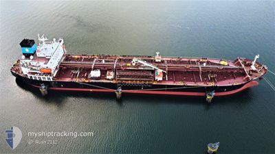
HENRY MAERSK
Tanker
Current Trip
| Time Travelled | 2 days |
|---|---|
| Remaining Time | 23 h, 51 mins |
| Distance Travelled | 604.15 nm |
| Remaining Distance | 410.33 nm |
| AVG Speed | 12.2 Knots |
| MAX Speed | 15.9 Knots |
| AVG Wind | 17.7 knots |
| MAX Wind | 30 knots |
| MIN Temp | 7.9°C / 46.22°F |
| MAX Temp | 17°C / 62.6°F |
| Draught | 9.8 m |
| Position Received | 2 d ago |
Current Position
| Longitude | --- |
|---|---|
| Latitude | --- |
| Status | Under way using engine |
| Speed | 14.1 Knots |
| Course | 84.6° |
| Area | Alboran Sea |
| Station | T-AIS |
| Position Received | 2 d ago |
Info
Information
The current position of HENRY MAERSK is in Alboran Sea with coordinates 36.10421° / -4.33100° as reported on 2025-12-03 23:32 by AIS to our vessel tracker app. The vessel's current speed is 14.1 Knots and is heading at the port of MARSAXLOKK. The estimated time of arrival as calculated by MyShipTracking vessel tracking app is 2025-12-07 06:29 LT
The vessel HENRY MAERSK (IMO: 9399351, MMSI: 219280000) is a Tanker It's sailing under the flag of [DK] Denmark.
In this page you can find informations about the vessels current position, last detected port calls, and current voyage information. If the vessels is not in coverage by AIS you will find the latest position.
The current position of HENRY MAERSK is detected by our AIS receivers and we are not responsible for the reliability of the data. The last position was recorded while the vessel was in Coverage by the Ais receivers of our vessel tracking app.
The current draught of HENRY MAERSK as reported by AIS is 9.8 meters
Weather
| Temperature | 15.5°C / 59.9°F |
|---|---|
| Wind Speed | 23 knots |
| Direction | 317° NW |
| Pressure | 1016.7 hPa |
| Humidity | 62.7 % |
| Cloud Coverage | 3 % |
Featured Company
Last Port Calls
| Port | Arrival | Departure | Time In Port |
|---|---|---|---|
| 2025-12-02 04:52 | 2025-12-03 20:03 | 1 d | |
| 2025-11-22 10:55 | 2025-11-24 08:58 | 1 d | |
| 2025-11-17 16:57 | 2025-11-17 17:50 | 52 m | |
| 2025-11-12 23:41 | 2025-11-17 15:51 | 4 d | |
| 2025-11-12 22:07 | 2025-11-12 22:55 | 48 m | |
| 2025-11-06 16:36 | 2025-11-08 19:42 | 2 d | |
| 2025-10-22 13:41 | 2025-10-24 23:41 | 2 d | |
| 2025-10-10 19:12 | 2025-10-16 17:34 | 5 d |
Most Visited Ports (Last year)
| Port | Arrivals | |
|---|---|---|
| 3 | ||
| 2 | ||
| 2 | ||
| 2 | ||
| 2 | ||
| 1 |
Last Trips
| Origin | Departure | Destination | Arrival | Distance | |
|---|---|---|---|---|---|
| 2025-11-24 08:58 | 2025-12-02 04:52 | 514.95 nm | |||
| 2025-11-17 17:50 | 2025-11-22 10:55 | 1427.15 nm | |||
| 2025-11-17 15:51 | 2025-11-17 16:57 | 6.21 nm | |||
| 2025-11-12 22:55 | 2025-11-12 23:41 | 5.67 nm | |||
| 2025-11-08 19:42 | 2025-11-12 22:07 | 865.73 nm | |||
| 2025-10-24 23:41 | 2025-11-06 16:36 | 1611.75 nm | |||
| 2025-10-16 17:34 | 2025-10-22 13:41 | 1530.05 nm | |||
| 2025-09-28 13:09 | 2025-10-10 19:12 | 1074.58 nm |
Events
| Time | Event | Details | Position / Dest | Info |
|---|---|---|---|---|
| 2025-12-03 23:39 | Status Changed | Default Under way using engine |
36.10701 / -4.30078
ESALG > MTMAR
|
Speed: 14.1 kn Course: 84.6° |
| 2025-12-03 23:32 | Status Changed | Under way using engine Default |
36.10421 / -4.33100
ESALG > MTMAR
|
Speed: 14.1 kn Course: 84° |
| 2025-12-03 23:32 | OUT of Coverage |
36.10421 / -4.33100
Alboran Sea
ESALG > MTMAR
|
Speed: 14.1 kn Course: 84.6° |
|
| 2025-12-03 23:26 | Status Changed | Default Under way using engine |
36.10181 / -4.36106
ESALG > MTMAR
|
Speed: 14 kn Course: 83.1° |
| 2025-12-03 23:17 | Status Changed | Under way using engine Default |
36.09763 / -4.40643
ESALG > MTMAR
|
Speed: 13.9 kn Course: 82° |
| 2025-12-03 23:11 | Status Changed | Default Under way using engine |
36.09480 / -4.43476
ESALG > MTMAR
|
Speed: 13.8 kn Course: 82° |
| 2025-12-03 20:23 | ETA Changed | 2025/12/07 07:00 2025/12/07 06:00 |
36.01435 / -5.23391
ESALG > MTMAR
|
Speed: 13.4 kn Course: 81.6° |
| 2025-12-03 20:19 | Change Sea Area | Spanish part of the Alboran Sea Gibraltarian part of the Alboran Sea |
36.01424 / -5.24964
Alboran Sea
ESALG > MTMAR
|
Speed: 14.1 kn Course: 120.8° |
| 2025-12-03 19:58 | Change Sea Area | Gibraltarian part of the Alboran Sea Gibraltarian part of the Strait of Gibraltar |
36.06312 / -5.32822
Alboran Sea
ESALG > MTMAR
|
Speed: 12.8 kn Course: 115.4° |
| 2025-12-03 19:22 | Change Sea Area | Gibraltarian part of the Strait of Gibraltar Spanish part of the Strait of Gibraltar |
36.14171 / -5.39213
Strait of Gibraltar
ESALG > MTMAR
|
Speed: 7.8 kn Course: 170.3° |