
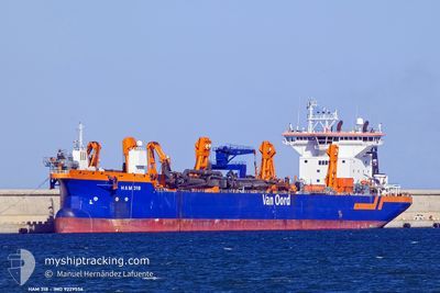
HAM 318
Trailing Suction Hopper Dredger
Current Trip
TWTXG
| Time Travelled | 2 days |
|---|---|
| Remaining Time | --- |
| Distance Travelled | 111.78 nm |
| Remaining Distance | --- |
| AVG Speed | 8.3 Knots |
| MAX Speed | 14.2 Knots |
| AVG Wind | 5.1 knots |
| MAX Wind | 10 knots |
| MIN Temp | 18°C / 64.4°F |
| MAX Temp | 22.3°C / 72.14°F |
| Draught | 6.8 m |
| Position Received | 9 d ago |
Current Position
| Longitude | --- |
|---|---|
| Latitude | --- |
| Status | Under way using engine |
| Speed | 15.7 Knots |
| Course | 49° |
| Area | South China Sea |
| Station | T-AIS |
| Position Received | 9 d ago |
Info
Information
The current position of HAM 318 is in South China Sea with coordinates 1.33238° / 104.38619° as reported on 2025-02-21 02:06 by AIS to our vessel tracker app. The vessel's current speed is 15.7 Knots
The vessel HAM 318 (IMO: 9229556, MMSI: 245508000) is a Trailing Suction Hopper Dredger that was built in 2001 ( 24 years old ). It's sailing under the flag of [NL] Netherlands.
In this page you can find informations about the vessels current position, last detected port calls, and current voyage information. If the vessels is not in coverage by AIS you will find the latest position.
The current position of HAM 318 is detected by our AIS receivers and we are not responsible for the reliability of the data. The last position was recorded while the vessel was in Coverage by the Ais receivers of our vessel tracking app.
The current draught of HAM 318 as reported by AIS is 6.8 meters
Weather
| Temperature | 22.3°C / 72.14°F |
|---|---|
| Wind Speed | 10 knots |
| Direction | 215° SW |
| Pressure | 1012 hPa |
| Humidity | 93.8 % |
| Cloud Coverage | 88 % |
Featured Company
Last Port Calls
| Port | Arrival | Departure | Time In Port |
|---|---|---|---|
| 2025-02-27 15:42 | 2025-02-28 11:24 | 19 h | |
| 2025-02-14 09:13 | 2025-02-21 07:49 | 6 d |
Last Trips
| Origin | Departure | Destination | Arrival | Distance | |
|---|---|---|---|---|---|
| 2025-02-21 07:49 | 2025-02-27 15:42 | 1720.76 nm |
Events
| Time | Event | Details | Position / Dest | Info |
|---|---|---|---|---|
| 2025-03-02 09:32 | STOP Moving | 11.63 nm, South West of TAICHUNG |
24.12509 / 120.35690
TWTXG
|
Speed: 0.1 kn Course: 81° |
| 2025-03-02 07:53 | START Moving | 12.2 nm, South West of TAICHUNG |
24.12575 / 120.34311
TWTXG
|
Speed: 9 kn Course: 285° |
| 2025-03-02 04:11 | STOP Moving | 11.43 nm, South West of TAICHUNG |
24.12354 / 120.36337
TWTXG
|
Speed: 0.3 kn Course: 268° |
| 2025-03-02 03:44 | START Moving | 11.5 nm, South West of TAICHUNG |
24.12295 / 120.36217
TWTXG
|
Speed: 3.8 kn Course: 313° |
| 2025-03-02 01:38 | STOP Moving | 11.53 nm, South West of TAICHUNG |
24.12470 / 120.35985
TWTXG
|
Speed: 0.2 kn Course: 213° |
| 2025-03-01 23:27 | START Moving | 11.61 nm, South West of TAICHUNG |
24.12371 / 120.35877
TWTXG
|
Speed: 3.2 kn Course: 96° |
| 2025-03-01 20:34 | STOP Moving | 11.68 nm, South West of TAICHUNG |
24.12432 / 120.35656
TWTXG
|
Speed: 0.3 kn Course: 87° |
| 2025-03-01 20:19 | START Moving | 12.18 nm, South West of TAICHUNG |
24.12462 / 120.34440
TWTXG
|
Speed: 4.7 kn Course: 91° |
| 2025-03-01 20:08 | STOP Moving | 12.48 nm, South West of TAICHUNG |
24.12642 / 120.33601
TWTXG
|
Speed: 0.1 kn Course: 107° |
| 2025-03-01 19:12 | START Moving | 17.42 nm, West of TAICHUNG |
24.14982 / 120.22065
TWTXG
|
Speed: 13 kn Course: 103° |