
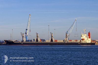
HAI NAM 86
Bulk Carrier
Current Trip
| Time Travelled | 5 days |
|---|---|
| Remaining Time | 5 days |
| Distance Travelled | 1367.74 nm |
| Remaining Distance | 1404.98 nm |
| AVG Speed | 10.5 Knots |
| MAX Speed | 12.5 Knots |
| AVG Wind | 8.8 knots |
| MAX Wind | 21.9 knots |
| MIN Temp | 14.1°C / 57.38°F |
| MAX Temp | 28.4°C / 83.12°F |
| Draught | 9.7 m |
| Position Received | 3 d ago |
Current Position
| Longitude | 123.25790° |
|---|---|
| Latitude | 33.57115° |
| Status | Under way using engine |
| Speed | 10.8 Knots |
| Course | 175° |
| Area | Yellow Sea |
| Station | T-AIS |
| Position Received | 3 d ago |
Info
Information
The current position of HAI NAM 86 is in Yellow Sea with coordinates 33.57115° / 123.25790° as reported on 2024-06-02 00:54 by AIS to our vessel tracker app. The vessel's current speed is 10.8 Knots and is heading at the port of SINGAPORE. The estimated time of arrival as calculated by MyShipTracking vessel tracking app is 2024-06-10 20:04 LT
The vessel HAI NAM 86 (IMO: 9303601, MMSI: 574004170) is a Bulk Carrier that was built in 2004 ( 20 years old ). It's sailing under the flag of [VN] Vietnam.
In this page you can find informations about the vessels current position, last detected port calls, and current voyage information. If the vessels is not in coverage by AIS you will find the latest position.
The current position of HAI NAM 86 is detected by our AIS receivers and we are not responsible for the reliability of the data. The last position was recorded while the vessel was in Coverage by the Ais receivers of our vessel tracking app.
The current draught of HAI NAM 86 as reported by AIS is 9.7 meters
Weather
| Temperature | 28.9°C / 84.02°F |
|---|---|
| Wind Speed | 5 knots |
| Direction | 230° SW |
| Pressure | 1010.9 hPa |
| Humidity | 81 % |
| Cloud Coverage | 100 % |
Featured Company
Events
| Time | Event | Details | Position / Dest | Info |
|---|---|---|---|---|
| 2024-06-02 00:58 | Status Changed | Default Under way using engine |
33.55808 / 123.25800
SINGAPORE
|
Speed: 10.8 kn Course: 175° |
| 2024-06-02 00:54 | OUT of Coverage |
33.57115 / 123.25790
Yellow Sea
SINGAPORE
|
Speed: 10.8 kn Course: 175° |
|
| 2024-06-02 00:53 | Status Changed | Under way using engine Default |
33.57513 / 123.25765
SINGAPORE
|
Speed: 10.7 kn Course: 181° |
| 2024-06-02 00:33 | Status Changed | Default Under way using engine |
33.63427 / 123.25873
SINGAPORE
|
Speed: 10.6 kn Course: 175° |
| 2024-06-02 00:02 | Status Changed | Under way using engine Default |
33.72440 / 123.25590
SINGAPORE
|
Speed: 10 kn Course: 179° |
| 2024-06-01 23:51 | Status Changed | Default Under way using engine |
33.75763 / 123.25568
SINGAPORE
|
Speed: 10.6 kn Course: 179° |
| 2024-06-01 23:49 | Status Changed | Under way using engine Default |
33.76350 / 123.25563
SINGAPORE
|
Speed: 10 kn Course: 178° |
| 2024-06-01 23:41 | Status Changed | Default Under way using engine |
33.78500 / 123.25500
SINGAPORE
|
Speed: 10.7 kn Course: 178° |
| 2024-06-01 23:31 | Status Changed | Under way using engine Default |
33.81827 / 123.25438
SINGAPORE
|
Speed: 10 kn Course: 178° |
| 2024-06-01 23:17 | Status Changed | Default Under way using engine |
33.85833 / 123.25333
SINGAPORE
|
Speed: 10.9 kn Course: 179° |