
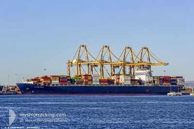
GSL GRANIA
Container Ship
Current Trip
| Time Travelled | 17 days |
|---|---|
| Remaining Time | 11 days |
| Distance Travelled | 7375.64 nm |
| Remaining Distance | 5068.79 nm |
| AVG Speed | 18.1 Knots |
| MAX Speed | 21.2 Knots |
| AVG Wind | 12.1 knots |
| MAX Wind | 24.6 knots |
| MIN Temp | 15.5°C / 59.9°F |
| MAX Temp | 31°C / 87.8°F |
| Draught | 13.3 m |
| Position Received | 3 d ago |
Current Position
| Longitude | 17.62133° |
|---|---|
| Latitude | -34.33082° |
| Status | Under way using engine |
| Speed | 17.6 Knots |
| Course | 301.3° |
| Area | South Atlantic Ocean |
| Station | T-AIS |
| Position Received | 3 d ago |
Info
Information
The current position of GSL GRANIA is in South Atlantic Ocean with coordinates -34.33082° / 17.62133° as reported on 2024-05-09 07:42 by AIS to our vessel tracker app. The vessel's current speed is 17.6 Knots and is heading at the port of NEW YORK. The estimated time of arrival as calculated by MyShipTracking vessel tracking app is 2024-05-24 07:04 LT
The vessel GSL GRANIA (IMO: 9285653, MMSI: 636019493) is a Container Ship that was built in 2004 ( 20 years old ). It's sailing under the flag of [LR] Liberia.
In this page you can find informations about the vessels current position, last detected port calls, and current voyage information. If the vessels is not in coverage by AIS you will find the latest position.
The current position of GSL GRANIA is detected by our AIS receivers and we are not responsible for the reliability of the data. The last position was recorded while the vessel was in Coverage by the Ais receivers of our vessel tracking app.
The current draught of GSL GRANIA as reported by AIS is 13.3 meters
Weather
| Temperature | 23.8°C / 74.84°F |
|---|---|
| Wind Speed | 12 knots |
| Direction | 117° ESE |
| Pressure | 1015.6 hPa |
| Humidity | 61.3 % |
| Cloud Coverage | 78 % |
Featured Company
Last Port Calls
| Port | Arrival | Departure | Time In Port |
|---|---|---|---|
| 2024-04-25 02:17 | 2024-04-26 14:42 | 1 d | |
| 2024-04-17 04:33 | 2024-04-17 21:28 | 16 h | |
| 2024-04-15 17:26 | 2024-04-16 17:31 | 1 d | |
| 2024-04-14 07:12 | 2024-04-14 18:14 | 11 h | |
| 2024-04-05 06:41 | 2024-04-06 21:52 | 1 d | |
| 2024-03-05 22:57 | 2024-03-07 20:14 | 1 d | |
| 2024-03-02 03:04 | 2024-03-02 22:51 | 19 h |
Most Visited Ports (Last year)
| Port | Arrivals | |
|---|---|---|
| 9 | ||
| 5 | ||
| 5 | ||
| 4 | ||
| 4 | ||
| 4 |
Last Trips
| Origin | Departure | Destination | Arrival | Distance | |
|---|---|---|---|---|---|
| 2024-04-17 21:28 | 2024-04-25 02:17 | 1581.89 nm | |||
| 2024-04-16 17:31 | 2024-04-17 04:33 | 100.69 nm | |||
| 2024-04-14 18:14 | 2024-04-15 17:26 | 69.15 nm | |||
| 2024-04-06 21:52 | 2024-04-14 07:12 | 1510.07 nm | |||
| 2024-03-07 20:14 | 2024-04-05 06:41 | 12480.12 nm | |||
| 2024-03-02 22:51 | 2024-03-05 22:57 | 119.56 nm | |||
| 2024-02-28 04:00 | 2024-03-02 03:04 | 526.45 nm |
Events
| Time | Event | Details | Position / Dest | Info |
|---|---|---|---|---|
| 2024-05-09 07:47 | Status Changed | Default Under way using engine |
-34.31866 / 17.59747
SGSIN>USNWK
|
Speed: 17.6 kn Course: 301.3° |
| 2024-05-09 07:42 | OUT of Coverage |
-34.33082 / 17.62133
South Atlantic Ocean
SGSIN>USNWK
|
Speed: 17.6 kn Course: 301.3° |
|
| 2024-05-09 07:26 | Status Changed | Under way using engine Default |
-34.37324 / 17.70283
SGSIN>USNWK
|
Speed: 17 kn Course: 303° |
| 2024-05-09 07:15 | Status Changed | Default Under way using engine |
-34.40017 / 17.75458
SGSIN>USNWK
|
Speed: 17.5 kn Course: 315.7° |
| 2024-05-09 07:08 | Status Changed | Under way using engine Default |
-34.42101 / 17.78439
SGSIN>USNWK
|
Speed: 17.3 kn Course: 317° |
| 2024-05-09 06:53 | Status Changed | Default Under way using engine |
-34.47333 / 17.84500
SGSIN>USNWK
|
Speed: 17.6 kn Course: 309.1° |
| 2024-05-09 06:30 | Status Changed | Under way using engine Default |
-34.54304 / 17.95304
SGSIN>USNWK
|
Speed: 16.9 kn Course: 307° |
| 2024-05-09 06:14 | Status Changed | Default Under way using engine |
-34.58667 / 18.02667
SGSIN>USNWK
|
Speed: 16.9 kn Course: 298.1° |
| 2024-05-09 05:32 | Status Changed | Under way using engine Default |
-34.67709 / 18.24229
SGSIN>USNWK
|
Speed: 17.2 kn Course: 293° |
| 2024-05-09 05:31 | Status Changed | Default Under way using engine |
-34.67947 / 18.24986
SGSIN>USNWK
|
Speed: 17.1 kn Course: 293.2° |