
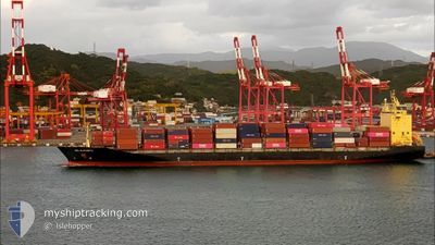
GSL ELIZABETH
Container Ship
Current Trip
| Time Travelled | 3 days |
|---|---|
| Remaining Time | --- |
| Distance Travelled | 34.99 nm |
| Remaining Distance | --- |
| AVG Speed | 14.1 Knots |
| MAX Speed | 17.2 Knots |
| AVG Wind | 18.7 knots |
| MAX Wind | 29 knots |
| MIN Temp | 7.7°C / 45.86°F |
| MAX Temp | 10.9°C / 51.62°F |
| Draught | 7.5 m |
| Position Received | 49 m ago |
Current Position
| Longitude | --- |
|---|---|
| Latitude | --- |
| Status | At anchor |
| Speed | 0.1 Knots |
| Course | 197° |
| Area | North Sea |
| Station | T-AIS |
| Position Received | 49 m ago |
Info
Information
The current position of GSL ELIZABETH is in North Sea with coordinates 53.90314° / 7.82478° as reported on 2025-12-10 04:49 by AIS to our vessel tracker app. The vessel's current speed is 0.1 Knots and is heading at the port of ANCHORAGE. The estimated time of arrival as calculated by MyShipTracking vessel tracking app is 2025-12-06 16:00 LT
The vessel GSL ELIZABETH (IMO: 9308429, MMSI: 636021006) is a Container Ship that was built in 2006 ( 19 years old ). It's sailing under the flag of [LR] Liberia.
In this page you can find informations about the vessels current position, last detected port calls, and current voyage information. If the vessels is not in coverage by AIS you will find the latest position.
The current position of GSL ELIZABETH is detected by our AIS receivers and we are not responsible for the reliability of the data. The last position was recorded while the vessel was in Coverage by the Ais receivers of our vessel tracking app.
The current draught of GSL ELIZABETH as reported by AIS is 7.5 meters
Weather
| Temperature | 10.4°C / 50.72°F |
|---|---|
| Wind Speed | 21 knots |
| Direction | 232° SW |
| Pressure | 1009.6 hPa |
| Humidity | 91 % |
| Cloud Coverage | 100 % |
Featured Company
Last Port Calls
| Port | Arrival | Departure | Time In Port |
|---|---|---|---|
| 2025-12-05 22:20 | 2025-12-06 23:13 | 1 d | |
| 2025-12-03 11:33 | 2025-12-04 04:56 | 17 h | |
| 2025-12-02 09:10 | 2025-12-03 06:52 | 21 h | |
| 2025-11-29 09:24 | 2025-11-30 04:00 | 18 h | |
| 2025-11-28 14:46 | 2025-11-29 06:15 | 15 h | |
| 2025-11-26 13:21 | 2025-11-27 05:05 | 15 h | |
| 2025-11-25 08:16 | 2025-11-26 08:53 | 1 d | |
| 2025-11-22 10:15 | 2025-11-23 13:04 | 1 d | |
| 2025-11-21 12:05 | 2025-11-22 06:14 | 18 h | |
| 2025-11-19 11:04 | 2025-11-20 02:33 | 15 h |
Most Visited Ports (Last year)
| Port | Arrivals | |
|---|---|---|
| 28 | ||
| 28 | ||
| 22 | ||
| 10 | ||
| 9 | ||
| 8 |
Last Trips
| Origin | Departure | Destination | Arrival | Distance | |
|---|---|---|---|---|---|
| 2025-12-04 04:56 | 2025-12-05 22:20 | 539.58 nm | |||
| 2025-12-03 06:52 | 2025-12-03 11:33 | 53.91 nm | |||
| 2025-11-30 04:00 | 2025-12-02 09:10 | 594.48 nm | |||
| 2025-11-29 06:15 | 2025-11-29 09:24 | 46.55 nm | |||
| 2025-11-27 05:05 | 2025-11-28 14:46 | 531.65 nm | |||
| 2025-11-26 08:53 | 2025-11-26 13:21 | 54.51 nm | |||
| 2025-11-23 13:04 | 2025-11-25 08:16 | 473.63 nm | |||
| 2025-11-22 06:14 | 2025-11-22 10:15 | 47.49 nm | |||
| 2025-11-20 02:33 | 2025-11-21 12:05 | 532.64 nm | |||
| 2025-11-19 06:23 | 2025-11-19 11:04 | 55.48 nm |
Events
| Time | Event | Details | Position / Dest | Info |
|---|---|---|---|---|
| 2025-12-10 04:55 | Status Changed | Default At anchor |
53.90319 / 7.82468
DEBRV ANCHORAGE
|
Speed: 0.1 kn Course: 197° |
| 2025-12-10 04:49 | Status Changed | At anchor Default |
53.90314 / 7.82478
DEBRV ANCHORAGE
|
Speed: Course: 198° |
| 2025-12-10 04:37 | Status Changed | Default At anchor |
53.90313 / 7.82490
DEBRV ANCHORAGE
|
Speed: Course: 204° |
| 2025-12-10 04:24 | Status Changed | At anchor Default |
53.90304 / 7.82539
DEBRV ANCHORAGE
|
Speed: 0.1 kn Course: 210° |
| 2025-12-10 04:13 | IN Coverage |
53.90305 / 7.82526
North Sea
|
Speed: 0.1 kn Course: 313.1° |
|
| 2025-12-09 21:34 | Status Changed | Default At anchor |
53.90292 / 7.82566
DEBRV ANCHORAGE
|
Speed: Course: 223° |
| 2025-12-09 21:28 | Status Changed | At anchor Default |
53.90301 / 7.82547
DEBRV ANCHORAGE
|
Speed: Course: 221° |
| 2025-12-09 21:28 | OUT of Coverage |
53.90301 / 7.82547
North Sea
|
Speed: Course: 80.5° |
|
| 2025-12-09 21:13 | Status Changed | Default At anchor |
53.90313 / 7.82508
DEBRV ANCHORAGE
|
Speed: Course: 212° |
| 2025-12-09 21:01 | Status Changed | At anchor Default |
53.90326 / 7.82465
DEBRV ANCHORAGE
|
Speed: Course: 207° |