
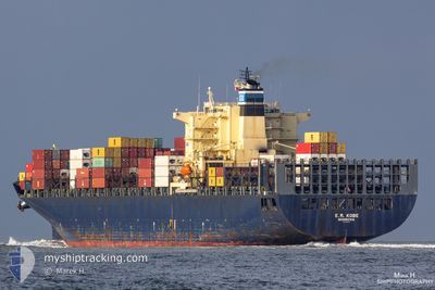
GSL DOROTHEA
Container Ship
Current Trip
CNDAI
| Time Travelled | 3 days |
|---|---|
| Remaining Time | --- |
| Distance Travelled | 491.57 nm |
| Remaining Distance | --- |
| AVG Speed | 11.7 Knots |
| MAX Speed | 14.9 Knots |
| AVG Wind | 8.3 knots |
| MAX Wind | 20 knots |
| MIN Temp | 17.4°C / 63.32°F |
| MAX Temp | 23.7°C / 74.66°F |
| Draught | 12.7 m |
| Position Received | 3 d ago |
Current Position
| Longitude | 118.79922° |
|---|---|
| Latitude | 38.77747° |
| Status | Under way using engine |
| Speed | 10.6 Knots |
| Course | 94.7° |
| Area | Yellow Sea |
| Station | T-AIS |
| Position Received | 3 d ago |
Info
Information
The current position of GSL DOROTHEA is in Yellow Sea with coordinates 38.77747° / 118.79922° as reported on 2024-06-13 08:32 by AIS to our vessel tracker app. The vessel's current speed is 10.6 Knots
The vessel GSL DOROTHEA (IMO: 9222974, MMSI: 636020769) is a Container Ship that was built in 2001 ( 23 years old ). It's sailing under the flag of [LR] Liberia.
In this page you can find informations about the vessels current position, last detected port calls, and current voyage information. If the vessels is not in coverage by AIS you will find the latest position.
The current position of GSL DOROTHEA is detected by our AIS receivers and we are not responsible for the reliability of the data. The last position was recorded while the vessel was in Coverage by the Ais receivers of our vessel tracking app.
The current draught of GSL DOROTHEA as reported by AIS is 12.7 meters
Weather
| Temperature | 22.2°C / 71.96°F |
|---|---|
| Wind Speed | 11 knots |
| Direction | 200° SSW |
| Pressure | 1008.8 hPa |
| Humidity | 80.3 % |
| Cloud Coverage | 100 % |
Featured Company
Last Port Calls
| Port | Arrival | Departure | Time In Port |
|---|---|---|---|
| 2024-06-12 02:57 | 2024-06-13 04:37 | 1 d | |
| 2024-06-04 09:46 | 2024-06-05 13:29 | 1 d | |
| 2024-06-03 01:14 | 2024-06-04 00:41 | 23 h | |
| 2024-05-29 05:25 | 2024-05-30 13:47 | 1 d | |
| 2024-05-26 00:06 | 2024-05-26 19:50 | 19 h | |
| 2024-05-23 08:08 | 2024-05-24 06:12 | 22 h | |
| 2024-05-18 13:51 | 2024-05-19 07:39 | 17 h | |
| 2024-05-13 06:07 | 2024-05-14 01:42 | 19 h | |
| 2024-05-10 03:07 | 2024-05-11 08:56 | 1 d | |
| 2024-05-04 10:44 | 2024-05-05 15:46 | 1 d |
Last Trips
| Origin | Departure | Destination | Arrival | Distance | |
|---|---|---|---|---|---|
| 2024-06-05 21:29 | 2024-06-12 10:57 | 1772.37 nm | |||
| 2024-06-04 08:41 | 2024-06-04 17:46 | 75.83 nm | |||
| 2024-05-30 21:47 | 2024-06-03 09:14 | 1494.47 nm | |||
| 2024-05-27 03:50 | 2024-05-29 13:25 | 43.35 nm | |||
| 2024-05-24 14:12 | 2024-05-26 08:06 | 34.99 nm | |||
| 2024-05-19 14:39 | 2024-05-23 16:08 | 774.67 nm | |||
| 2024-05-14 08:42 | 2024-05-18 20:51 | 838.93 nm | |||
| 2024-05-11 16:56 | 2024-05-13 13:07 | 749.29 nm | |||
| 2024-05-05 23:46 | 2024-05-10 11:07 | 277.12 nm | |||
| 2024-04-25 17:08 | 2024-05-04 18:44 | 2579.36 nm |
Events
| Time | Event | Details | Position / Dest | Info |
|---|---|---|---|---|
| 2024-06-14 21:08 | STOP Moving |
35.78905 / 121.03371
CNDAI
|
Speed: 0.3 kn Course: 251° |
|
| 2024-06-13 08:37 | Status Changed | Default Under way using engine |
38.77705 / 118.81602
CNDAI
|
Speed: 10.6 kn Course: 94.7° |
| 2024-06-13 08:32 | OUT of Coverage |
38.77747 / 118.79922
Yellow Sea
|
Speed: 10.6 kn Course: 94.7° |
|
| 2024-06-13 07:37 | Status Changed | Under way using engine Default |
38.79993 / 118.58652
CNDAI
|
Speed: 11.2 kn Course: 98° |
| 2024-06-13 07:25 | IN Coverage |
38.79985 / 118.58717
Yellow Sea
|
Speed: 11.1 kn Course: 97.5° |
|
| 2024-06-13 04:37 | PORT DEPARTURE |
|
38.95678 / 117.88039
CNDAI
|
Speed: 10.4 kn Course: 101° |
| 2024-06-13 04:01 | START Moving |
38.98885 / 117.78575
[CN] TIANJIN
|
Speed: 5.9 kn Course: 154° |
|
| 2024-06-12 02:57 | STOP Moving |
38.99120 / 117.77834
[CN] TIANJIN
|
Speed: Course: 345° |
|
| 2024-06-12 02:57 | PORT ARRIVAL |
|
38.99120 / 117.77834
[CN] TIANJIN
|
Speed: 0.8 kn Course: 337° |
| 2024-06-11 18:23 | START Moving |
38.75753 / 119.75502
CNDAI
|
Speed: 5.3 kn Course: 222° |