
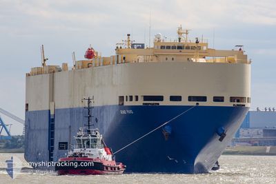
GRAND PAVO
Vehicles Carrier
Current Trip
CNNGG > PABLB
| Time Travelled | 10 days |
|---|---|
| Remaining Time | --- |
| Distance Travelled | 4062.06 nm |
| Remaining Distance | --- |
| AVG Speed | 16.4 Knots |
| MAX Speed | 19.3 Knots |
| AVG Wind | 7.9 knots |
| MAX Wind | 22 knots |
| MIN Temp | 20.1°C / 68.18°F |
| MAX Temp | 30.2°C / 86.36°F |
| Draught | 9.6 m |
| Position Received | 5 d ago |
Current Position
| Longitude | -120.53602° |
|---|---|
| Latitude | 25.56489° |
| Status | Under way using engine |
| Speed | 17 Knots |
| Course | 295.3° |
| Area | North Pacific Ocean |
| Station | T-AIS |
| Position Received | 5 d ago |
Info
Information
The current position of GRAND PAVO is in North Pacific Ocean with coordinates 25.56489° / -120.53602° as reported on 2024-08-26 13:05 by AIS to our vessel tracker app. The vessel's current speed is 17 Knots
The vessel GRAND PAVO (IMO: 9284776, MMSI: 352879000) is a Vehicles Carrier that was built in 2005 ( 19 years old ). It's sailing under the flag of [PA] Panama.
In this page you can find informations about the vessels current position, last detected port calls, and current voyage information. If the vessels is not in coverage by AIS you will find the latest position.
The current position of GRAND PAVO is detected by our AIS receivers and we are not responsible for the reliability of the data. The last position was recorded while the vessel was in Coverage by the Ais receivers of our vessel tracking app.
The current draught of GRAND PAVO as reported by AIS is 9.6 meters
Weather
| Temperature | 21.9°C / 71.42°F |
|---|---|
| Wind Speed | 9 knots |
| Direction | 40° NE |
| Pressure | 1019.9 hPa |
| Humidity | 82.8 % |
| Cloud Coverage | 98 % |
Featured Company
Last Port Calls
| Port | Arrival | Departure | Time In Port |
|---|---|---|---|
| 2024-08-20 16:02 | 2024-08-21 12:59 | 20 h | |
| 2024-08-16 00:49 | 2024-08-16 10:58 | 10 h | |
| 2024-08-12 15:21 | 2024-08-13 02:28 | 11 h | |
| 2024-08-11 00:53 | |||
| 2024-08-07 17:46 | 2024-08-08 05:39 | 11 h | |
| 2024-07-31 09:45 | 2024-08-02 15:43 | 2 d | |
| 2024-07-07 06:04 | 2024-07-07 22:10 | 16 h | |
| 2024-07-04 02:42 | 2024-07-06 16:30 | 2 d | |
| 2024-07-02 09:42 | 2024-07-03 17:36 | 1 d |
Most Visited Ports (Last year)
| Port | Arrivals | |
|---|---|---|
| 5 | ||
| 3 | ||
| 3 | ||
| 3 | ||
| 3 | ||
| 2 |
Last Trips
| Origin | Departure | Destination | Arrival | Distance | |
|---|---|---|---|---|---|
| 2024-08-16 10:58 | 2024-08-20 16:02 | 187.09 nm | |||
| 2024-08-13 02:28 | 2024-08-16 00:49 | 87.62 nm | |||
| 2024-08-11 00:53 | 2024-08-12 15:21 | 281.92 nm | |||
| 2024-08-02 15:43 | 2024-08-07 17:46 | 503.17 nm | |||
| 2024-07-07 22:10 | 2024-07-31 09:45 | 9233.76 nm | |||
| 2024-07-06 16:30 | 2024-07-07 06:04 | 125.06 nm | |||
| 2024-07-03 17:36 | 2024-07-04 02:42 | 127.86 nm | |||
| 2024-06-26 09:52 | 2024-07-02 09:42 | 2526.19 nm |
Events
| Time | Event | Details | Position / Dest | Info |
|---|---|---|---|---|
| 2024-08-26 13:10 | Status Changed | Default Under way using engine |
25.57557 / -120.56094
CNNGG > PABLB
|
Speed: 17 kn Course: 295.3° |
| 2024-08-26 13:05 | Status Changed | Under way using engine Default |
25.56489 / -120.53602
CNNGG > PABLB
|
Speed: 16.9 kn Course: 296° |
| 2024-08-26 13:05 | OUT of Coverage |
25.56489 / -120.53602
North Pacific Ocean
|
Speed: 17 kn Course: 295.3° |
|
| 2024-08-26 13:00 | Status Changed | Default Under way using engine |
25.55615 / -120.51564
CNNGG > PABLB
|
Speed: 16.7 kn Course: 295.3° |
| 2024-08-26 12:53 | Status Changed | Under way using engine Default |
25.54015 / -120.47910
CNNGG > PABLB
|
Speed: 16.8 kn Course: 297° |
| 2024-08-26 12:50 | Status Changed | Default Under way using engine |
25.53507 / -120.46795
CNNGG > PABLB
|
Speed: 16.9 kn Course: 296.3° |
| 2024-08-26 12:40 | Status Changed | Under way using engine Default |
25.51275 / -120.41871
CNNGG > PABLB
|
Speed: 17 kn Course: 296° |
| 2024-08-26 12:39 | Status Changed | Default Under way using engine |
25.51065 / -120.41404
CNNGG > PABLB
|
Speed: 17 kn Course: 296.4° |
| 2024-08-26 12:22 | Status Changed | Under way using engine Default |
25.47597 / -120.33730
CNNGG > PABLB
|
Speed: 17.1 kn Course: 296° |
| 2024-08-26 12:18 | Status Changed | Default Under way using engine |
25.46660 / -120.31673
CNNGG > PABLB
|
Speed: 17 kn Course: 297.2° |