
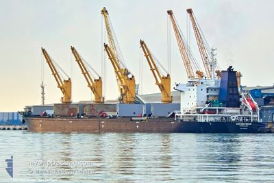
GOLDEN NOUR
Bulk Carrier
Current Trip
| Time Travelled | 49 days |
|---|---|
| Remaining Time | --- |
| Distance Travelled | 2532.81 nm |
| Remaining Distance | --- |
| AVG Speed | 9.6 Knots |
| MAX Speed | 9.6 Knots |
| AVG Wind | 13.2 knots |
| MAX Wind | 27 knots |
| MIN Temp | 8.6°C / 47.48°F |
| MAX Temp | 24.5°C / 76.1°F |
| Draught | 6 m |
| Position Received | 4 h, 13 m ago |
Current Position
| Longitude | --- |
|---|---|
| Latitude | --- |
| Status | At anchor |
| Speed | 0.3 Knots |
| Course | 65° |
| Area | Black Sea |
| Station | T-AIS |
| Position Received | 4 h, 13 m ago |
Info
Information
The current position of GOLDEN NOUR is in Black Sea with coordinates 44.12249° / 28.79119° as reported on 2025-12-05 16:36 by AIS to our vessel tracker app. The vessel's current speed is 0.3 Knots
The vessel GOLDEN NOUR (IMO: 9497440, MMSI: 667002297) is a Bulk Carrier that was built in 2011 ( 14 years old ). It's sailing under the flag of [SL] Sierra Leone.
In this page you can find informations about the vessels current position, last detected port calls, and current voyage information. If the vessels is not in coverage by AIS you will find the latest position.
The current position of GOLDEN NOUR is detected by our AIS receivers and we are not responsible for the reliability of the data. The last position was recorded while the vessel was in Coverage by the Ais receivers of our vessel tracking app.
The current draught of GOLDEN NOUR as reported by AIS is 6 meters
Weather
| Temperature | 12.1°C / 53.78°F |
|---|---|
| Wind Speed | 19 knots |
| Direction | 72° ENE |
| Pressure | 1014.8 hPa |
| Humidity | 79.4 % |
| Cloud Coverage | 100 % |
Featured Company
Events
| Time | Event | Details | Position / Dest | Info |
|---|---|---|---|---|
| 2025-12-05 16:42 | Status Changed | Default At anchor |
44.12228 / 28.79128
RO CND
|
Speed: 0.3 kn Course: 65° |
| 2025-12-05 16:36 | Detected in Sea | Romanian part of the Black Sea |
44.12249 / 28.79119
Black Sea
|
Speed: 0.3 kn Course: 136.9° |
| 2025-12-05 16:36 | Status Changed | At anchor Default |
44.12249 / 28.79119
RO CND
|
Speed: 0.4 kn Course: 48° |
| 2025-12-05 16:36 | OUT of Coverage |
44.12249 / 28.79119
Black Sea
|
Speed: 0.3 kn Course: 136.9° |
|
| 2025-12-05 16:24 | IN Coverage |
44.12249 / 28.79119
Black Sea
|
Speed: 0.3 kn Course: 136.9° |
|
| 2025-12-05 10:53 | STOP Moving | 5.28 nm, East of CONSTANTA |
44.12333 / 28.79350
RO CND
|
Speed: 0.1 kn Course: 78° |
| 2025-12-05 08:13 | START Moving | 5.61 nm, East of CONSTANTA |
44.14531 / 28.79751
RO CND
|
Speed: 3.1 kn Course: 110° |
| 2025-12-03 16:13 | STOP Moving | 5.49 nm, East of CONSTANTA |
44.14280 / 28.79542
RO CND
|
Speed: 0.2 kn Course: 91° |
| 2025-12-03 10:43 | Status Changed | Default Under way using engine |
43.30464 / 28.72932
RO CND
|
Speed: 10.8 kn Course: 64.1° |
| 2025-12-03 10:40 | OUT of Coverage |
43.29962 / 28.71503
Black Sea
RO CND
|
Speed: 10.8 kn Course: 64.1° |