
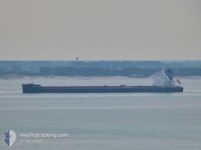
GOLDEN FREEZE
Cargo
Current Trip
| Time Travelled | 11 days |
|---|---|
| Remaining Time | 15 h, 24 mins |
| Distance Travelled | 2868.88 nm |
| Remaining Distance | 140.08 nm |
| AVG Speed | 10.4 Knots |
| MAX Speed | 15.7 Knots |
| AVG Wind | 14.3 knots |
| MAX Wind | 28 knots |
| MIN Temp | -3.2°C / 26.24°F |
| MAX Temp | 12.3°C / 54.14°F |
| Draught | 14.4 m |
| Position Received | 2 m ago |
Current Position
| Longitude | --- |
|---|---|
| Latitude | --- |
| Status | Under way using engine |
| Speed | 8.6 Knots |
| Course | 47.5° |
| Area | English Channel |
| Station | T-AIS |
| Position Received | 2 m ago |
Info
Information
The current position of GOLDEN FREEZE is in English Channel with coordinates 50.52454° / 1.08578° as reported on 2025-03-03 08:45 by AIS to our vessel tracker app. The vessel's current speed is 8.6 Knots and is heading at the port of GENT. The estimated time of arrival as calculated by MyShipTracking vessel tracking app is 2025-03-04 01:11 LT
The vessel GOLDEN FREEZE (IMO: 984990400, MMSI: 538009115) is a Cargo It's sailing under the flag of [MH] Marshall Is.
In this page you can find informations about the vessels current position, last detected port calls, and current voyage information. If the vessels is not in coverage by AIS you will find the latest position.
The current position of GOLDEN FREEZE is detected by our AIS receivers and we are not responsible for the reliability of the data. The last position was recorded while the vessel was in Coverage by the Ais receivers of our vessel tracking app.
The current draught of GOLDEN FREEZE as reported by AIS is 14.4 meters
Weather
| Temperature | 6.6°C / 43.88°F |
|---|---|
| Wind Speed | 5 knots |
| Direction | 49° NE |
| Pressure | 1030 hPa |
| Humidity | 68.9 % |
| Cloud Coverage | 3 % |
Featured Company
Last Port Calls
| Port | Arrival | Departure | Time In Port |
|---|---|---|---|
| 2025-02-18 16:48 | 2025-02-19 17:55 | 1 d | |
| 2025-01-31 12:14 | 2025-02-03 15:22 | 3 d | |
| 2025-01-30 12:06 | 2025-01-30 18:42 | 6 h | |
| 2025-01-03 10:10 | 2025-01-04 22:54 | 1 d |
Most Visited Ports (Last year)
| Port | Arrivals | |
|---|---|---|
| 3 | ||
| 3 | ||
| 3 | ||
| 2 | ||
| 2 | ||
| 1 |
Last Trips
| Origin | Departure | Destination | Arrival | Distance | |
|---|---|---|---|---|---|
| 2025-02-03 15:22 | 2025-02-18 16:48 | 886.12 nm | |||
| 2025-01-30 18:42 | 2025-01-31 12:14 | 0.48 nm | |||
| 2025-01-04 22:54 | 2025-01-30 12:06 | 4139.87 nm | |||
| 2024-12-21 13:10 | 2025-01-03 10:10 | 3294.70 nm |
Events
| Time | Event | Details | Position / Dest | Info |
|---|---|---|---|---|
| 2025-03-03 07:44 | Change Sea Area | French part of the English Channel United Kingdom part of the English Channel |
50.45236 / .88544
English Channel
BEGNE
|
Speed: 9.3 kn Course: 75.9° |
| 2025-03-03 05:56 | Status Changed | Under way using engine Default |
50.37952 / .44408
BEGNE
|
Speed: 9.6 kn Course: 76° |
| 2025-03-03 05:54 | Status Changed | Default Under way using engine |
50.37802 / .43541
BEGNE
|
Speed: 9.6 kn Course: 75.5° |
| 2025-03-03 00:28 | Change Sea Area | United Kingdom part of the English Channel French part of the English Channel |
50.14035 / -.90330
English Channel
BEGNE
|
Speed: 12.6 kn Course: 75.3° |
| 2025-03-03 00:28 | Status Changed | Under way using engine Default |
50.14035 / -.90330
BEGNE
|
Speed: 12.7 kn Course: 76° |
| 2025-03-03 00:28 | IN Coverage |
50.14035 / -.90330
English Channel
BEGNE
|
Speed: 12.6 kn Course: 75.3° |
|
| 2025-03-03 00:28 | Status Changed | Default Under way using engine |
50.13975 / -.90692
BEGNE
|
Speed: 12.7 kn Course: 75.6° |
| 2025-03-03 00:27 | Status Changed | Under way using engine Default |
50.13947 / -.90860
BEGNE
|
Speed: 12.8 kn Course: 76° |
| 2025-03-02 22:47 | Status Changed | Default Under way using engine |
50.03470 / -1.48790
BEGNE
|
Speed: 15.1 kn Course: 72.7° |
| 2025-03-02 22:40 | OUT of Coverage |
50.02524 / -1.53274
English Channel
BEGNE
|
Speed: 15.1 kn Course: 72.7° |